TopoQuest Logo
Do you find TopoQuest useful?
Help keep TopoQuest running and adding new maps/features by donating!
Bitcoin:  19c7KJd3qBynnjoSw5npx9KScwjBe4ifkT
Litecoin:  LXs6TkuXGGXo1vDsWCkWVdjQX94eUKd6ui
Home View Maps Find Maps Find Places Resources & Links


Montegail Pond, Maine Topographic Map

USGS Map Title: Montegail Pond, ME
USGS Map MRC: 44067G7
DRG (GeoTIFF) Download: o44067g7.tif


Neighboring USGS Topographic Map Quads:


  Peaked Mountain, ME  
44067H8
 

  Tug Mountain, ME  
44067H7
 

  Wesley, ME  
44067H6
 

  Northeast Bluff, ME  
44067G8
 

  Montegail Pond, ME  
44067G7
 

  Peaked Mountain Pond, ME  
44067G6
 

  Schoodic Lake, ME  
44067F8
 

  Epping, ME  
44067F7
 

  Columbia Falls, ME  
44067F6


Map MRC Location:

N45°
W68°
N45°
W67°
H8 H7 H6 H5 H4 H3 H2 H1
G8 G7 G6 G5 G4 G3 G2 G1
F8 F7 F6 F5 F4 F3 F2 F1
E8 E7 E6 E5 E4 E3 E2 E1
D8 D7 D6 D5 D4 D3 D2 D1
C8 C7 C6 C5 C4 C3 C2 C1
B8 B7 B6 B5 B4 B3 B2 B1
A8 A7 A6 A5 A4 A3 A2 A1
N44°
W68°
N44°
W67°

Montegail Pond, ME USGS 1:24K Topographic Map Preview:
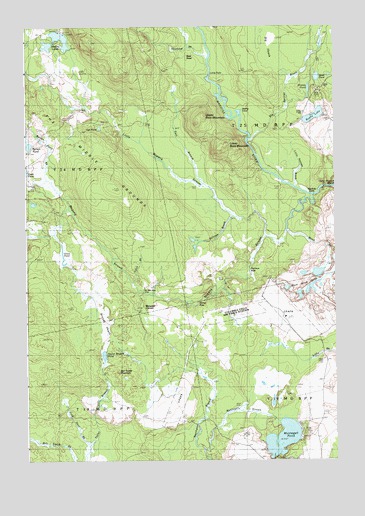
Montegail Pond, ME USGS Topographic Map
Click on map above to begin viewing in our Map Viewer.

This topographic map contains these locations and features:
Feature Name Type Latitude Longitude GNIS ID View Map
Bald HeadSummitN44.8659°W67.8092°561499View Map
Barren PondLakeN44.8407°W67.8733°561641View Map
Barren Pond BrookStreamN44.8309°W67.8675°561642View Map
Ben Tucker MountainSummitN44.7754°W67.8380°562043View Map
Big HeathSwampN44.8687°W67.7750°562173View Map
Big Springy BrookStreamN44.8423°W67.7842°562240View Map
Bill Smith BrookStreamN44.7504°W67.8567°562261View Map
Billings BrookStreamN44.8204°W67.7919°562266View Map
Black BrookStreamN44.8156°W67.7697°562390View Map
Black Brook PondsLakeN44.7996°W67.7597°562420View Map
Brandy HeathSwampN44.7898°W67.8458°562903View Map
Brewster CornerPopulated PlaceN44.7951°W67.8108°579152View Map
Dead PondLakeN44.8603°W67.7568°564875View Map
Duck PondLakeN44.8331°W67.8750°565352View Map
East Branch Little Mopang StreamStreamN44.8295°W67.8036°565550View Map
Fred Dorr BrookStreamN44.7545°W67.8503°566546View Map
Grass PondLakeN44.8084°W67.8598°567072View Map
Grassy PondLakeN44.8570°W67.7602°567084View Map
Hadley LakesLakeN44.8717°W67.8602°567419View Map
Haunted BrookStreamN44.8667°W67.8011°567768View Map
Horse RipsRapidsN44.7945°W67.8064°568291View Map
Ingley CoveBayN44.8501°W67.7889°568632View Map
Larry BrookStreamN44.8015°W67.8325°569391View Map
Little FallsFallsN44.8604°W67.8011°569770View Map
Little Mopang StreamStreamN44.8145°W67.7775°569915View Map
Little Spring BrookStreamN44.8287°W67.7661°570072View Map
Lower Buck MountainSummitN44.8407°W67.7940°570478View Map
Machias EddyRapidsN44.8265°W67.7611°570616View Map
Montegail PondLakeN44.7564°W67.7715°571519View Map
Montegail StreamStreamN44.7501°W67.8019°571520View Map
Mopang StreamStreamN44.8259°W67.7589°571655View Map
Northwest Branch Montegail StreamStreamN44.7531°W67.8036°572468View Map
Oak PondLakeN44.8460°W67.8447°572632View Map
Penman RipsRapidsN44.8040°W67.7844°573161View Map
Pineo CampLocaleN44.7626°W67.8697°573410View Map
Rocky LakeLakeN44.8491°W67.7581°574391View Map
Six Mile DamLocaleN44.7990°W67.8286°575503View Map
T18 MD BPPCivilN44.7512°W67.8656°1987564View Map
T19 MD BPPCivilN44.7678°W67.7537°1987566View Map
T25 MD BPPCivilN44.8551°W67.7621°1987568View Map
Taylor BranchStreamN44.7501°W67.8517°576673View Map
Taylor Brook PondLakeN44.7804°W67.8436°576679View Map
The Middle GroundsFlatN44.8365°W67.8547°576847View Map
Upper Buck MountainSummitN44.8471°W67.8053°577578View Map
Upper Wigwam RapidsRapidsN44.8287°W67.7508°578864View Map

Note: Coordinates in the location and feature list above are referenced to NAD83 datum.


Copyright (C) 2008-2024 Ryan Niemi / Sunset Dynamics ... All Rights Reserved