TopoQuest Logo
Do you find TopoQuest useful?
Help keep TopoQuest running and adding new maps/features by donating!
Bitcoin:  19c7KJd3qBynnjoSw5npx9KScwjBe4ifkT
Litecoin:  LXs6TkuXGGXo1vDsWCkWVdjQX94eUKd6ui
Home View Maps Find Maps Find Places Resources & Links


Belfort, New York Topographic Map

USGS Map Title: Belfort, NY
USGS Map MRC: 43075H3
DRG (GeoTIFF) Download: o43075h3.tif


Neighboring USGS Topographic Map Quads:


  Natural Bridge, NY  
44075A4
 

  Remington Corners, NY  
44075A3
 

  Oswegatchie SW, NY  
44075A2
 

  Croghan, NY  
43075H4
 

  Belfort, NY  
43075H3


  Lowville, NY  
43075G4
 

  Crystal Dale, NY  
43075G3


Map MRC Location:

N44°
W76°
N44°
W75°
H8 H7 H6 H5 H4 H3 H2 H1
G8 G7 G6 G5 G4 G3 G2 G1
F8 F7 F6 F5 F4 F3 F2 F1
E8 E7 E6 E5 E4 E3 E2 E1
D8 D7 D6 D5 D4 D3 D2 D1
C8 C7 C6 C5 C4 C3 C2 C1
B8 B7 B6 B5 B4 B3 B2 B1
A8 A7 A6 A5 A4 A3 A2 A1
N43°
W76°
N43°
W75°

Belfort, NY USGS 1:24K Topographic Map Preview:
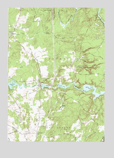
Belfort, NY USGS Topographic Map
Click on map above to begin viewing in our Map Viewer.

This topographic map contains these locations and features:
Feature Name Type Latitude Longitude GNIS ID View Map
Balsam CreekStreamN43.9326°W75.3677°942945View Map
Balsam CreekStreamN43.9501°W75.2885°942947View Map
BelfortPopulated PlaceN43.9281°W75.3321°972214View Map
Belfort PondReservoirN43.9263°W75.3271°943575View Map
Bushs CornersLocaleN43.8820°W75.2969°945324View Map
Carthage ReservoirReservoirN43.9765°W75.3277°945933View Map
Cold CreekStreamN43.9515°W75.2824°947048View Map
Croghan ReservoirReservoirN43.9078°W75.3047°947762View Map
Effley Falls PondReservoirN43.9187°W75.2603°949417View Map
Elmer FallsFallsN43.9270°W75.2882°970108View Map
Elmer Falls PondReservoirN43.9246°W75.2845°949569View Map
Henry School (historical)SchoolN43.9119°W75.3656°2519080View Map
High FallsPopulated PlaceN43.9231°W75.3721°972616View Map
High Falls PondReservoirN43.9281°W75.3664°952738View Map
Indian RiverPopulated PlaceN43.9765°W75.3688°972650View Map
KirschnervillePopulated PlaceN43.8831°W75.3369°954719View Map
Moser FarmLocaleN43.8922°W75.3339°2635228View Map
Saint Anthonys ChurchChurchN43.9751°W75.3691°963335View Map
Saint Vincent De Paul ChurchChurchN43.9292°W75.3324°964266View Map
Sandy CreekStreamN43.8845°W75.3441°964426View Map
Sweet School (historical)SchoolN43.9436°W75.2944°2519081View Map
Taylorville PondReservoirN43.9275°W75.3020°967107View Map
Town of CroghanCivilN43.9699°W75.3603°978878View Map
Warner CreekStreamN43.9501°W75.2885°968805View Map

Note: Coordinates in the location and feature list above are referenced to NAD83 datum.


Copyright (C) 2008-2024 Ryan Niemi / Sunset Dynamics ... All Rights Reserved