TopoQuest Logo
Do you find TopoQuest useful?
Help keep TopoQuest running and adding new maps/features by donating!
Bitcoin:  19c7KJd3qBynnjoSw5npx9KScwjBe4ifkT
Litecoin:  LXs6TkuXGGXo1vDsWCkWVdjQX94eUKd6ui
Home View Maps Find Maps Find Places Resources & Links


Lorman, Mississippi Topographic Map

USGS Map Title: Lorman, MS
USGS Map MRC: 31091G1
DRG (GeoTIFF) Download: o31091g1.tif


Neighboring USGS Topographic Map Quads:


  Saint Joseph, LA  
31091H2
 

  Widows Creek, MS  
31091H1
 

  Port Gibson, MS  
31090H8
 

  Rodney, MS  
31091G2
 

  Lorman, MS  
31091G1
 

  Red Lick, MS  
31090G8
 

  Church Hill, MS  
31091F2
 

  Fayette, MS  
31091F1
 

  Gin Branch, MS  
31090F8


Map MRC Location:

N32°
W92°
N32°
W91°
H8 H7 H6 H5 H4 H3 H2 H1
G8 G7 G6 G5 G4 G3 G2 G1
F8 F7 F6 F5 F4 F3 F2 F1
E8 E7 E6 E5 E4 E3 E2 E1
D8 D7 D6 D5 D4 D3 D2 D1
C8 C7 C6 C5 C4 C3 C2 C1
B8 B7 B6 B5 B4 B3 B2 B1
A8 A7 A6 A5 A4 A3 A2 A1
N31°
W92°
N31°
W91°

Lorman, MS USGS 1:24K Topographic Map Preview:
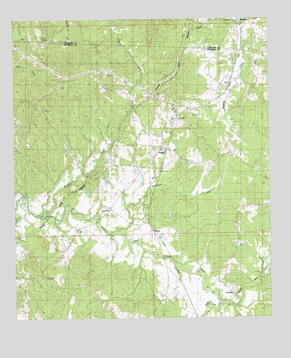
Lorman, MS USGS Topographic Map
Click on map above to begin viewing in our Map Viewer.

This topographic map contains these locations and features:
Feature Name Type Latitude Longitude GNIS ID View Map
Barnes CreekStreamN31.8735°W91.0109°666530View Map
Bolls CreekStreamN31.7568°W91.0243°667412View Map
C L Huff Lake DamDamN31.8052°W91.0634°680899View Map
C L Huff Lake DamDamN31.8052°W91.0884°680900View Map
Cane Ridge Church (historical)ChurchN31.8146°W91.0584°686415View Map
China Grove CemeteryCemeteryN31.8332°W91.0648°668392View Map
Claiborne County Fire Department Station 1BuildingN31.8696°W91.0148°2667871View Map
CliftonPopulated PlaceN31.8349°W91.0446°686416View Map
Coon BoxLocaleN31.7957°W91.0784°668795View Map
Fellowship ChurchChurchN31.8377°W91.1109°669934View Map
Gibbs SchoolSchoolN31.8013°W91.1148°670373View Map
Hickman CreekStreamN31.7927°W91.1146°671147View Map
Jessamine Ridge ChurchChurchN31.7877°W91.0476°671865View Map
Katherine Street Lake DamDamN31.7918°W91.0501°680895View Map
LormanPopulated PlaceN31.8204°W91.0501°672868View Map
Lorman Post OfficePost OfficeN31.8220°W91.0505°2768745View Map
McCaa CemeteryCemeteryN31.8590°W91.0165°673286View Map
MeltonPopulated PlaceN31.7866°W91.0571°692065View Map
Morning Star ChurchChurchN31.8477°W91.0223°673829View Map
North Fork (historical)Populated PlaceN31.8179°W91.0954°686428View Map
Poplar Hill SchoolSchoolN31.7638°W91.0937°676229View Map
Ridge CemeteryCemeteryN31.8152°W91.0579°676652View Map
Russum Oil FieldOilfieldN31.8502°W91.0048°691018View Map
Russum SchoolSchoolN31.8699°W91.0162°676973View Map
Sam Fonda Lake DamDamN31.7852°W91.0518°680892View Map
Shankstown (historical)Populated PlaceN31.8146°W91.0293°707704View Map
Shankstown CreekStreamN31.7849°W91.0796°677611View Map
StoningtonPopulated PlaceN31.7591°W91.0173°692246View Map
Waterloo CemeteryCemeteryN31.8440°W91.0593°679367View Map
Waterloo ChurchChurchN31.8471°W91.0626°679368View Map

Note: Coordinates in the location and feature list above are referenced to NAD83 datum.


Copyright (C) 2008-2024 Ryan Niemi / Sunset Dynamics ... All Rights Reserved