TopoQuest Logo
Do you find TopoQuest useful?
Help keep TopoQuest running and adding new maps/features by donating!
Bitcoin:  19c7KJd3qBynnjoSw5npx9KScwjBe4ifkT
Litecoin:  LXs6TkuXGGXo1vDsWCkWVdjQX94eUKd6ui
Home View Maps Find Maps Find Places Resources & Links


Rodney, Mississippi Topographic Map

USGS Map Title: Rodney, MS
USGS Map MRC: 31091G2
DRG (GeoTIFF) Download: o31091g2.tif


Neighboring USGS Topographic Map Quads:


  Lake Bruin, LA  
31091H3
 

  Saint Joseph, LA  
31091H2
 

  Widows Creek, MS  
31091H1
 

  Chamblee, LA  
31091G3
 

  Rodney, MS  
31091G2
 

  Lorman, MS  
31091G1
 

  Pine Ridge, MS  
31091F3
 

  Church Hill, MS  
31091F2
 

  Fayette, MS  
31091F1


Map MRC Location:

N32°
W92°
N32°
W91°
H8 H7 H6 H5 H4 H3 H2 H1
G8 G7 G6 G5 G4 G3 G2 G1
F8 F7 F6 F5 F4 F3 F2 F1
E8 E7 E6 E5 E4 E3 E2 E1
D8 D7 D6 D5 D4 D3 D2 D1
C8 C7 C6 C5 C4 C3 C2 C1
B8 B7 B6 B5 B4 B3 B2 B1
A8 A7 A6 A5 A4 A3 A2 A1
N31°
W92°
N31°
W91°

Rodney, MS USGS 1:24K Topographic Map Preview:
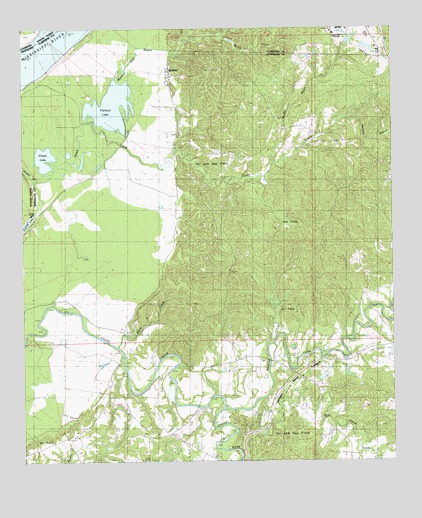
Rodney, MS USGS Topographic Map
Click on map above to begin viewing in our Map Viewer.

This topographic map contains these locations and features:
Feature Name Type Latitude Longitude GNIS ID View Map
Alcorn College Lake DamDamN31.8685°W91.1318°680920View Map
Alcorn College Lake DamDamN31.8702°W91.1351°680921View Map
Alcorn College Lake DamDamN31.8702°W91.1384°680922View Map
Alcorn State University AirportAirportN31.8669°W91.1315°680328View Map
Black CreekStreamN31.7938°W91.2379°667209View Map
Brownland Oil FieldOilfieldN31.8185°W91.1598°691009View Map
Bush LakeLakeN31.8657°W91.2146°667851View Map
Calvits LakeSwampN31.8127°W91.2179°686414View Map
Cool Boiler BayouStreamN31.8732°W91.1858°668789View Map
Dobyns Bridge (historical)BridgeN31.7799°W91.1487°686418View Map
Dowd CreekStreamN31.8368°W91.2421°669365View Map
Fayette Oil and Gas FieldOilfieldN31.7616°W91.1529°669928View Map
Flatland LakeLakeN31.8542°W91.2181°670030View Map
George Harrell Lake DamDamN31.7768°W91.1401°680887View Map
George Harrell Lake DamDamN31.7785°W91.1518°680889View Map
Golden Mount ChurchChurchN31.7866°W91.2098°670458View Map
Griffin CemeteryCemeteryN31.8418°W91.1432°670739View Map
Gum Ridge (historical)Populated PlaceN31.7835°W91.2446°707694View Map
Harpers BranchStreamN31.8488°W91.1396°670960View Map
Huntley (historical)Populated PlaceN31.7766°W91.1807°686422View Map
Idlewild Oil FieldOilfieldN31.7552°W91.2393°671652View Map
Ihrie (historical)Populated PlaceN31.7785°W91.2182°707695View Map
Laurel Hill CemeteryCemeteryN31.8535°W91.1737°672324View Map
Laurel Hill ChurchChurchN31.8491°W91.1643°672325View Map
Laurel Hill Plantation (historical)LocaleN31.8571°W91.1765°686788View Map
Logan CemeteryCemeteryN31.8421°W91.1959°672769View Map
Mammy Judy BayouStreamN31.8480°W91.2274°691638View Map
Miller School (historical)SchoolN31.8718°W91.1501°686795View Map
Mount Israel ChurchChurchN31.7791°W91.1704°674041View Map
Mud Island CreekStreamN31.7679°W91.1687°674439View Map
Muddy BayouStreamN31.8352°W91.1657°674448View Map
Noland Hill SchoolSchoolN31.8024°W91.1340°674930View Map
North Fayette Oil FieldOilfieldN31.7935°W91.1612°691014View Map
North Fork Coles CreekStreamN31.7660°W91.1829°674947View Map
Old Mount Zion Church (historical)ChurchN31.8632°W91.2007°686429View Map
Old Rodney Presbyterian ChurchChurchN31.8627°W91.1993°686430View Map
Piazza LakeLakeN31.8384°W91.2423°675697View Map
R R Smith Lake DamDamN31.7835°W91.1251°680891View Map
R R Smith Lake DamDamN31.7852°W91.1334°680893View Map
Richland ChurchChurchN31.7577°W91.2098°676640View Map
RodneyPopulated PlaceN31.8613°W91.1998°676809View Map
Rodney Baptist ChurchChurchN31.8613°W91.2012°686433View Map
Rodney CemeteryCemeteryN31.8627°W91.1987°707702View Map
Rodney Island Oil FieldOilfieldN31.8640°W91.2321°691016View Map
Rodney LandingLocaleN31.8218°W91.2446°686436View Map
Rodney Oil FieldOilfieldN31.8374°W91.1862°691017View Map
Rodney Sacred Heart Catholic ChurchChurchN31.8577°W91.1993°686437View Map
Rodney School (historical)SchoolN31.8635°W91.1998°686438View Map
Saint Peter ChurchChurchN31.7729°W91.2184°677227View Map
South Fork Coles CreekStreamN31.7663°W91.1832°694844View Map
Southside Plantation (historical)LocaleN31.8377°W91.2140°686441View Map
Supervisor District 5CivilN31.8199°W91.1983°711913View Map
Travelers Rest ChurchChurchN31.8327°W91.1940°678858View Map
Uniontown (historical)Populated PlaceN31.7585°W91.1729°686442View Map
Williams Lake DamDamN31.7502°W91.1834°680877View Map

Note: Coordinates in the location and feature list above are referenced to NAD83 datum.


Copyright (C) 2008-2024 Ryan Niemi / Sunset Dynamics ... All Rights Reserved