TopoQuest Logo
Do you find TopoQuest useful?
Help keep TopoQuest running and adding new maps/features by donating!
Bitcoin:  19c7KJd3qBynnjoSw5npx9KScwjBe4ifkT
Litecoin:  LXs6TkuXGGXo1vDsWCkWVdjQX94eUKd6ui
Home View Maps Find Maps Find Places Resources & Links


Long Prairie, Minnesota Topographic Map

USGS Map Title: Long Prairie, MN
USGS Map MRC: 45094H7
DRG (GeoTIFF) Download: o45094h7.tif


Neighboring USGS Topographic Map Quads:


  Browerville SW, MN  
46094A8
 

  Browerville, MN  
46094A7
 

  Lake Beauty, MN  
46094A6
 

  Round Prairie, MN  
45094H8
 

  Long Prairie, MN  
45094H7
 

  Swanville, MN  
45094H6
 

  Sauk Lake, MN  
45094G8
 

  Ward Springs, MN  
45094G7
 

  Burtrum, MN  
45094G6


Map MRC Location:

N46°
W95°
N46°
W94°
H8 H7 H6 H5 H4 H3 H2 H1
G8 G7 G6 G5 G4 G3 G2 G1
F8 F7 F6 F5 F4 F3 F2 F1
E8 E7 E6 E5 E4 E3 E2 E1
D8 D7 D6 D5 D4 D3 D2 D1
C8 C7 C6 C5 C4 C3 C2 C1
B8 B7 B6 B5 B4 B3 B2 B1
A8 A7 A6 A5 A4 A3 A2 A1
N45°
W95°
N45°
W94°

Long Prairie, MN USGS 1:24K Topographic Map Preview:
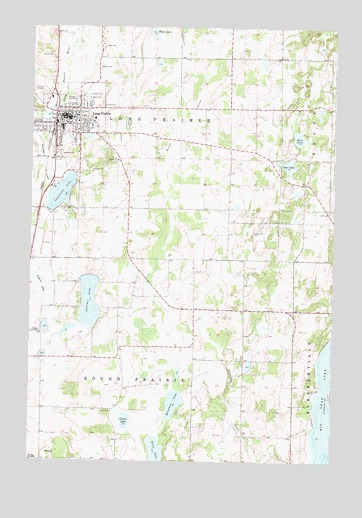
Long Prairie, MN USGS Topographic Map
Click on map above to begin viewing in our Map Viewer.

This topographic map contains these locations and features:
Feature Name Type Latitude Longitude GNIS ID View Map
American Lutheran ChurchChurchN45.9714°W94.8506°2068869View Map
Assembly of God ChurchChurchN45.9747°W94.8653°2068871View Map
Bernard Fry Structure DamDamN45.8850°W94.8370°1776345View Map
Big Swan LakeLakeN45.8844°W94.7515°640140View Map
Camp RNL RV ParkLocaleN45.9847°W94.8658°2068879View Map
Center LakeLakeN45.8868°W94.8367°641049View Map
Centracare Care ClinicHospitalN45.9736°W94.8489°2068877View Map
Charlotte LakeLakeN45.9522°W94.8627°641117View Map
City of Long PrairieCivilN45.9723°W94.8599°2395758View Map
Dahn LakeLakeN45.9605°W94.7691°642595View Map
Emmanuel Lutheran ChurchChurchN45.9811°W94.8564°2068857View Map
Felix LakeLakeN45.8759°W94.8229°643592View Map
First Baptist ChurchChurchN45.9747°W94.8653°2068870View Map
Hansman LakeLakeN45.8915°W94.8155°644641View Map
KEYL-AM (Long Prairie)TowerN45.9625°W94.8695°662940View Map
Lake Charlotte ParkParkN45.9578°W94.8556°2068854View Map
Lashier LakeLakeN45.9258°W94.8708°646515View Map
Latimer LakeLakeN45.9209°W94.8505°646518View Map
Long Drive-InLocaleN45.9819°W94.8700°2702904View Map
Long PrairiePopulated PlaceN45.9747°W94.8656°647139View Map
Long Prairie (historical)LocaleN45.9708°W94.8661°2068865View Map
Long Prairie Ambulance ServiceBuildingN45.9733°W94.8609°2721216View Map
Long Prairie CemeteryCemeteryN45.9411°W94.7836°647140View Map
Long Prairie City HallBuildingN45.9744°W94.8594°2068864View Map
Long Prairie Country ClubLocaleN45.9681°W94.8528°2068859View Map
Long Prairie Fire DepartmentBuildingN45.9652°W94.8665°2068858View Map
Long Prairie High SchoolSchoolN45.9814°W94.8500°2068872View Map
Long Prairie LibraryBuildingN45.9744°W94.8594°2068863View Map
Long Prairie Memorial Hospital and HomeHospitalN45.9737°W94.8487°2068876View Map
Long Prairie Memorial Nursing HomeHospitalN45.9736°W94.8489°2068875View Map
Long Prairie Middle SchoolSchoolN45.9708°W94.8625°2068874View Map
Long Prairie Police DepartmentBuildingN45.9652°W94.8665°2068862View Map
Long Prairie Post OfficePost OfficeN45.9747°W94.8589°2068890View Map
Meyer LakeLakeN45.9975°W94.8240°647790View Map
Mud LakeLakeN45.9681°W94.7650°648271View Map
Saint Mary CemeteryCemeteryN45.9794°W94.8531°650832View Map
Saint Mary's ChurchChurchN45.9739°W94.8575°2068866View Map
Saint Mary's SchoolSchoolN45.9739°W94.8575°2068873View Map
School Number 2268SchoolN45.9122°W94.8714°651560View Map
Todd County CourthouseBuildingN45.9725°W94.8608°2068855View Map
Todd County FairgroundsLocaleN45.9722°W94.8639°2068853View Map
Todd County JailBuildingN45.9726°W94.8610°2758670View Map
Todd County MuseumBuildingN45.9739°W94.8589°2068861View Map
Todd County Sheriff's OfficeBuildingN45.9725°W94.8610°2068856View Map
Todd FieldAirportN45.8986°W94.8739°660259View Map
Township of Long PrairieCivilN45.9764°W94.8325°664821View Map
Township of Round PrairieCivilN45.8897°W94.8286°665481View Map
Trinity Lutheran ChurchChurchN45.9728°W94.8558°2068860View Map
United Methodist ChurchChurchN45.9742°W94.8558°2068867View Map
Venewitz CreekStreamN45.9739°W94.8672°653625View Map
Zion United Church of ChristChurchN45.9694°W94.8517°2068868View Map

Note: Coordinates in the location and feature list above are referenced to NAD83 datum.


Copyright (C) 2008-2024 Ryan Niemi / Sunset Dynamics ... All Rights Reserved