TopoQuest Logo
Do you find TopoQuest useful?
Help keep TopoQuest running and adding new maps/features by donating!
Bitcoin:  19c7KJd3qBynnjoSw5npx9KScwjBe4ifkT
Litecoin:  LXs6TkuXGGXo1vDsWCkWVdjQX94eUKd6ui
Home View Maps Find Maps Find Places Resources & Links


Browerville, Minnesota Topographic Map

USGS Map Title: Browerville, MN
USGS Map MRC: 46094A7
DRG (GeoTIFF) Download: o46094a7.tif


Neighboring USGS Topographic Map Quads:


  Clarissa, MN  
46094B8
 

  Browerville NE, MN  
46094B7
 

  Lincoln, MN  
46094B6
 

  Browerville SW, MN  
46094A8
 

  Browerville, MN  
46094A7
 

  Lake Beauty, MN  
46094A6
 

  Round Prairie, MN  
45094H8
 

  Long Prairie, MN  
45094H7
 

  Swanville, MN  
45094H6


Map MRC Location:

N47°
W95°
N47°
W94°
H8 H7 H6 H5 H4 H3 H2 H1
G8 G7 G6 G5 G4 G3 G2 G1
F8 F7 F6 F5 F4 F3 F2 F1
E8 E7 E6 E5 E4 E3 E2 E1
D8 D7 D6 D5 D4 D3 D2 D1
C8 C7 C6 C5 C4 C3 C2 C1
B8 B7 B6 B5 B4 B3 B2 B1
A8 A7 A6 A5 A4 A3 A2 A1
N46°
W95°
N46°
W94°

Browerville, MN USGS 1:24K Topographic Map Preview:
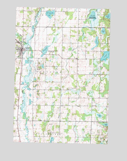
Browerville, MN USGS Topographic Map
Click on map above to begin viewing in our Map Viewer.

This topographic map contains these locations and features:
Feature Name Type Latitude Longitude GNIS ID View Map
BrowervillePopulated PlaceN46.0858°W94.8659°640527View Map
Browerville (historical)LocaleN46.0856°W94.8653°2068920View Map
Browerville AmbulanceBuildingN46.0851°W94.8676°2721232View Map
Browerville City HallBuildingN46.0850°W94.8667°2068928View Map
Browerville Fire DepartmentBuildingN46.0860°W94.8668°2068929View Map
Browerville High SchoolSchoolN46.0858°W94.8714°2068926View Map
Browerville Police DepartmentBuildingN46.0851°W94.8676°2068927View Map
Browerville Post OfficePost OfficeN46.0844°W94.8667°2068922View Map
Christ the King ChurchChurchN46.0867°W94.8675°2068924View Map
Christ the King SchoolSchoolN46.0869°W94.8678°2068925View Map
City of BrowervilleCivilN46.0807°W94.8646°2393436View Map
Coal LakeLakeN46.0815°W94.7552°641364View Map
Drayer CreekStreamN46.0908°W94.8581°642921View Map
Eagle CreekStreamN46.0908°W94.8581°643011View Map
Evergreen CemeteryCemeteryN46.0955°W94.8656°643460View Map
Harris CreekStreamN46.0911°W94.8614°644686View Map
Horseshoe LakeLakeN46.1193°W94.8301°645222View Map
Jacobs LakeLakeN46.0180°W94.7533°645571View Map
KXDL-FM (Browerville)TowerN46.0541°W94.8475°663020View Map
Lakewood ClinicHospitalN46.0831°W94.8683°2068923View Map
Long LakeLakeN46.0935°W94.7683°647072View Map
Mud LakeLakeN46.1187°W94.7733°648278View Map
Rice LakeLakeN46.0261°W94.7620°649999View Map
Round LakeLakeN46.1041°W94.7592°650335View Map
School Number 2267SchoolN46.0777°W94.7925°651559View Map
School Number 2285SchoolN46.0014°W94.7931°651568View Map
School Number 2327SchoolN46.0202°W94.8406°651580View Map
School Number 2362SchoolN46.0352°W94.7711°651585View Map
Sheet LakeLakeN46.0864°W94.8349°651934View Map
Sheets Lake State Wildlife Management AreaParkN46.0850°W94.8325°651935View Map
Township of HartfordCivilN46.0629°W94.8333°664404View Map
Turtle Creek State Wildlife Management AreaParkN46.1144°W94.7745°653371View Map
Weitemier CemeteryCemeteryN46.1072°W94.8270°653896View Map
Zion Lutheran ChurchChurchN46.0897°W94.8711°2068921View Map

Note: Coordinates in the location and feature list above are referenced to NAD83 datum.


Copyright (C) 2008-2024 Ryan Niemi / Sunset Dynamics ... All Rights Reserved