TopoQuest Logo
Do you find TopoQuest useful?
Help keep TopoQuest running and adding new maps/features by donating!
Bitcoin:  19c7KJd3qBynnjoSw5npx9KScwjBe4ifkT
Litecoin:  LXs6TkuXGGXo1vDsWCkWVdjQX94eUKd6ui
Home View Maps Find Maps Find Places Resources & Links


Lodge Corner, Arkansas Topographic Map

USGS Map Title: Lodge Corner, AR
USGS Map MRC: 34091C5
DRG (GeoTIFF) Download: o34091c5.tif


Neighboring USGS Topographic Map Quads:


  Humphrey, AR  
34091D6
 

  Stuttgart South, AR  
34091D5
 

  Almyra, AR  
34091D4
 

  Humphrey SW, AR  
34091C6
 

  Lodge Corner, AR  
34091C5
 

  De Witt SW, AR  
34091C4
 

  Cornerstone, AR  
34091B6
 

  Reydell, AR  
34091B5
 

  One Horse Store, AR  
34091B4


Map MRC Location:

N35°
W92°
N35°
W91°
H8 H7 H6 H5 H4 H3 H2 H1
G8 G7 G6 G5 G4 G3 G2 G1
F8 F7 F6 F5 F4 F3 F2 F1
E8 E7 E6 E5 E4 E3 E2 E1
D8 D7 D6 D5 D4 D3 D2 D1
C8 C7 C6 C5 C4 C3 C2 C1
B8 B7 B6 B5 B4 B3 B2 B1
A8 A7 A6 A5 A4 A3 A2 A1
N34°
W92°
N34°
W91°

Lodge Corner, AR USGS 1:24K Topographic Map Preview:
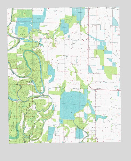
Lodge Corner, AR USGS Topographic Map
Click on map above to begin viewing in our Map Viewer.

This topographic map contains these locations and features:
Feature Name Type Latitude Longitude GNIS ID View Map
Bayless CemeteryCemeteryN34.3143°W91.6179°46170View Map
Benson BridgeBridgeN34.2937°W91.5843°46389View Map
Benson Bridge ChurchChurchN34.2926°W91.5904°46390View Map
Benson LakeLakeN34.3137°W91.5873°74653View Map
Brewer ChurchChurchN34.2665°W91.5748°46927View Map
Brewer School (historical)SchoolN34.2665°W91.5751°63867View Map
Cox ReservoirReservoirN34.3687°W91.5437°62180View Map
Ditch Number 15CanalN34.3234°W91.5032°62267View Map
Grand Cypress IslandIslandN34.2679°W91.6204°49542View Map
HaglerPopulated PlaceN34.2543°W91.5282°57040View Map
Hamptons ReservoirReservoirN34.2832°W91.5598°63871View Map
Horseshoe LakeSwampN34.2539°W91.6011°50341View Map
Jesus Name ChurchChurchN34.3479°W91.6065°50642View Map
King BayouStreamN34.3359°W91.5985°50847View Map
Lodge CornerPopulated PlaceN34.3001°W91.5251°51382View Map
One Horse Volunteer Fire Department SubstationBuildingN34.2619°W91.5579°2116904View Map
Red Hill School (historical)SchoolN34.3459°W91.5729°63876View Map
Stillwell School (historical)SchoolN34.3215°W91.5362°63879View Map
Township of GarlandCivilN34.3271°W91.5102°63660View Map
Wilson ReservoirReservoirN34.3623°W91.5988°78910View Map
Youngblood BridgeBridgeN34.3473°W91.6132°56615View Map

Note: Coordinates in the location and feature list above are referenced to NAD83 datum.


Copyright (C) 2008-2024 Ryan Niemi / Sunset Dynamics ... All Rights Reserved