TopoQuest Logo
Do you find TopoQuest useful?
Help keep TopoQuest running and adding new maps/features by donating!
Bitcoin:  19c7KJd3qBynnjoSw5npx9KScwjBe4ifkT
Litecoin:  LXs6TkuXGGXo1vDsWCkWVdjQX94eUKd6ui
Home View Maps Find Maps Find Places Resources & Links


One Horse Store, Arkansas Topographic Map

USGS Map Title: One Horse Store, AR
USGS Map MRC: 34091B4
DRG (GeoTIFF) Download: o34091b4.tif


Neighboring USGS Topographic Map Quads:


  Lodge Corner, AR  
34091C5
 

  De Witt SW, AR  
34091C4
 

  De Witt, AR  
34091C3
 

  Reydell, AR  
34091B5
 

  One Horse Store, AR  
34091B4
 

  Tichnor, AR  
34091B3
 

  Cades, AR  
34091A5
 

  Gillett, AR  
34091A4
 

  Arkansas Post, AR  
34091A3


Map MRC Location:

N35°
W92°
N35°
W91°
H8 H7 H6 H5 H4 H3 H2 H1
G8 G7 G6 G5 G4 G3 G2 G1
F8 F7 F6 F5 F4 F3 F2 F1
E8 E7 E6 E5 E4 E3 E2 E1
D8 D7 D6 D5 D4 D3 D2 D1
C8 C7 C6 C5 C4 C3 C2 C1
B8 B7 B6 B5 B4 B3 B2 B1
A8 A7 A6 A5 A4 A3 A2 A1
N34°
W92°
N34°
W91°

One Horse Store, AR USGS 1:24K Topographic Map Preview:
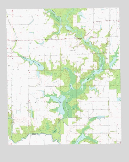
One Horse Store, AR USGS Topographic Map
Click on map above to begin viewing in our Map Viewer.

This topographic map contains these locations and features:
Feature Name Type Latitude Longitude GNIS ID View Map
Chaney LakeReservoirN34.1758°W91.4054°80865View Map
Chaney Lake DamDamN34.1768°W91.4101°80864View Map
Cooper School (historical)SchoolN34.1468°W91.3882°62178View Map
Flag LakeLakeN34.1286°W91.4192°75712View Map
Haller CemeteryCemeteryN34.2034°W91.3909°49788View Map
Haller LakeReservoirN34.1999°W91.3955°75731View Map
Hurricane BayouStreamN34.2365°W91.4329°50427View Map
Jacobs LakeReservoirN34.1704°W91.4287°75747View Map
Johnson School (historical)SchoolN34.2062°W91.4415°62228View Map
Lake WilsonReservoirN34.2439°W91.4171°80867View Map
Lake Wilson DamDamN34.2468°W91.4185°80866View Map
Little Pecan LakeLakeN34.1946°W91.4344°75765View Map
Loyd Rodgers ReservoirReservoirN34.2426°W91.4463°75781View Map
Lumsden LakeReservoirN34.1540°W91.4736°80857View Map
Lumsden Lake DamDamN34.1501°W91.4735°80856View Map
Lumsdens ReservoirReservoirN34.1620°W91.4430°75783View Map
Lumsdens Reservoir DamDamN34.1640°W91.4418°80863View Map
McKinley ReservoirReservoirN34.2025°W91.3819°80869View Map
McKinley Reservoir DamDamN34.1968°W91.3868°80868View Map
Mill BayouStreamN34.1273°W91.4446°51963View Map
One Horse StoreLocaleN34.2209°W91.4946°53049View Map
One Horse Volunteer Fire DepartmentBuildingN34.2214°W91.4939°2116903View Map
Pampas School (historical)SchoolN34.1584°W91.4962°62274View Map
Pecan BayouStreamN34.1948°W91.4382°53257View Map
Pecan LakeReservoirN34.1786°W91.4170°75817View Map
Prairie School (historical)SchoolN34.2234°W91.3862°62284View Map
Rodgers Lake Number OneReservoirN34.2184°W91.4614°80859View Map
Rodgers Lake Number One DamDamN34.2184°W91.4585°80858View Map
Rodgers Lake Number TwoReservoirN34.2305°W91.4421°80861View Map
Rodgers Lake Number Two DamDamN34.2351°W91.4401°80860View Map
Sid's Place AirportAirportN34.2190°W91.4573°2770242View Map
Sollars ReservoirReservoirN34.2032°W91.4760°75853View Map
Stanley Point School (historical)SchoolN34.1929°W91.3871°62304View Map
Township of Bayou MetoCivilN34.2148°W91.4788°63656View Map
Township of StanleyCivilN34.1573°W91.3925°63670View Map
Van Camp CemeteryCemeteryN34.2226°W91.4534°55881View Map
Wegert ReservoirReservoirN34.2008°W91.4731°75882View Map
Wegert Reservoir DamDamN34.1940°W91.4657°80862View Map
Wheeler LakeLakeN34.1377°W91.4485°75883View Map

Note: Coordinates in the location and feature list above are referenced to NAD83 datum.


Copyright (C) 2008-2024 Ryan Niemi / Sunset Dynamics ... All Rights Reserved