TopoQuest Logo
Do you find TopoQuest useful?
Help keep TopoQuest running and adding new maps/features by donating!
Bitcoin:  19c7KJd3qBynnjoSw5npx9KScwjBe4ifkT
Litecoin:  LXs6TkuXGGXo1vDsWCkWVdjQX94eUKd6ui
Home View Maps Find Maps Find Places Resources & Links


Libuse, Louisiana Topographic Map

USGS Map Title: Libuse, LA
USGS Map MRC: 31092C3
DRG (GeoTIFF) Download: o31092c3.tif


Neighboring USGS Topographic Map Quads:


  Ball, LA  
31092D4
 

  Green Gables, LA  
31092D3
 

  Holloway, LA  
31092D2
 

  Alexandria, LA  
31092C4
 

  Libuse, LA  
31092C3
 

  Buckeye, LA  
31092C2
 

  Woodworth East, LA  
31092B4
 

  Latanier, LA  
31092B3
 

  Effie, LA  
31092B2


Map MRC Location:

N32°
W93°
N32°
W92°
H8 H7 H6 H5 H4 H3 H2 H1
G8 G7 G6 G5 G4 G3 G2 G1
F8 F7 F6 F5 F4 F3 F2 F1
E8 E7 E6 E5 E4 E3 E2 E1
D8 D7 D6 D5 D4 D3 D2 D1
C8 C7 C6 C5 C4 C3 C2 C1
B8 B7 B6 B5 B4 B3 B2 B1
A8 A7 A6 A5 A4 A3 A2 A1
N31°
W93°
N31°
W92°

Libuse, LA USGS 1:24K Topographic Map Preview:
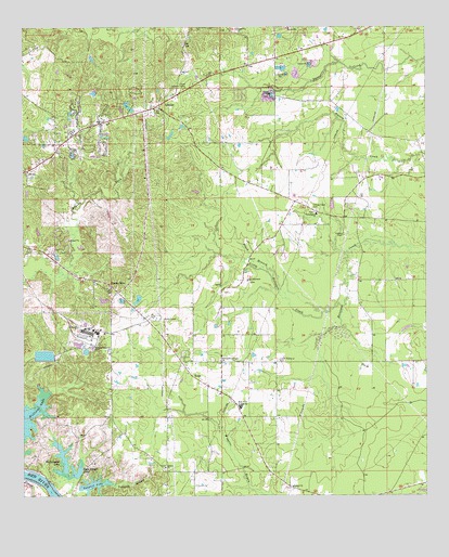
Libuse, LA USGS Topographic Map
Click on map above to begin viewing in our Map Viewer.

This topographic map contains these locations and features:
Feature Name Type Latitude Longitude GNIS ID View Map
Barron School (historical)SchoolN31.3480°W92.2693°551666View Map
Black BranchStreamN31.3035°W92.2935°533177View Map
Brushy ForkStreamN31.3088°W92.3657°553808View Map
Buckeye Ward ElevenCivilN31.3585°W92.2737°545178View Map
Buttonwood LakeLakeN31.2598°W92.3633°553845View Map
Carmel Baptist ChurchChurchN31.2530°W92.2915°553898View Map
Cedar Grove School (historical)SchoolN31.2505°W92.2835°551684View Map
Craig CemeteryCemeteryN31.3074°W92.3051°551695View Map
Craig TabernacleChurchN31.3077°W92.3049°534231View Map
Czech National CemeteryCemeteryN31.2860°W92.2962°534381View Map
Holiday Village Volunteer Fire Department District 4 Station 1BuildingN31.3496°W92.3452°2672900View Map
Holiday Village Volunteer Fire Department District 4 Station 4BuildingN31.3296°W92.2928°2672994View Map
Hooper CemeteryCemeteryN31.3199°W92.2754°535772View Map
KolinPopulated PlaceN31.2832°W92.3226°543364View Map
Kolin Baptist ChurchChurchN31.2830°W92.3240°551726View Map
LibusePopulated PlaceN31.3541°W92.3335°536431View Map
Libuse Czech CemeteryCemeteryN31.3268°W92.2837°536432View Map
Libuse Lookout TowerTowerN31.3591°W92.3240°558795View Map
Libuse Post OfficePost OfficeN31.3541°W92.3343°1631746View Map
Little Horsepen CreekStreamN31.3013°W92.2760°555076View Map
MollerPopulated PlaceN31.3563°W92.2935°551740View Map
Palmer ChurchChurchN31.2580°W92.3307°555584View Map
Parish Governing Authority District BCivilN31.2926°W92.3728°1930302View Map
Philadelphia Baptist ChurchChurchN31.3255°W92.2840°555634View Map
Philadelphia School (historical)SchoolN31.3255°W92.2843°551756View Map
Rock Island LakeLakeN31.2573°W92.3580°555819View Map
Ruby - Kolan Volunteer Fire DepartmentBuildingN31.2828°W92.3271°2672769View Map
Ruby - Wise Elementary SchoolSchoolN31.2737°W92.3075°555864View Map
Saints Francis and Ann ChurchChurchN31.2860°W92.3129°555951View Map
Shady OaksPopulated PlaceN31.3060°W92.3468°543657View Map
Tanyard BranchStreamN31.2538°W92.3468°539785View Map
Tanyard LakeLakeN31.2531°W92.3531°556205View Map
Wise School (historical)SchoolN31.2544°W92.3282°551804View Map

Note: Coordinates in the location and feature list above are referenced to NAD83 datum.


Copyright (C) 2008-2024 Ryan Niemi / Sunset Dynamics ... All Rights Reserved