TopoQuest Logo
Do you find TopoQuest useful?
Help keep TopoQuest running and adding new maps/features by donating!
Bitcoin:  19c7KJd3qBynnjoSw5npx9KScwjBe4ifkT
Litecoin:  LXs6TkuXGGXo1vDsWCkWVdjQX94eUKd6ui
Home View Maps Find Maps Find Places Resources & Links


Leroy, Pennsylvania Topographic Map

USGS Map Title: Leroy, PA
USGS Map MRC: 41076F6
DRG (GeoTIFF) Download: o41076f6.tif


Neighboring USGS Topographic Map Quads:


  Troy, PA  
41076G7
 

  East Troy, PA  
41076G6
 

  Ulster, PA  
41076G5
 

  Canton, PA  
41076F7
 

  Leroy, PA  
41076F6
 

  Powell, PA  
41076F5
 

  Grover, PA  
41076E7
 

  Shunk, PA  
41076E6
 

  Overton, PA  
41076E5


Map MRC Location:

N42°
W77°
N42°
W76°
H8 H7 H6 H5 H4 H3 H2 H1
G8 G7 G6 G5 G4 G3 G2 G1
F8 F7 F6 F5 F4 F3 F2 F1
E8 E7 E6 E5 E4 E3 E2 E1
D8 D7 D6 D5 D4 D3 D2 D1
C8 C7 C6 C5 C4 C3 C2 C1
B8 B7 B6 B5 B4 B3 B2 B1
A8 A7 A6 A5 A4 A3 A2 A1
N41°
W77°
N41°
W76°

Leroy, PA USGS 1:24K Topographic Map Preview:
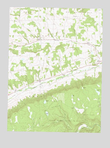
Leroy, PA USGS Topographic Map
Click on map above to begin viewing in our Map Viewer.

This topographic map contains these locations and features:
Feature Name Type Latitude Longitude GNIS ID View Map
Bailey CornersLocaleN41.7184°W76.6894°1198347View Map
BarclayPopulated PlaceN41.6559°W76.6263°1203020View Map
Barclay CemeteryCemeteryN41.6476°W76.6302°2776403View Map
CarbonPopulated PlaceN41.6498°W76.6616°1203221View Map
Carbon RunStreamN41.6309°W76.6430°1171190View Map
Fairview ChurchChurchN41.7490°W76.6302°1174527View Map
Granville CenterPopulated PlaceN41.7179°W76.7069°1198280View Map
Granville Center CemeteryCemeteryN41.7184°W76.7081°2776437View Map
Gulf BrookStreamN41.6737°W76.7055°1176304View Map
Holcomb CemeteryCemeteryN41.6715°W76.7036°2776443View Map
Holcomb PondLakeN41.6550°W76.7000°1177191View Map
Holcomb PondSwampN41.6695°W76.6499°1177192View Map
LaquinPopulated PlaceN41.6323°W76.6508°1203985View Map
LeroyPopulated PlaceN41.6759°W76.7072°1204014View Map
Leroy CemeteryCemeteryN41.6808°W76.6887°2776454View Map
Marsh RunStreamN41.6298°W76.7152°1180458View Map
McCraney RunStreamN41.6373°W76.6730°1180672View Map
Mott Family CemeteryCemeteryN41.6729°W76.7011°2776467View Map
Mud PondReservoirN41.6534°W76.6630°1195723View Map
Mud PondLakeN41.6623°W76.6639°1182013View Map
Mud Pond DamDamN41.6534°W76.6630°1195722View Map
Sayees CornersLocaleN41.7145°W76.6452°1187048View Map
Sunfish PondLakeN41.6437°W76.6968°1189066View Map
Swamp RunStreamN41.6309°W76.7050°1189131View Map
Swimming DamReservoirN41.6659°W76.6295°1189190View Map
Township of GranvilleCivilN41.7141°W76.7183°1215980View Map
Township of LeroyCivilN41.6426°W76.7188°1215982View Map
Turnip Patch RunStreamN41.6515°W76.6811°1189967View Map
Vroman HillPopulated PlaceN41.7415°W76.6616°1204880View Map
Vroman Hill CemeteryCemeteryN41.7440°W76.6599°2776517View Map
Vroman Hill Church (historical)ChurchN41.7423°W76.6558°1197328View Map
Wallace BrookStreamN41.6640°W76.7375°1190512View Map
West FranklinPopulated PlaceN41.6967°W76.6269°1198309View Map
West LeroyPopulated PlaceN41.6651°W76.7397°1204929View Map
Woodruff CornersLocaleN41.6834°W76.6777°1191758View Map

Note: Coordinates in the location and feature list above are referenced to NAD83 datum.


Copyright (C) 2008-2024 Ryan Niemi / Sunset Dynamics ... All Rights Reserved