TopoQuest Logo
Do you find TopoQuest useful?
Help keep TopoQuest running and adding new maps/features by donating!
Bitcoin:  19c7KJd3qBynnjoSw5npx9KScwjBe4ifkT
Litecoin:  LXs6TkuXGGXo1vDsWCkWVdjQX94eUKd6ui
Home View Maps Find Maps Find Places Resources & Links


Grover, Pennsylvania Topographic Map

USGS Map Title: Grover, PA
USGS Map MRC: 41076E7
DRG (GeoTIFF) Download: o41076e7.tif


Neighboring USGS Topographic Map Quads:


  Gleason, PA  
41076F8
 

  Canton, PA  
41076F7
 

  Leroy, PA  
41076F6
 

  Ralston, PA  
41076E8
 

  Grover, PA  
41076E7
 

  Shunk, PA  
41076E6
 

  Bodines, PA  
41076D8
 

  Barbours, PA  
41076D7
 

  Hillsgrove, PA  
41076D6


Map MRC Location:

N42°
W77°
N42°
W76°
H8 H7 H6 H5 H4 H3 H2 H1
G8 G7 G6 G5 G4 G3 G2 G1
F8 F7 F6 F5 F4 F3 F2 F1
E8 E7 E6 E5 E4 E3 E2 E1
D8 D7 D6 D5 D4 D3 D2 D1
C8 C7 C6 C5 C4 C3 C2 C1
B8 B7 B6 B5 B4 B3 B2 B1
A8 A7 A6 A5 A4 A3 A2 A1
N41°
W77°
N41°
W76°

Grover, PA USGS 1:24K Topographic Map Preview:
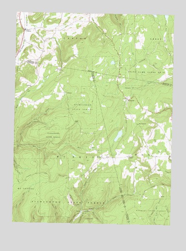
Grover, PA USGS Topographic Map
Click on map above to begin viewing in our Map Viewer.

This topographic map contains these locations and features:
Feature Name Type Latitude Longitude GNIS ID View Map
Bear RunStreamN41.5087°W76.8108°1168934View Map
Bills TrailTrailN41.5098°W76.7761°1206244View Map
Bovier Run TrailTrailN41.5148°W76.8447°1170040View Map
Bryans TrailTrailN41.5120°W76.7830°1206243View Map
ChemungPopulated PlaceN41.5906°W76.8388°1203255View Map
Deer TrailTrailN41.5045°W76.7730°1173102View Map
Devils ElbowBendN41.5601°W76.8233°1192354View Map
East Branch TrailTrailN41.5051°W76.7544°1173777View Map
EllentonPopulated PlaceN41.5395°W76.8041°1174145View Map
GroverPopulated PlaceN41.6145°W76.8672°1176284View Map
Grover Post OfficePost OfficeN41.6150°W76.8668°2768375View Map
Hoghouse RunStreamN41.5084°W76.8200°1177182View Map
Long Run TrailTrailN41.5151°W76.8641°1179902View Map
Maple SummitPopulated PlaceN41.5595°W76.7761°1204098View Map
Maple Summit ChurchChurchN41.5598°W76.7688°1197386View Map
MastenPopulated PlaceN41.5073°W76.8205°1204117View Map
Miles Road TrailTrailN41.5334°W76.8561°1206222View Map
North Branch Rock RunStreamN41.5465°W76.8711°1193039View Map
North Pleasant StreamStreamN41.5073°W76.8200°1182621View Map
Parsons Hill ChurchChurchN41.5812°W76.8619°1200106View Map
Rutty CemeteryCemeteryN41.5997°W76.8741°2776488View Map
Short Run TrailTrailN41.5101°W76.8522°1187603View Map
South Street SchoolSchoolN41.5462°W76.7691°1197385View Map
Tompkins CornersLocaleN41.5409°W76.7836°1189644View Map
Tompkins Corners VistaSummitN41.5326°W76.7788°1201873View Map
Township of McNettCivilN41.5476°W76.8528°1216759View Map
WheelervillePopulated PlaceN41.5745°W76.7850°1191221View Map

Note: Coordinates in the location and feature list above are referenced to NAD83 datum.


Copyright (C) 2008-2024 Ryan Niemi / Sunset Dynamics ... All Rights Reserved