TopoQuest Logo
Do you find TopoQuest useful?
Help keep TopoQuest running and adding new maps/features by donating!
Bitcoin:  19c7KJd3qBynnjoSw5npx9KScwjBe4ifkT
Litecoin:  LXs6TkuXGGXo1vDsWCkWVdjQX94eUKd6ui
Home View Maps Find Maps Find Places Resources & Links


Ulster, Pennsylvania Topographic Map

USGS Map Title: Ulster, PA
USGS Map MRC: 41076G5
DRG (GeoTIFF) Download: o41076g5.tif


Neighboring USGS Topographic Map Quads:


  Bentley Creek, PA  
41076H6
 

  Sayre, PA  
41076H5
 

  Litchfield, PA  
41076H4
 

  East Troy, PA  
41076G6
 

  Ulster, PA  
41076G5
 

  Towanda, PA  
41076G4
 

  Leroy, PA  
41076F6
 

  Powell, PA  
41076F5
 

  Monroeton, PA  
41076F4


Map MRC Location:

N42°
W77°
N42°
W76°
H8 H7 H6 H5 H4 H3 H2 H1
G8 G7 G6 G5 G4 G3 G2 G1
F8 F7 F6 F5 F4 F3 F2 F1
E8 E7 E6 E5 E4 E3 E2 E1
D8 D7 D6 D5 D4 D3 D2 D1
C8 C7 C6 C5 C4 C3 C2 C1
B8 B7 B6 B5 B4 B3 B2 B1
A8 A7 A6 A5 A4 A3 A2 A1
N41°
W77°
N41°
W76°

Ulster, PA USGS 1:24K Topographic Map Preview:
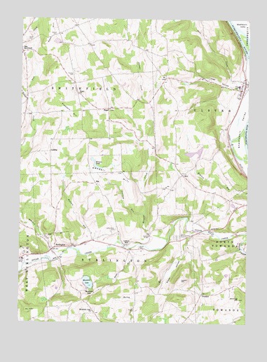
Ulster, PA USGS Topographic Map
Click on map above to begin viewing in our Map Viewer.

This topographic map contains these locations and features:
Feature Name Type Latitude Longitude GNIS ID View Map
Bailey RunStreamN41.7879°W76.5308°1168583View Map
Borough of BurlingtonCivilN41.7817°W76.6056°1214950View Map
Bradford CountyCivilN41.7887°W76.5155°1213660View Map
Bradford County HomeBuildingN41.7751°W76.6230°1208387View Map
Bradford County Memorial ParkCemeteryN41.7858°W76.5380°1213450View Map
Browns CreekStreamN41.7848°W76.5424°1170387View Map
Browns PondLakeN41.8153°W76.5832°1170394View Map
BurlingtonPopulated PlaceN41.7798°W76.6074°1170725View Map
Burlington Post OfficePost OfficeN41.7786°W76.6086°2773089View Map
Cash Creek AirportAirportN41.8642°W76.5102°2442965View Map
CoddingPopulated PlaceN41.8204°W76.6083°1203297View Map
Deerlick RunStreamN41.7948°W76.5558°1173109View Map
Gustin CemeteryCemeteryN41.7815°W76.5589°1176325View Map
James Campbell Family CemeteryCemeteryN41.7820°W76.5762°2776446View Map
Jennings HillSummitN41.7609°W76.5036°1178044View Map
Kendall HillSummitN41.8159°W76.5886°1178353View Map
Luthers MillsPopulated PlaceN41.7823°W76.5663°1180085View Map
Luthers Mills CemeteryCemeteryN41.7885°W76.5720°1180086View Map
Lynch HillSummitN41.7679°W76.5358°1180115View Map
MacPopulated PlaceN41.8076°W76.5830°1204083View Map
Mill CreekStreamN41.7748°W76.6213°1181150View Map
Mitchell CemeteryCemeteryN41.8682°W76.6062°1181368View Map
Mountain LakeLocaleN41.7579°W76.5869°1212951View Map
Mountain LakePopulated PlaceN41.7623°W76.5833°1204234View Map
Mountain Lake CemeteryCemeteryN41.7557°W76.5834°2776468View Map
Mountain Lake ChurchChurchN41.7548°W76.5841°1181952View Map
Oak Grove CemeteryCemeteryN41.8070°W76.6058°2776472View Map
Oscoluwa Engine and Hose Company Station 2BuildingN41.7756°W76.6237°2653362View Map
OvershotPopulated PlaceN41.7620°W76.5238°1204342View Map
Pail Factory CemeteryCemeteryN41.7832°W76.5011°2776478View Map
Peas CreekStreamN41.8423°W76.6188°1183428View Map
Peas HillSummitN41.8745°W76.6072°1183429View Map
Pleasant HillSummitN41.8354°W76.5963°1184028View Map
Pond RunStreamN41.7817°W76.5561°1184240View Map
RiggsPopulated PlaceN41.8381°W76.5761°1204509View Map
Riggs ChurchChurchN41.8440°W76.5930°1185065View Map
SacoPopulated PlaceN41.8109°W76.5349°1204571View Map
Saco CemeteryCemeteryN41.8116°W76.5360°2776489View Map
Slater HollowValleyN41.7792°W76.5327°1187792View Map
Spaulding CreekStreamN41.8717°W76.5052°1188155View Map
Thomas CemeteryCemeteryN41.8521°W76.5960°1189476View Map
Toad HollowValleyN41.8472°W76.5066°1189605View Map
Tomjack CreekStreamN41.7781°W76.6013°1189639View Map
Totem ParkParkN41.8431°W76.5047°1189671View Map
Township of BurlingtonCivilN41.7655°W76.5696°1215976View Map
Township of SmithfieldCivilN41.8592°W76.6144°1215992View Map
Township of UlsterCivilN41.8508°W76.5282°1216001View Map
UlsterPopulated PlaceN41.8459°W76.5019°1190074View Map
Ulster Catholic / Immaculate Conception CemeteryCemeteryN41.8452°W76.5046°2776512View Map
Ulster CemeteryCemeteryN41.8448°W76.5053°2776513View Map
Ulster Fire Department Station 17BuildingN41.8482°W76.5004°2653400View Map
Ulster Post OfficePost OfficeN41.8455°W76.5020°2768379View Map
Union CemeteryCemeteryN41.8663°W76.6220°1190119View Map
Wallace RunStreamN41.7801°W76.5805°1190519View Map
West Branch Tomjack CreekStreamN41.7948°W76.6247°1190937View Map

Note: Coordinates in the location and feature list above are referenced to NAD83 datum.


Copyright (C) 2008-2024 Ryan Niemi / Sunset Dynamics ... All Rights Reserved