TopoQuest Logo
Do you find TopoQuest useful?
Help keep TopoQuest running and adding new maps/features by donating!
Bitcoin:  19c7KJd3qBynnjoSw5npx9KScwjBe4ifkT
Litecoin:  LXs6TkuXGGXo1vDsWCkWVdjQX94eUKd6ui
Home View Maps Find Maps Find Places Resources & Links


Leesburg, Georgia Topographic Map

USGS Map Title: Leesburg, GA
USGS Map MRC: 31084F2
DRG (GeoTIFF) Download: o31084f2.tif


Neighboring USGS Topographic Map Quads:


  Bronwood, GA  
31084G3
 

  Neyami, GA  
31084G2
 

  Leslie SE, GA  
31084G1
 

  Sasser, GA  
31084F3
 

  Leesburg, GA  
31084F2
 

  Albany NE, GA  
31084F1
 

  Pretoria, GA  
31084E3
 

  Albany West, GA  
31084E2
 

  Albany East, GA  
31084E1


Map MRC Location:

N32°
W85°
N32°
W84°
H8 H7 H6 H5 H4 H3 H2 H1
G8 G7 G6 G5 G4 G3 G2 G1
F8 F7 F6 F5 F4 F3 F2 F1
E8 E7 E6 E5 E4 E3 E2 E1
D8 D7 D6 D5 D4 D3 D2 D1
C8 C7 C6 C5 C4 C3 C2 C1
B8 B7 B6 B5 B4 B3 B2 B1
A8 A7 A6 A5 A4 A3 A2 A1
N31°
W85°
N31°
W84°

Leesburg, GA USGS 1:24K Topographic Map Preview:
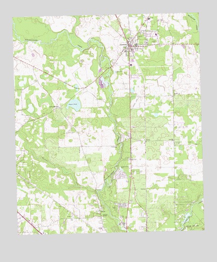
Leesburg, GA USGS Topographic Map
Click on map above to begin viewing in our Map Viewer.

This topographic map contains these locations and features:
Feature Name Type Latitude Longitude GNIS ID View Map
Alpha ChurchChurchN31.7371°W84.1652°310496View Map
Bethlehem-Lee ChurchChurchN31.7038°W84.1424°311252View Map
Byne CrossroadsPopulated PlaceN31.6977°W84.2194°331301View Map
CenturyPopulated PlaceN31.6774°W84.1627°326216View Map
City of LeesburgCivilN31.7325°W84.1687°2404906View Map
ForresterPopulated PlaceN31.6499°W84.1627°331747View Map
Fowltown CreekStreamN31.6491°W84.1963°355903View Map
Haley PlantationLocaleN31.6868°W84.1999°1705034View Map
Jackson BridgeBridgeN31.7199°W84.1857°343387View Map
James PondLakeN31.6992°W84.2095°316045View Map
Kinchafoonee ChurchChurchN31.6749°W84.1819°316424View Map
Lee County CourthouseBuildingN31.7302°W84.1732°343391View Map
Lee County Elementary SchoolSchoolN31.7329°W84.1671°343392View Map
Lee County Emergency Medical Services Century StationBuildingN31.6749°W84.1733°2625445View Map
Lee County Fire Department Station 1 LeesburgBuildingN31.7458°W84.1605°2604199View Map
Lee County Fire Department Station HeadquartersBuildingN31.6749°W84.1733°2604197View Map
Lee County High SchoolSchoolN31.7321°W84.1677°343393View Map
LeesburgPopulated PlaceN31.7321°W84.1707°356352View Map
Leesburg CemeteryCemeteryN31.7332°W84.1546°316750View Map
Leesburg DivisionCivilN31.7132°W84.2087°1936356View Map
Leesburg Police DepartmentBuildingN31.7327°W84.1728°2733547View Map
Lowe CemeteryCemeteryN31.6754°W84.1341°317457View Map
Mount Calvary ChurchChurchN31.6668°W84.1721°318577View Map
PalmyraPopulated PlaceN31.6377°W84.1944°332597View Map
Palmyra CemeteryCemeteryN31.6413°W84.1985°320176View Map
Palmyra SpringsSpringN31.6357°W84.1927°320179View Map
Reedy CreekStreamN31.7441°W84.2491°321462View Map
Rock Hole CreekStreamN31.6521°W84.2080°343401View Map
Spring Hill ChurchChurchN31.6774°W84.1435°323417View Map
Upper SchoolSchoolN31.7471°W84.1577°324629View Map
WIKX-FM (Leesburg)TowerN31.6280°W84.1957°352722View Map
WJIZ-FM (Albany)TowerN31.6557°W84.1749°352604View Map
Wooten ChurchChurchN31.7371°W84.1719°334182View Map

Note: Coordinates in the location and feature list above are referenced to NAD83 datum.


Copyright (C) 2008-2024 Ryan Niemi / Sunset Dynamics ... All Rights Reserved