TopoQuest Logo
Do you find TopoQuest useful?
Help keep TopoQuest running and adding new maps/features by donating!
Bitcoin:  19c7KJd3qBynnjoSw5npx9KScwjBe4ifkT
Litecoin:  LXs6TkuXGGXo1vDsWCkWVdjQX94eUKd6ui
Home View Maps Find Maps Find Places Resources & Links


Sasser, Georgia Topographic Map

USGS Map Title: Sasser, GA
USGS Map MRC: 31084F3
DRG (GeoTIFF) Download: o31084f3.tif


Neighboring USGS Topographic Map Quads:


  Dawson, GA  
31084G4
 

  Bronwood, GA  
31084G3
 

  Neyami, GA  
31084G2
 

  Chickasawhatchee, GA  
31084F4
 

  Sasser, GA  
31084F3
 

  Leesburg, GA  
31084F2
 

  Holt, GA  
31084E4
 

  Pretoria, GA  
31084E3
 

  Albany West, GA  
31084E2


Map MRC Location:

N32°
W85°
N32°
W84°
H8 H7 H6 H5 H4 H3 H2 H1
G8 G7 G6 G5 G4 G3 G2 G1
F8 F7 F6 F5 F4 F3 F2 F1
E8 E7 E6 E5 E4 E3 E2 E1
D8 D7 D6 D5 D4 D3 D2 D1
C8 C7 C6 C5 C4 C3 C2 C1
B8 B7 B6 B5 B4 B3 B2 B1
A8 A7 A6 A5 A4 A3 A2 A1
N31°
W85°
N31°
W84°

Sasser, GA USGS 1:24K Topographic Map Preview:
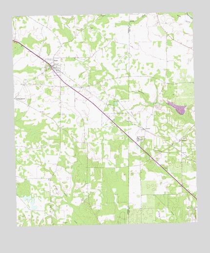
Sasser, GA USGS Topographic Map
Click on map above to begin viewing in our Map Viewer.

This topographic map contains these locations and features:
Feature Name Type Latitude Longitude GNIS ID View Map
Albany LakeReservoirN31.6422°W84.3656°338509View Map
Albany Lake DamDamN31.6352°W84.3616°338508View Map
Anchorage Alcoholic Medical CenterHospitalN31.6338°W84.2566°343375View Map
ArmenaPopulated PlaceN31.6810°W84.2846°326160View Map
Ayresport Airport (historical)AirportN31.6452°W84.3207°351651View Map
Carlisle ChurchChurchN31.7243°W84.3321°344629View Map
ChickasawhatcheePopulated PlaceN31.7013°W84.3746°355146View Map
Chickasawhatchee Baptist CemeteryCemeteryN31.6985°W84.3727°344632View Map
Colonial PlantationLocaleN31.7332°W84.2535°1705033View Map
Dunbar School (historical)SchoolN31.7241°W84.3410°344649View Map
Huckby CemeteryCemeteryN31.7410°W84.3185°315777View Map
Hutchinson School (historical)SchoolN31.7374°W84.2666°343386View Map
Jordan Grove ChurchChurchN31.6677°W84.2741°316272View Map
Kiokee CemeteryCemeteryN31.6271°W84.3427°344666View Map
Kiokee ChurchChurchN31.6268°W84.3424°316466View Map
Lee County Fire Department Station 3 PalmyraBuildingN31.6404°W84.2510°2604194View Map
Macedonia ChurchChurchN31.7207°W84.3446°317532View Map
Mount Olive ChurchChurchN31.7143°W84.3424°318738View Map
Mount Zion ChurchChurchN31.6929°W84.3544°318954View Map
Nike Site TU-79C (historical)MilitaryN31.6336°W84.2567°1987831View Map
Nike Site TU-79L (historical)MilitaryN31.6308°W84.2761°1987832View Map
OaklandPopulated PlaceN31.6741°W84.2599°332544View Map
Piney Grove School (historical)SchoolN31.6774°W84.3346°344686View Map
SasserPopulated PlaceN31.7199°W84.3471°332984View Map
Sasser Commercial Historic DistrictParkN31.7199°W84.3477°344696View Map
Sasser DivisionCivilN31.6860°W84.3557°1936529View Map
Terrell County Fire and Rescue Station 2BuildingN31.7197°W84.3485°2604027View Map
Town of SasserCivilN31.7199°W84.3478°2407293View Map
WAZE-FM (Dawson)TowerN31.7291°W84.3427°352672View Map
WGNP-FM (Albany)TowerN31.6452°W84.3541°352601View Map

Note: Coordinates in the location and feature list above are referenced to NAD83 datum.


Copyright (C) 2008-2024 Ryan Niemi / Sunset Dynamics ... All Rights Reserved