TopoQuest Logo
Do you find TopoQuest useful?
Help keep TopoQuest running and adding new maps/features by donating!
Bitcoin:  19c7KJd3qBynnjoSw5npx9KScwjBe4ifkT
Litecoin:  LXs6TkuXGGXo1vDsWCkWVdjQX94eUKd6ui
Home View Maps Find Maps Find Places Resources & Links


Kenly West, North Carolina Topographic Map

USGS Map Title: Kenly West, NC
USGS Map MRC: 35078E2
DRG (GeoTIFF) Download: o35078e2.tif


Neighboring USGS Topographic Map Quads:


  Flowers, NC  
35078F3
 

  Stancils Chapel, NC  
35078F2
 

  Lucama, NC  
35078F1
 

  Selma, NC  
35078E3
 

  Kenly West, NC  
35078E2
 

  Kenly East, NC  
35078E1
 

  Four Oaks NE, NC  
35078D3
 

  Princeton, NC  
35078D2
 

  Northwest Goldsboro, NC  
35078D1


Map MRC Location:

N36°
W79°
N36°
W78°
H8 H7 H6 H5 H4 H3 H2 H1
G8 G7 G6 G5 G4 G3 G2 G1
F8 F7 F6 F5 F4 F3 F2 F1
E8 E7 E6 E5 E4 E3 E2 E1
D8 D7 D6 D5 D4 D3 D2 D1
C8 C7 C6 C5 C4 C3 C2 C1
B8 B7 B6 B5 B4 B3 B2 B1
A8 A7 A6 A5 A4 A3 A2 A1
N35°
W79°
N35°
W78°

Kenly West, NC USGS 1:24K Topographic Map Preview:
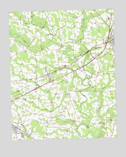
Kenly West, NC USGS Topographic Map
Click on map above to begin viewing in our Map Viewer.

This topographic map contains these locations and features:
Feature Name Type Latitude Longitude GNIS ID View Map
BagleyPopulated PlaceN35.5765°W78.1694°980422View Map
Bethany ChurchChurchN35.5074°W78.2428°981078View Map
Beulah ChurchChurchN35.5924°W78.1872°981269View Map
BeulahtownPopulated PlaceN35.5938°W78.1714°1019118View Map
Big BranchStreamN35.5560°W78.1633°1023827View Map
Browns PondReservoirN35.5935°W78.2364°999137View Map
Browns Pond DamDamN35.5935°W78.2364°999136View Map
Buffalo CreekStreamN35.5954°W78.1978°982176View Map
Burnt Stocking BranchStreamN35.5293°W78.1994°1023863View Map
Cardinal Country ClubLocaleN35.5268°W78.1906°982647View Map
Carters ChapelChurchN35.5863°W78.2294°982699View Map
Country Squire Mobile EstatesPopulated PlaceN35.5804°W78.1397°2505444View Map
Crumplers CrossroadsPopulated PlaceN35.5404°W78.2358°1019874View Map
Faith ChurchChurchN35.6243°W78.2083°1024557View Map
Fellowship ChurchChurchN35.5182°W78.1255°985036View Map
Fellowship ChurchChurchN35.5588°W78.2267°985038View Map
Giles ChapelChurchN35.5054°W78.2500°985686View Map
Glendale Chapel SchoolSchoolN35.6182°W78.1680°985729View Map
Holly Springs ChurchChurchN35.5946°W78.1714°986962View Map
Johnston County Emergency Medical Services - MicroBuildingN35.5624°W78.2041°2720567View Map
Kenly Elementary SchoolSchoolN35.5890°W78.1275°1006693View Map
Kenly Volunteer Fire DepartmentBuildingN35.5941°W78.1252°2638832View Map
Lake BensonReservoirN35.6103°W78.2078°981014View Map
Little Buffalo CreekStreamN35.5846°W78.1617°988560View Map
Little CreekStreamN35.5110°W78.1706°988604View Map
Long BranchStreamN35.6135°W78.2228°988923View Map
Lowell MillPopulated PlaceN35.5665°W78.1608°1021299View Map
MicroPopulated PlaceN35.5638°W78.2044°1021423View Map
Micro - Pine Level Elementary SchoolSchoolN35.5128°W78.2481°1006692View Map
Micro Elementary SchoolSchoolN35.5588°W78.2017°1006694View Map
Micro Police DepartmentBuildingN35.5629°W78.2048°2769632View Map
Micro Post OfficePost OfficeN35.5614°W78.2044°2774100View Map
Micro Volunteer Fire DepartmentBuildingN35.5624°W78.2040°2639832View Map
Niagara ChurchChurchN35.5496°W78.1522°991144View Map
North Johnston High SchoolSchoolN35.5710°W78.1844°991240View Map
Oak Grove InnPopulated PlaceN35.5674°W78.1911°1021692View Map
Parrish ChurchChurchN35.5296°W78.1861°991894View Map
Pine LevelPopulated PlaceN35.5132°W78.2444°992263View Map
Pine Level Police DepartmentBuildingN35.5123°W78.2449°2769686View Map
Pine Level Post OfficePost OfficeN35.5131°W78.2456°2774130View Map
Pine Level Volunteer Fire DepartmentBuildingN35.5136°W78.2449°2638154View Map
Rains CrossroadsPopulated PlaceN35.5152°W78.1444°1022138View Map
Ramblewood Mobile Home ParkPopulated PlaceN35.6229°W78.1255°2505557View Map
Town of MicroCivilN35.5627°W78.2041°2406155View Map
Town of Pine LevelCivilN35.5037°W78.2492°2407117View Map
Township of BeulahCivilN35.5902°W78.1449°1026845View Map
Township of MicroCivilN35.5725°W78.2050°1026852View Map
Township of Pine LevelCivilN35.5152°W78.2362°1026854View Map
Warren ChapelChurchN35.5663°W78.1961°996801View Map
White Rock ChurchChurchN35.5657°W78.1972°997205View Map

Note: Coordinates in the location and feature list above are referenced to NAD83 datum.


Copyright (C) 2008-2024 Ryan Niemi / Sunset Dynamics ... All Rights Reserved