TopoQuest Logo
Do you find TopoQuest useful?
Help keep TopoQuest running and adding new maps/features by donating!
Bitcoin:  19c7KJd3qBynnjoSw5npx9KScwjBe4ifkT
Litecoin:  LXs6TkuXGGXo1vDsWCkWVdjQX94eUKd6ui
Home View Maps Find Maps Find Places Resources & Links


Princeton, North Carolina Topographic Map

USGS Map Title: Princeton, NC
USGS Map MRC: 35078D2
DRG (GeoTIFF) Download: o35078d2.tif


Neighboring USGS Topographic Map Quads:


  Selma, NC  
35078E3
 

  Kenly West, NC  
35078E2
 

  Kenly East, NC  
35078E1
 

  Four Oaks NE, NC  
35078D3
 

  Princeton, NC  
35078D2
 

  Northwest Goldsboro, NC  
35078D1
 

  Newton Grove North, NC  
35078C3
 

  Grantham, NC  
35078C2
 

  Southwest Goldsboro, NC  
35078C1


Map MRC Location:

N36°
W79°
N36°
W78°
H8 H7 H6 H5 H4 H3 H2 H1
G8 G7 G6 G5 G4 G3 G2 G1
F8 F7 F6 F5 F4 F3 F2 F1
E8 E7 E6 E5 E4 E3 E2 E1
D8 D7 D6 D5 D4 D3 D2 D1
C8 C7 C6 C5 C4 C3 C2 C1
B8 B7 B6 B5 B4 B3 B2 B1
A8 A7 A6 A5 A4 A3 A2 A1
N35°
W79°
N35°
W78°

Princeton, NC USGS 1:24K Topographic Map Preview:
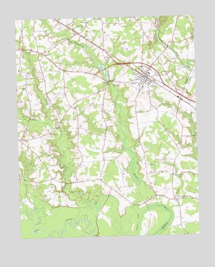
Princeton, NC USGS Topographic Map
Click on map above to begin viewing in our Map Viewer.

This topographic map contains these locations and features:
Feature Name Type Latitude Longitude GNIS ID View Map
Bakers ChapelChurchN35.4346°W78.2267°980451View Map
Bawdy CreekStreamN35.3785°W78.1986°1027373View Map
Bizzell Grove ChurchChurchN35.4974°W78.2000°981508View Map
Bizzell Grove Memorial GardensCemeteryN35.4952°W78.2019°981509View Map
BrogdenPopulated PlaceN35.4307°W78.2481°1025184View Map
Brogden Volunteer Fire DepartmentBuildingN35.4309°W78.2489°2639560View Map
Burden CreekStreamN35.3888°W78.1455°982270View Map
Cedar Grove ChurchChurchN35.4152°W78.1567°982846View Map
DelwoodPopulated PlaceN35.4596°W78.1650°1005077View Map
Grace ChurchChurchN35.4715°W78.1619°985889View Map
Hephzibah ChurchChurchN35.4793°W78.2289°986634View Map
Hinton FieldAirportN35.4512°W78.1574°2679244View Map
Holts Mill Pond DamDamN35.4638°W78.1858°998996View Map
Holts PondSwampN35.4829°W78.1998°986985View Map
Oakland ChurchChurchN35.4091°W78.1380°991475View Map
Oakland Volunteer Fire DepartmentBuildingN35.4099°W78.1273°2639253View Map
Old Union ChurchChurchN35.4271°W78.2422°991619View Map
Overby CemeteryCemeteryN35.4329°W78.2403°991737View Map
PrincetonPopulated PlaceN35.4660°W78.1605°1022084View Map
Princeton Fire and RescueBuildingN35.4692°W78.1630°2639788View Map
Princeton Police DepartmentBuildingN35.4696°W78.1638°2769724View Map
Princeton Post OfficePost OfficeN35.4656°W78.1600°2505388View Map
Princeton QuarryMineN35.4753°W78.1403°2649270View Map
Princeton Union SchoolSchoolN35.4677°W78.1578°1006691View Map
Quincosin SwampStreamN35.4404°W78.2278°992954View Map
Raccoon SwampSwampN35.3792°W78.1675°992971View Map
Raynor TownPopulated PlaceN35.3952°W78.1408°1006342View Map
Saint Pauls ChurchChurchN35.3960°W78.1361°994083View Map
Shiloh ChurchChurchN35.4060°W78.2136°994693View Map
Spring BranchStreamN35.4993°W78.1494°995324View Map
Stevens ChapelChurchN35.4613°W78.2436°995480View Map
Thompson CemeteryCemeteryN35.4682°W78.2428°996047View Map
Town of PrincetonCivilN35.4668°W78.1606°2407161View Map
Township of Boon HillCivilN35.4431°W78.1930°1026846View Map

Note: Coordinates in the location and feature list above are referenced to NAD83 datum.


Copyright (C) 2008-2024 Ryan Niemi / Sunset Dynamics ... All Rights Reserved