TopoQuest Logo
Do you find TopoQuest useful?
Help keep TopoQuest running and adding new maps/features by donating!
Bitcoin:  19c7KJd3qBynnjoSw5npx9KScwjBe4ifkT
Litecoin:  LXs6TkuXGGXo1vDsWCkWVdjQX94eUKd6ui
Home View Maps Find Maps Find Places Resources & Links


John Hen Creek, Montana Topographic Map

USGS Map Title: John Hen Creek, MT
USGS Map MRC: 45106H3
DRG (GeoTIFF) Download: o45106h3.tif


Neighboring USGS Topographic Map Quads:


  Mitchell Coulee, MT  
46106A4
 

  Crain Place, MT  
46106A3
 

  Miller Creek SW, MT  
46106A2
 

  Hammond Draw NW, MT  
45106H4
 

  John Hen Creek, MT  
45106H3
 

  Brandenberg NW, MT  
45106H2
 

  Hammond Draw SW, MT  
45106G4
 

  Hammond Draw, MT  
45106G3
 

  Brandenberg, MT  
45106G2


Map MRC Location:

N46°
W107°
N46°
W106°
H8 H7 H6 H5 H4 H3 H2 H1
G8 G7 G6 G5 G4 G3 G2 G1
F8 F7 F6 F5 F4 F3 F2 F1
E8 E7 E6 E5 E4 E3 E2 E1
D8 D7 D6 D5 D4 D3 D2 D1
C8 C7 C6 C5 C4 C3 C2 C1
B8 B7 B6 B5 B4 B3 B2 B1
A8 A7 A6 A5 A4 A3 A2 A1
N45°
W107°
N45°
W106°

John Hen Creek, MT USGS 1:24K Topographic Map Preview:
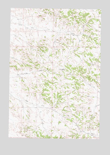
John Hen Creek, MT USGS Topographic Map
Click on map above to begin viewing in our Map Viewer.

This topographic map contains these locations and features:
Feature Name Type Latitude Longitude GNIS ID View Map
02N43E02ABBD01 WellWellN45.9617°W106.3453°813587View Map
02N43E10DDAA01 WellWellN45.9367°W106.3511°813453View Map
02N43E12AC__01 SpringSpringN45.9400°W106.3317°813475View Map
02N43E12CABB01 SpringSpringN45.9394°W106.3308°813470View Map
02N43E12CBAC01 SpringSpringN45.9394°W106.3345°813471View Map
02N43E23CBAB01 WellWellN45.9108°W106.3545°813305View Map
02N43E23CBBA01 WellWellN45.9114°W106.3556°813311View Map
02N43E24CCBA01 WellWellN45.9072°W106.3358°813269View Map
02N43E24CCBC01 WellWellN45.9067°W106.3361°813262View Map
02N43E24CDDA01 WellWellN45.9053°W106.3275°813245View Map
02N43E25BCAA01 WellWellN45.9000°W106.3325°813203View Map
02N43E27AADD01 WellWellN45.9006°W106.3589°813206View Map
02N43E36BAAB01 WellWellN45.8892°W106.3286°813117View Map
02N43E36DBDD01 WellWellN45.8800°W106.3231°813025View Map
02N44E17CABC01 WellWellN45.9258°W106.2892°813391View Map
02N44E19CCCC01 WellWellN45.9047°W106.3164°813235View Map
02N44E21DDDC01 WellWellN45.9067°W106.2561°813261View Map
02N44E29AABA01 WellWellN45.9039°W106.2786°813233View Map
02N44E29CBBB01 WellWellN45.8967°W106.2950°813180View Map
02N44E32DAAC01 WellWellN45.8819°W106.2770°813038View Map
02N44E33CACD01 SpringSpringN45.8800°W106.2672°813024View Map
02N44E33DDAC01 WellWellN45.8783°W106.2561°813011View Map
02N44E34CCCD01 WellWellN45.8761°W106.2525°812988View Map
03N43E25DDCA01 SpringSpringN45.9792°W106.3197°813667View Map
03N43E26ACAC01 SpringSpringN45.9869°W106.3445°813691View Map
03N43E26DACC01 WellWellN45.9819°W106.3417°813674View Map
03N43E27ABDC01 WellWellN45.9892°W106.3645°813692View Map
03N44E21CBAB01 WellWellN45.9997°W106.2714°813723View Map
03N44E28DBCC01 SpringSpringN45.9828°W106.2636°813677View Map
03N44E28DBDC01 WellWellN45.9828°W106.2614°813676View Map
03N44E31BAAA01 WellWellN45.9786°W106.3064°813662View Map
03N44E31CBDC01 WellWellN45.9681°W106.3136°813623View Map
03N44E31CBDC02 WellWellN45.9678°W106.3131°813622View Map
03N44E32BBDA01 WellWellN45.9758°W106.2911°813655View Map
03N44E32BDBA01 WellWellN45.9744°W106.2875°813651View Map
Gobblers KnobSummitN45.9414°W106.3042°771819View Map
Signal Butte (historical)Populated PlaceN45.9536°W106.3506°1716741View Map

Note: Coordinates in the location and feature list above are referenced to NAD83 datum.


Copyright (C) 2008-2024 Ryan Niemi / Sunset Dynamics ... All Rights Reserved