TopoQuest Logo
Do you find TopoQuest useful?
Help keep TopoQuest running and adding new maps/features by donating!
Bitcoin:  19c7KJd3qBynnjoSw5npx9KScwjBe4ifkT
Litecoin:  LXs6TkuXGGXo1vDsWCkWVdjQX94eUKd6ui
Home View Maps Find Maps Find Places Resources & Links


Hammond Draw, Montana Topographic Map

USGS Map Title: Hammond Draw, MT
USGS Map MRC: 45106G3
DRG (GeoTIFF) Download: o45106g3.tif


Neighboring USGS Topographic Map Quads:


  Hammond Draw NW, MT  
45106H4
 

  John Hen Creek, MT  
45106H3
 

  Brandenberg NW, MT  
45106H2
 

  Hammond Draw SW, MT  
45106G4
 

  Hammond Draw, MT  
45106G3
 

  Brandenberg, MT  
45106G2
 

  Garfield Peak, MT  
45106F4
 

  Ashland NE, MT  
45106F3
 

  Cook Creek Reservoir, MT  
45106F2


Map MRC Location:

N46°
W107°
N46°
W106°
H8 H7 H6 H5 H4 H3 H2 H1
G8 G7 G6 G5 G4 G3 G2 G1
F8 F7 F6 F5 F4 F3 F2 F1
E8 E7 E6 E5 E4 E3 E2 E1
D8 D7 D6 D5 D4 D3 D2 D1
C8 C7 C6 C5 C4 C3 C2 C1
B8 B7 B6 B5 B4 B3 B2 B1
A8 A7 A6 A5 A4 A3 A2 A1
N45°
W107°
N45°
W106°

Hammond Draw, MT USGS 1:24K Topographic Map Preview:
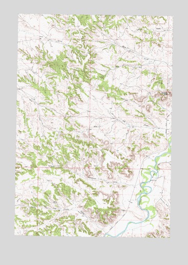
Hammond Draw, MT USGS Topographic Map
Click on map above to begin viewing in our Map Viewer.

This topographic map contains these locations and features:
Feature Name Type Latitude Longitude GNIS ID View Map
01N43E02CCDA01 WellWellN45.8619°W106.3528°812848View Map
01N43E15ACAA01 WellWellN45.8433°W106.3639°812671View Map
01N43E22BBAA01 WellWellN45.8325°W106.3739°812561View Map
01N43E24DDAA01 WellWellN45.8206°W106.3178°812432View Map
01N43E25BBDC01 WellWellN45.8144°W106.3339°812333View Map
01N43E26BCAB01 WellWellN45.8136°W106.3547°812322View Map
01N43E27CDDD01 WellWellN45.8039°W106.3703°812198View Map
01N43E36BDAC01 WellWellN45.7981°W106.3320°812141View Map
01N44E04DABD01 WellWellN45.8672°W106.2572°812893View Map
01N44E06CDAB01 WellWellN45.8647°W106.3083°812873View Map
01N44E07AADA01 WellWellN45.8592°W106.2972°812814View Map
01N44E08ACCB01 WellWellN45.8550°W106.2861°812778View Map
01N44E16DBDB01 WellWellN45.8372°W106.2622°812608View Map
01N44E17AAAD01 WellWellN45.8458°W106.2761°812696View Map
01N44E18AACB01 WellWellN45.8444°W106.3006°812685View Map
01N44E19DCAA01 WellWellN45.8208°W106.3017°812437View Map
01N44E27CBAC01 WellWellN45.8086°W106.2511°812258View Map
01N44E29ACBD01 WellWellN45.8125°W106.2839°812303View Map
01N44E30BCDA01 WellWellN45.8092°W106.3097°812264View Map
01N44E30BDCA01 SpringSpringN45.8064°W106.3097°812233View Map
01N44E31AABA01 WellWellN45.8028°W106.2995°812186View Map
01N44E31CDCB01 WellWellN45.7900°W106.3103°812059View Map
01N44E33DBDC01 WellWellN45.7928°W106.2625°812086View Map
01S44E04DBAA01 WellWellN45.7806°W106.3017°811955View Map
01S44E05ABCC01 WellWellN45.7856°W106.3258°812010View Map
01S44E06CAAB01 WellWellN45.7814°W106.3489°811965View Map
01S44E08DCAD01 WellWellN45.7614°W106.3200°811760View Map
01S44E10CDBC01 WellWellN45.7628°W106.2895°811767View Map
01S44E14B___01 WellWellN45.7553°W106.2686°811696View Map
Brandenburg School (historical)SchoolN45.7889°W106.2742°1716738View Map
Geddes Post Office (historical)Post OfficeN45.7667°W106.2833°1716691View Map
Hammond DrawValleyN45.7797°W106.2836°772108View Map
Houston DrawValleyN45.7731°W106.2600°785100View Map
Roe and Cooper CreekStreamN45.7514°W106.2995°775910View Map
Trembling ButteSummitN45.8317°W106.2533°777750View Map

Note: Coordinates in the location and feature list above are referenced to NAD83 datum.


Copyright (C) 2008-2024 Ryan Niemi / Sunset Dynamics ... All Rights Reserved