TopoQuest Logo
Do you find TopoQuest useful?
Help keep TopoQuest running and adding new maps/features by donating!
Bitcoin:  19c7KJd3qBynnjoSw5npx9KScwjBe4ifkT
Litecoin:  LXs6TkuXGGXo1vDsWCkWVdjQX94eUKd6ui
Home View Maps Find Maps Find Places Resources & Links


Hardinsburg, Indiana Topographic Map

USGS Map Title: Hardinsburg, IN
USGS Map MRC: 38086D3
DRG (GeoTIFF) Download: o38086d3.tif


Neighboring USGS Topographic Map Quads:


  Paoli, IN  
38086E4
 

  Livonia, IN  
38086E3
 

  Becks Mill, IN  
38086E2
 

  Valeene, IN  
38086D4
 

  Hardinsburg, IN  
38086D3
 

  Fredericksburg, IN  
38086D2
 

  English, IN  
38086C4
 

  Milltown, IN  
38086C3
 

  Depauw, IN  
38086C2


Map MRC Location:

N39°
W87°
N39°
W86°
H8 H7 H6 H5 H4 H3 H2 H1
G8 G7 G6 G5 G4 G3 G2 G1
F8 F7 F6 F5 F4 F3 F2 F1
E8 E7 E6 E5 E4 E3 E2 E1
D8 D7 D6 D5 D4 D3 D2 D1
C8 C7 C6 C5 C4 C3 C2 C1
B8 B7 B6 B5 B4 B3 B2 B1
A8 A7 A6 A5 A4 A3 A2 A1
N38°
W87°
N38°
W86°

Hardinsburg, IN USGS 1:24K Topographic Map Preview:
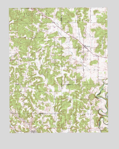
Hardinsburg, IN USGS Topographic Map
Click on map above to begin viewing in our Map Viewer.

This topographic map contains these locations and features:
Feature Name Type Latitude Longitude GNIS ID View Map
Baptist Hill ChurchChurchN38.4553°W86.2814°450653View Map
Cave SpringSpringN38.4289°W86.2633°451780View Map
Crossroads ChurchChurchN38.4239°W86.3633°450823View Map
Dry RunStreamN38.4276°W86.2550°450871View Map
Duck CreekStreamN38.4767°W86.3114°451716View Map
FayettevillePopulated PlaceN38.4517°W86.2628°451779View Map
Flood CreekStreamN38.3973°W86.3430°451854View Map
Green Briar ChurchChurchN38.4995°W86.3492°435387View Map
Haiti HollowValleyN38.3918°W86.2514°450996View Map
HardinsburgPopulated PlaceN38.4609°W86.2786°451013View Map
Honey CreekStreamN38.4231°W86.2544°451057View Map
Honey CreekStreamN38.4376°W86.2730°451058View Map
Honey SinkBasinN38.4362°W86.2716°451781View Map
Horseshoe BendBendN38.4109°W86.2647°451062View Map
Lowells LandingAirportN38.4454°W86.2598°2676978View Map
Marengo CemeteryCemeteryN38.3764°W86.3414°2110948View Map
Marengo CemeteryCemeteryN38.3762°W86.3406°2110949View Map
Marengo Cemetery Old SectionCemeteryN38.3761°W86.3402°2110947View Map
Oak Grove ChurchChurchN38.4698°W86.3444°451287View Map
Old Unity CemeteryCemeteryN38.4276°W86.2586°451300View Map
Posey SinkBasinN38.4556°W86.2694°451782View Map
Providence CemeteryCemeteryN38.4891°W86.3063°451367View Map
Ragroad HillSummitN38.4556°W86.2869°451376View Map
RegoPopulated PlaceN38.4851°W86.3178°451385View Map
Rock Springs ChurchChurchN38.4478°W86.3736°451402View Map
Scotland Cave SinkBasinN38.4767°W86.2766°451783View Map
Self IslandIslandN38.4181°W86.2580°451443View Map
Sinking CreekStreamN38.4481°W86.2708°451468View Map
South Central Area Vocational SchoolSchoolN38.4617°W86.2778°451737View Map
Stoler CreekStreamN38.4634°W86.3008°451513View Map
Totten CemeteryCemeteryN38.3789°W86.2622°451576View Map
Totten Ford BridgeBridgeN38.3770°W86.2597°451577View Map
Town of HardinsburgCivilN38.4620°W86.2733°2396985View Map
Union ChurchChurchN38.3981°W86.2758°451589View Map
Walton CemeteryCemeteryN38.4453°W86.2808°451607View Map

Note: Coordinates in the location and feature list above are referenced to NAD83 datum.


Copyright (C) 2008-2024 Ryan Niemi / Sunset Dynamics ... All Rights Reserved