TopoQuest Logo
Do you find TopoQuest useful?
Help keep TopoQuest running and adding new maps/features by donating!
Bitcoin:  19c7KJd3qBynnjoSw5npx9KScwjBe4ifkT
Litecoin:  LXs6TkuXGGXo1vDsWCkWVdjQX94eUKd6ui
Home View Maps Find Maps Find Places Resources & Links


Depauw, Indiana Topographic Map

USGS Map Title: Depauw, IN
USGS Map MRC: 38086C2
DRG (GeoTIFF) Download: o38086c2.tif


Neighboring USGS Topographic Map Quads:


  Hardinsburg, IN  
38086D3
 

  Fredericksburg, IN  
38086D2
 

  Palmyra, IN  
38086D1
 

  Milltown, IN  
38086C3
 

  Depauw, IN  
38086C2
 

  Crandall, IN  
38086C1
 

  Leavenworth, IN  
38086B3
 

  Corydon West, IN  
38086B2
 

  Corydon East, IN  
38086B1


Map MRC Location:

N39°
W87°
N39°
W86°
H8 H7 H6 H5 H4 H3 H2 H1
G8 G7 G6 G5 G4 G3 G2 G1
F8 F7 F6 F5 F4 F3 F2 F1
E8 E7 E6 E5 E4 E3 E2 E1
D8 D7 D6 D5 D4 D3 D2 D1
C8 C7 C6 C5 C4 C3 C2 C1
B8 B7 B6 B5 B4 B3 B2 B1
A8 A7 A6 A5 A4 A3 A2 A1
N38°
W87°
N38°
W86°

Depauw, IN USGS 1:24K Topographic Map Preview:
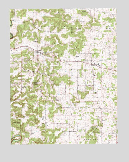
Depauw, IN USGS Topographic Map
Click on map above to begin viewing in our Map Viewer.

This topographic map contains these locations and features:
Feature Name Type Latitude Longitude GNIS ID View Map
Baker HollowValleyN38.2665°W86.2160°446894View Map
Blue River ChurchChurchN38.3623°W86.2353°431242View Map
Breedlove CemeteryCemeteryN38.3628°W86.1577°431472View Map
Byrd RidgeRidgeN38.3445°W86.1944°431924View Map
Clover ValleyValleyN38.2614°W86.1767°432686View Map
Corydon Stone QuarryMineN38.2503°W86.1528°2635787View Map
DepauwPopulated PlaceN38.3351°W86.2175°433484View Map
Devils ElbowBendN38.2573°W86.2383°433509View Map
FairdalePopulated PlaceN38.3262°W86.1711°434290View Map
Fairdale CemeteryCemeteryN38.3270°W86.1869°434291View Map
FrenchtownPopulated PlaceN38.3148°W86.2144°434836View Map
Glen-Hire Ranch Airport (historical)AirportN38.2967°W86.1883°449316View Map
Haas ChapelChurchN38.2906°W86.1975°435575View Map
Henry Ott HillSummitN38.3140°W86.1994°436038View Map
Lagle RidgeRidgeN38.3695°W86.1900°437509View Map
Leichner SpringSpringN38.3651°W86.2263°437758View Map
Little Saint LouisPopulated PlaceN38.3028°W86.2369°438138View Map
Loudens ChapelChurchN38.2695°W86.2105°438340View Map
Marion Herthel HillSummitN38.3337°W86.1914°438618View Map
Milltown Rock QuarryMineN38.3428°W86.2419°2649594View Map
MoberlyPopulated PlaceN38.2698°W86.2094°439302View Map
Mount Tabor ChurchChurchN38.3559°W86.1700°439707View Map
Mount Zion CemeteryCemeteryN38.3598°W86.2222°439728View Map
North Central SchoolSchoolN38.3231°W86.1464°440236View Map
Opossum Trial RidgeRidgeN38.3392°W86.1691°440672View Map
Orchard RidgeRidgeN38.3606°W86.2189°440687View Map
Pennington ChapelChurchN38.2645°W86.1528°440996View Map
Pennington Chapel RidgeRidgeN38.2592°W86.1547°440997View Map
Pitman CemeteryCemeteryN38.2601°W86.2255°441205View Map
RamseyPopulated PlaceN38.3237°W86.1547°441756View Map
Ramsey Volunteer Fire Department Station 1BuildingN38.3229°W86.1536°2626228View Map
Ramsey Volunteer Fire Department Station 3BuildingN38.3143°W86.2147°2626240View Map
Saint Bernards CemeteryCemeteryN38.3064°W86.2147°442500View Map
Saint Bernards ChurchChurchN38.3137°W86.2136°442501View Map
Satenfield CemeteryCemeteryN38.3309°W86.1730°443037View Map
Schoolhouse HillSummitN38.3448°W86.2161°443105View Map
Seigs HillSummitN38.3173°W86.2200°443207View Map
Township of SpencerCivilN38.2880°W86.2221°453860View Map
Woods ChapelChurchN38.3134°W86.1528°446308View Map

Note: Coordinates in the location and feature list above are referenced to NAD83 datum.


Copyright (C) 2008-2024 Ryan Niemi / Sunset Dynamics ... All Rights Reserved