TopoQuest Logo
Do you find TopoQuest useful?
Help keep TopoQuest running and adding new maps/features by donating!
Bitcoin:  19c7KJd3qBynnjoSw5npx9KScwjBe4ifkT
Litecoin:  LXs6TkuXGGXo1vDsWCkWVdjQX94eUKd6ui
Home View Maps Find Maps Find Places Resources & Links


Guthrie, Missouri Topographic Map

USGS Map Title: Guthrie, MO
USGS Map MRC: 38092G1
DRG (GeoTIFF) Download: o38092g1.tif


Neighboring USGS Topographic Map Quads:


  Millersburg, MO  
38092H2
 

  Millersburg NE, MO  
38092H1
 

  Kingdom City, MO  
38091H8
 

  Millersburg SW, MO  
38092G2
 

  Guthrie, MO  
38092G1
 

  Fulton, MO  
38091G8
 

  Jefferson City NW, MO  
38092F2
 

  New Bloomfield, MO  
38092F1
 

  Mokane West, MO  
38091F8


Map MRC Location:

N39°
W93°
N39°
W92°
H8 H7 H6 H5 H4 H3 H2 H1
G8 G7 G6 G5 G4 G3 G2 G1
F8 F7 F6 F5 F4 F3 F2 F1
E8 E7 E6 E5 E4 E3 E2 E1
D8 D7 D6 D5 D4 D3 D2 D1
C8 C7 C6 C5 C4 C3 C2 C1
B8 B7 B6 B5 B4 B3 B2 B1
A8 A7 A6 A5 A4 A3 A2 A1
N38°
W93°
N38°
W92°

Guthrie, MO USGS 1:24K Topographic Map Preview:
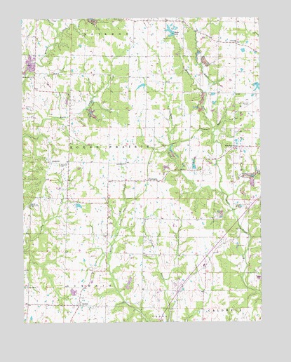
Guthrie, MO USGS Topographic Map
Click on map above to begin viewing in our Map Viewer.

This topographic map contains these locations and features:
Feature Name Type Latitude Longitude GNIS ID View Map
Althiser Lake DamDamN38.8134°W92.0352°761512View Map
Baker School (historical)SchoolN38.8603°W92.0693°753791View Map
BoydsvillePopulated PlaceN38.8159°W92.1105°748983View Map
Boydsville CemeteryCemeteryN38.8148°W92.1055°748984View Map
CarringtonPopulated PlaceN38.8081°W92.0596°749224View Map
Carrington Pits Picnic AreaLocaleN38.8214°W92.0466°754367View Map
Carrington School (historical)SchoolN38.8150°W92.0710°749225View Map
Cedar Creek Purchase UnitForestN38.8084°W92.1169°754431View Map
Central ChurchChurchN38.8648°W92.0124°749322View Map
Central School (historical)SchoolN38.8656°W92.0121°753790View Map
Davis CreekStreamN38.8025°W92.0196°749580View Map
Davis Lake DamDamN38.7617°W92.1002°762111View Map
Dry Fork ChurchChurchN38.7648°W92.1235°749723View Map
Dry Fork School (historical)SchoolN38.7689°W92.1238°753792View Map
Duley School (historical)SchoolN38.8008°W92.1021°753789View Map
Elton Hensley Memorial AirportAirportN38.8419°W92.0021°758686View Map
Eve Lake DamDamN38.8484°W92.0602°760596View Map
Filmore School (historical)SchoolN38.7780°W92.0254°753751View Map
GuthriePopulated PlaceN38.7570°W92.0966°750180View Map
Hundley CemeteryCemeteryN38.8384°W92.1238°750419View Map
Kirchoff LakeReservoirN38.8471°W92.0624°760597View Map
Middle River School (historical)SchoolN38.8223°W92.0141°751047View Map
Millers Creek CemeteryCemeteryN38.8511°W92.1191°1852280View Map
Millers Creek ChurchChurchN38.8512°W92.1191°751099View Map
New Bloomfield Fire Protection DistrictBuildingN38.7587°W92.0956°2621019View Map
Paris Fork CemeteryCemeteryN38.7986°W92.1210°753767View Map
Paris Fork ChurchChurchN38.7984°W92.1219°751493View Map
Reed Lake DamDamN38.8484°W92.0018°761486View Map
Reeds LakeLakeN38.8695°W92.0468°751845View Map
Reeds Lake DamDamN38.8684°W92.0452°761513View Map
Shady Grove School (historical)SchoolN38.7778°W92.0627°753771View Map
Township of GuthrieCivilN38.7646°W92.1104°766378View Map
Township of Round PrairieCivilN38.8227°W92.0856°766383View Map
Wright CemeteryCemeteryN38.8531°W92.0110°752984View Map

Note: Coordinates in the location and feature list above are referenced to NAD83 datum.


Copyright (C) 2008-2024 Ryan Niemi / Sunset Dynamics ... All Rights Reserved