TopoQuest Logo
Do you find TopoQuest useful?
Help keep TopoQuest running and adding new maps/features by donating!
Bitcoin:  19c7KJd3qBynnjoSw5npx9KScwjBe4ifkT
Litecoin:  LXs6TkuXGGXo1vDsWCkWVdjQX94eUKd6ui
Home View Maps Find Maps Find Places Resources & Links


Millersburg, Missouri Topographic Map

USGS Map Title: Millersburg, MO
USGS Map MRC: 38092H2
DRG (GeoTIFF) Download: o38092h2.tif


Neighboring USGS Topographic Map Quads:


  Browns, MO  
39092A3
 

  Hallsville, MO  
39092A2
 

  Hatton, MO  
39092A1
 

  Columbia, MO  
38092H3
 

  Millersburg, MO  
38092H2
 

  Millersburg NE, MO  
38092H1
 

  Ashland, MO  
38092G3
 

  Millersburg SW, MO  
38092G2
 

  Guthrie, MO  
38092G1


Map MRC Location:

N39°
W93°
N39°
W92°
H8 H7 H6 H5 H4 H3 H2 H1
G8 G7 G6 G5 G4 G3 G2 G1
F8 F7 F6 F5 F4 F3 F2 F1
E8 E7 E6 E5 E4 E3 E2 E1
D8 D7 D6 D5 D4 D3 D2 D1
C8 C7 C6 C5 C4 C3 C2 C1
B8 B7 B6 B5 B4 B3 B2 B1
A8 A7 A6 A5 A4 A3 A2 A1
N38°
W93°
N38°
W92°

Millersburg, MO USGS 1:24K Topographic Map Preview:
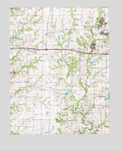
Millersburg, MO USGS Topographic Map
Click on map above to begin viewing in our Map Viewer.

This topographic map contains these locations and features:
Feature Name Type Latitude Longitude GNIS ID View Map
Allen CemeteryCemeteryN38.9998°W92.1302°748572View Map
Bone BranchStreamN38.9431°W92.1763°748963View Map
Boone County Fire Protection District Station 1BuildingN38.9628°W92.2468°2621351View Map
Boonesborough (historical)Populated PlaceN38.9770°W92.1499°759417View Map
Carter School (historical)SchoolN38.9479°W92.1878°759418View Map
Cedar ChurchChurchN38.9798°W92.1402°754048View Map
Cedar Creek AirportAirportN38.9211°W92.1664°2679315View Map
Cheng Lake DamDamN38.9684°W92.1785°764896View Map
Corns LakeLakeN38.9842°W92.2324°749479View Map
Daly DamDamN38.9750°W92.1268°762010View Map
Gillaspy School (historical)SchoolN38.9990°W92.2384°759419View Map
Hamilton CemeteryCemeteryN38.9483°W92.1873°750204View Map
HargPopulated PlaceN38.9267°W92.2313°750228View Map
Jacobs School (historical)SchoolN38.9637°W92.2371°759420View Map
KOPN-FM (Columbia)TowerN38.9964°W92.1974°759018View Map
Lake Chateau DamDamN38.9150°W92.1768°760214View Map
Lake LavistaReservoirN38.9689°W92.1733°761680View Map
Lake Lavista DamDamN38.9684°W92.1752°761679View Map
Lake of the Woods Recreation AreaLocaleN38.9687°W92.2368°755182View Map
Landhuis LakeReservoirN38.9232°W92.2103°762012View Map
Landhuis Lake DamDamN38.9234°W92.2102°762011View Map
LindberghPopulated PlaceN38.9559°W92.1282°750723View Map
Little Cedar CreekStreamN38.9039°W92.1649°750747View Map
Manacle ChapelChurchN38.9667°W92.1335°753762View Map
Manacle CreekStreamN38.9670°W92.1435°750914View Map
McGuire School (historical)SchoolN38.9775°W92.1713°759421View Map
Millersburg Fire Protection DistrictBuildingN38.9073°W92.1306°2620403View Map
Millersburg School (historical)SchoolN38.9055°W92.1299°753787View Map
Newman LakeReservoirN38.9450°W92.1468°760213View Map
Newman Lake Number 2 DamDamN38.9434°W92.1485°760212View Map
North Callaway Fire Protection District Station 4BuildingN38.9777°W92.1356°2621622View Map
Number 153 ReservoirReservoirN38.9705°W92.1879°761090View Map
Olivet ChurchChurchN38.9270°W92.2291°751433View Map
Prairie Grove CemeteryCemeteryN38.9743°W92.2032°751746View Map
Prairie Grove ChurchChurchN38.9587°W92.2168°751747View Map
Robnett School (historical)SchoolN38.9190°W92.1881°759422View Map
Sally BranchStreamN38.9264°W92.1543°752014View Map
ShawPopulated PlaceN38.9737°W92.2032°752099View Map
Simpson CemeteryCemeteryN38.9653°W92.1316°753786View Map
Simpson ChapelChurchN38.9653°W92.1310°752171View Map
StephensPopulated PlaceN38.9775°W92.1310°752350View Map
Stephens School (historical)SchoolN38.9791°W92.1311°753784View Map
Stephens Store (historical)LocaleN38.9778°W92.1313°753785View Map
Township of ColumbiaCivilN38.9564°W92.2388°766332View Map
Troy Newman Lake 1ReservoirN38.9146°W92.1796°760215View Map
Truitt School (historical)SchoolN38.9403°W92.1288°759479View Map
Turkey Farm Lake DamDamN38.9684°W92.1885°761089View Map
Turner School (historical)SchoolN38.9123°W92.2289°759423View Map
Welch Lake DamDamN38.9717°W92.2435°761385View Map

Note: Coordinates in the location and feature list above are referenced to NAD83 datum.


Copyright (C) 2008-2024 Ryan Niemi / Sunset Dynamics ... All Rights Reserved