TopoQuest Logo
Do you find TopoQuest useful?
Help keep TopoQuest running and adding new maps/features by donating!
Bitcoin:  19c7KJd3qBynnjoSw5npx9KScwjBe4ifkT
Litecoin:  LXs6TkuXGGXo1vDsWCkWVdjQX94eUKd6ui
Home View Maps Find Maps Find Places Resources & Links


Mokane West, Missouri Topographic Map

USGS Map Title: Mokane West, MO
USGS Map MRC: 38091F8
DRG (GeoTIFF) Download: o38091f8.tif


Neighboring USGS Topographic Map Quads:


  Guthrie, MO  
38092G1
 

  Fulton, MO  
38091G8
 

  Reform, MO  
38091G7
 

  New Bloomfield, MO  
38092F1
 

  Mokane West, MO  
38091F8
 

  Mokane East, MO  
38091F7
 

  Osage City, MO  
38092E1
 

  Loose Creek, MO  
38091E8
 

  Luystown, MO  
38091E7


Map MRC Location:

N39°
W92°
N39°
W91°
H8 H7 H6 H5 H4 H3 H2 H1
G8 G7 G6 G5 G4 G3 G2 G1
F8 F7 F6 F5 F4 F3 F2 F1
E8 E7 E6 E5 E4 E3 E2 E1
D8 D7 D6 D5 D4 D3 D2 D1
C8 C7 C6 C5 C4 C3 C2 C1
B8 B7 B6 B5 B4 B3 B2 B1
A8 A7 A6 A5 A4 A3 A2 A1
N38°
W92°
N38°
W91°

Mokane West, MO USGS 1:24K Topographic Map Preview:
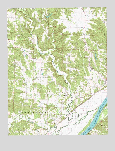
Mokane West, MO USGS Topographic Map
Click on map above to begin viewing in our Map Viewer.

This topographic map contains these locations and features:
Feature Name Type Latitude Longitude GNIS ID View Map
Browns FordPopulated PlaceN38.7050°W91.9591°749052View Map
Effie (historical)Populated PlaceN38.6262°W91.9530°740473View Map
Ewing CreekStreamN38.6878°W91.8871°755624View Map
Gallons CreekStreamN38.6756°W91.9777°755625View Map
Held DamDamN38.6917°W91.9668°762234View Map
Henke Lake DamDamN38.7417°W91.9518°764745View Map
Herring School (historical)SchoolN38.7348°W91.9580°753416View Map
Hillers CreekStreamN38.6428°W91.9041°750332View Map
Holman School (historical)SchoolN38.7300°W91.9052°753417View Map
Hord (historical)Populated PlaceN38.6528°W91.9613°753759View Map
Hord School (historical)SchoolN38.6503°W91.9593°753420View Map
Katy LakeReservoirN38.7016°W91.8895°758297View Map
Katy Lake DamDamN38.6984°W91.8885°761704View Map
LibertyPopulated PlaceN38.6892°W91.9593°750693View Map
Liberty Church (historical)ChurchN38.6892°W91.9582°753421View Map
Liberty School (historical)SchoolN38.6893°W91.9589°753760View Map
Middle RiverStreamN38.6520°W91.8849°751045View Map
Middle River CemeteryCemeteryN38.6633°W91.9257°751046View Map
Middle River Church (historical)ChurchN38.6634°W91.9249°753419View Map
Moore School (historical)SchoolN38.6617°W91.9096°753418View Map
Mount Tabor CemeteryCemeteryN38.6960°W91.9514°751199View Map
Muddy CreekStreamN38.6445°W91.9268°751221View Map
MusickLocaleN38.6853°W91.9449°753780View Map
Oakley ChurchChurchN38.6309°W91.9638°751404View Map
Paul Herring LakeReservoirN38.7420°W91.9479°764746View Map
Prairie ForkStreamN38.7071°W91.9487°751745View Map
PrentissLocaleN38.6798°W91.9999°743457View Map
Prime CreekStreamN38.7078°W91.9621°751760View Map
Riverview CemeteryCemeteryN38.6409°W91.9418°751900View Map
Snyder CreekStreamN38.7437°W91.9566°752242View Map
South Callaway Elementary SchoolSchoolN38.6889°W91.8935°751783View Map
South Callaway High SchoolSchoolN38.6874°W91.8920°2571051View Map
South Callaway Middle SchoolSchoolN38.6893°W91.8944°2571050View Map
Thornhill School (historical)SchoolN38.7009°W91.9046°754974View Map
Township of Cote Sans DesseinCivilN38.6307°W91.9855°766376View Map
Township of Saint AubertCivilN38.7265°W91.8998°766384View Map

Note: Coordinates in the location and feature list above are referenced to NAD83 datum.


Copyright (C) 2008-2024 Ryan Niemi / Sunset Dynamics ... All Rights Reserved