TopoQuest Logo
Do you find TopoQuest useful?
Help keep TopoQuest running and adding new maps/features by donating!
Bitcoin:  19c7KJd3qBynnjoSw5npx9KScwjBe4ifkT
Litecoin:  LXs6TkuXGGXo1vDsWCkWVdjQX94eUKd6ui
Home View Maps Find Maps Find Places Resources & Links


Green Mountain, Maine Topographic Map

USGS Map Title: Green Mountain, ME
USGS Map MRC: 46068B4
DRG (GeoTIFF) Download: o46068b4.tif


Neighboring USGS Topographic Map Quads:


  La Pomkeag Lake, ME  
46068C5
 

  Umcolcus Lake, ME  
46068C4
 

  McNally Ridge, ME  
46068C3
 

  Hay Brook Mountain, ME  
46068B5
 

  Green Mountain, ME  
46068B4
 

  Knowles Corner, ME  
46068B3
 

  Shin Pond, ME  
46068A5
 

  Mount Chase, ME  
46068A4
 

  Island Falls, ME  
46068A3


Map MRC Location:

N47°
W69°
N47°
W68°
H8 H7 H6 H5 H4 H3 H2 H1
G8 G7 G6 G5 G4 G3 G2 G1
F8 F7 F6 F5 F4 F3 F2 F1
E8 E7 E6 E5 E4 E3 E2 E1
D8 D7 D6 D5 D4 D3 D2 D1
C8 C7 C6 C5 C4 C3 C2 C1
B8 B7 B6 B5 B4 B3 B2 B1
A8 A7 A6 A5 A4 A3 A2 A1
N46°
W69°
N46°
W68°

Green Mountain, ME USGS 1:24K Topographic Map Preview:
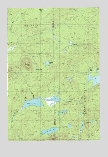
Green Mountain, ME USGS Topographic Map
Click on map above to begin viewing in our Map Viewer.

This topographic map contains these locations and features:
Feature Name Type Latitude Longitude GNIS ID View Map
Bear Mountain PondLakeN46.1285°W68.4117°561856View Map
Bradford PondLakeN46.1425°W68.3845°562860View Map
Chase PondLakeN46.1915°W68.3804°563888View Map
Duck PondLakeN46.1624°W68.4192°565359View Map
Gilman PondLakeN46.1827°W68.4164°566802View Map
Grass PondLakeN46.1521°W68.4249°567076View Map
Green MountainSummitN46.1958°W68.4732°567248View Map
Green Mountain PondLakeN46.1922°W68.4615°567250View Map
Green PondLakeN46.1500°W68.3999°567259View Map
Hale PondLakeN46.1376°W68.3999°567439View Map
Huntley PondLakeN46.1702°W68.4309°568483View Map
Lane Brook HillsSummitN46.1894°W68.4951°569362View Map
Lane Brook MeadowsSwampN46.2164°W68.4936°569363View Map
Lane Brook PondLakeN46.1981°W68.4460°569364View Map
Lost PondLakeN46.2023°W68.3898°570417View Map
Marley Bradford CemeteryCemeteryN46.1342°W68.3783°2678642View Map
Mud LakeLakeN46.1636°W68.4366°571874View Map
Pickett MountainSummitN46.1262°W68.4380°573301View Map
Pickett Mountain PondLakeN46.1342°W68.4433°573302View Map
Pleasant LakeLakeN46.1606°W68.4651°573490View Map
Rock PondLakeN46.1907°W68.3893°574351View Map
Rockabema LakeLakeN46.1827°W68.3781°574354View Map
Tote Road PondLakeN46.1386°W68.4171°577216View Map
Wadleigh BogSwampN46.2448°W68.4548°577755View Map

Note: Coordinates in the location and feature list above are referenced to NAD83 datum.


Copyright (C) 2008-2024 Ryan Niemi / Sunset Dynamics ... All Rights Reserved