TopoQuest Logo
Do you find TopoQuest useful?
Help keep TopoQuest running and adding new maps/features by donating!
Bitcoin:  19c7KJd3qBynnjoSw5npx9KScwjBe4ifkT
Litecoin:  LXs6TkuXGGXo1vDsWCkWVdjQX94eUKd6ui
Home View Maps Find Maps Find Places Resources & Links


Knowles Corner, Maine Topographic Map

USGS Map Title: Knowles Corner, ME
USGS Map MRC: 46068B3
DRG (GeoTIFF) Download: o46068b3.tif


Neighboring USGS Topographic Map Quads:


  Umcolcus Lake, ME  
46068C4
 

  McNally Ridge, ME  
46068C3
 

  Saint Croix Lake, ME  
46068C2
 

  Green Mountain, ME  
46068B4
 

  Knowles Corner, ME  
46068B3
 

  Smyrna Mills, ME  
46068B2
 

  Mount Chase, ME  
46068A4
 

  Island Falls, ME  
46068A3
 

  Oakfield, ME  
46068A2


Map MRC Location:

N47°
W69°
N47°
W68°
H8 H7 H6 H5 H4 H3 H2 H1
G8 G7 G6 G5 G4 G3 G2 G1
F8 F7 F6 F5 F4 F3 F2 F1
E8 E7 E6 E5 E4 E3 E2 E1
D8 D7 D6 D5 D4 D3 D2 D1
C8 C7 C6 C5 C4 C3 C2 C1
B8 B7 B6 B5 B4 B3 B2 B1
A8 A7 A6 A5 A4 A3 A2 A1
N46°
W69°
N46°
W68°

Knowles Corner, ME USGS 1:24K Topographic Map Preview:
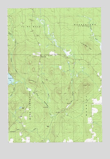
Knowles Corner, ME USGS Topographic Map
Click on map above to begin viewing in our Map Viewer.

This topographic map contains these locations and features:
Feature Name Type Latitude Longitude GNIS ID View Map
Atwell BrookStreamN46.1800°W68.3692°561345View Map
Baston BrookStreamN46.1603°W68.3261°561712View Map
BatesvillePopulated PlaceN46.1256°W68.3470°579123View Map
Bradford BrookStreamN46.1378°W68.3573°562854View Map
Cooper CemeteryCemeteryN46.2060°W68.3267°2678172View Map
Darling CemeteryCemeteryN46.1537°W68.3524°2678692View Map
East Hastings BrookStreamN46.1475°W68.3186°565618View Map
Frost and Adams RidgeRidgeN46.2131°W68.2714°566610View Map
Jackson SluiceCanalN46.1406°W68.3220°568750View Map
Kilgore SchoolSchoolN46.1500°W68.3617°569160View Map
Knowles CornerPopulated PlaceN46.2062°W68.3336°579457View Map
Lower FallsFallsN46.1523°W68.3078°570499View Map
Mattawamkeag HillSummitN46.1825°W68.3400°570915View Map
Mill BrookStreamN46.1289°W68.3250°571314View Map
MoroPopulated PlaceN46.1487°W68.3595°1988530View Map
Plantation of MoroCivilN46.1657°W68.3700°582607View Map
Rockabema Outlet DamDamN46.1800°W68.3694°1773841View Map
Rockabema SchoolSchoolN46.2039°W68.3348°574355View Map
Secret PondLakeN46.1575°W68.3582°575219View Map
Sholler MountainSummitN46.1771°W68.2704°575423View Map
Townline BrookStreamN46.2075°W68.3720°577243View Map
Upper FallsFallsN46.1606°W68.2942°577603View Map
West Hastings BrookStreamN46.1800°W68.3539°578157View Map

Note: Coordinates in the location and feature list above are referenced to NAD83 datum.


Copyright (C) 2008-2024 Ryan Niemi / Sunset Dynamics ... All Rights Reserved