TopoQuest Logo
Do you find TopoQuest useful?
Help keep TopoQuest running and adding new maps/features by donating!
Bitcoin:  19c7KJd3qBynnjoSw5npx9KScwjBe4ifkT
Litecoin:  LXs6TkuXGGXo1vDsWCkWVdjQX94eUKd6ui
Home View Maps Find Maps Find Places Resources & Links


Forsyth, Georgia Topographic Map

USGS Map Title: Forsyth, GA
USGS Map MRC: 33083A8
DRG (GeoTIFF) Download: o33083a8.tif


Neighboring USGS Topographic Map Quads:


  High Falls, GA  
33084B1
 

  Indian Springs, GA  
33083B8
 

  Berner, GA  
33083B7
 

  Johnstonville, GA  
33084A1
 

  Forsyth, GA  
33083A8
 

  East Juliette, GA  
33083A7
 

  Strouds, GA  
32084H1
 

  Smarr, GA  
32083H8
 

  Bolingbroke, GA  
32083H7


Map MRC Location:

N34°
W84°
N34°
W83°
H8 H7 H6 H5 H4 H3 H2 H1
G8 G7 G6 G5 G4 G3 G2 G1
F8 F7 F6 F5 F4 F3 F2 F1
E8 E7 E6 E5 E4 E3 E2 E1
D8 D7 D6 D5 D4 D3 D2 D1
C8 C7 C6 C5 C4 C3 C2 C1
B8 B7 B6 B5 B4 B3 B2 B1
A8 A7 A6 A5 A4 A3 A2 A1
N33°
W84°
N33°
W83°

Forsyth, GA USGS 1:24K Topographic Map Preview:
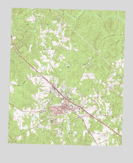
Forsyth, GA USGS Topographic Map
Click on map above to begin viewing in our Map Viewer.

This topographic map contains these locations and features:
Feature Name Type Latitude Longitude GNIS ID View Map
Al Burruss Correctional Training CenterBuildingN33.0572°W83.9763°2735713View Map
Banks Stephens Middle SchoolSchoolN33.0124°W83.9165°2545534View Map
Banks-Stephens Elementary SchoolSchoolN33.0343°W83.9355°343015View Map
Box AnklePopulated PlaceN33.1168°W83.9732°354826View Map
Brighton HeightsPopulated PlaceN33.0526°W83.9527°343023View Map
Brighton MillsPopulated PlaceN33.0515°W83.9535°334703View Map
Chambliss CemeteryCemeteryN33.0263°W83.8807°334704View Map
City of ForsythCivilN33.0347°W83.9380°2403638View Map
Cooks CreekStreamN33.0312°W83.8921°343030View Map
Crowder CemeteryCemeteryN33.1060°W83.9672°334706View Map
Exit 60CrossingN33.0279°W83.9099°1685673View Map
Exit 61CrossingN33.0351°W83.9216°1685674View Map
Exit 62CrossingN33.0429°W83.9382°1685675View Map
Exit 63CrossingN33.0540°W83.9513°1685676View Map
Fairview CemeteryCemeteryN33.0663°W83.9648°343044View Map
Fairview ChurchChurchN33.0662°W83.9649°355762View Map
Fellowship ChurchChurchN33.0493°W83.9499°343045View Map
First Baptist ChurchChurchN33.0368°W83.9416°343046View Map
First Presbyterian ChurchChurchN33.0357°W83.9391°343047View Map
ForsythPopulated PlaceN33.0343°W83.9382°331748View Map
Forsyth City CemeteryCemeteryN33.0301°W83.9360°343049View Map
Forsyth City HallBuildingN33.0357°W83.9388°343050View Map
Forsyth Commercial Historic DistrictParkN33.0357°W83.9385°343051View Map
Forsyth DivisionCivilN33.1009°W83.9170°1936271View Map
Forsyth Fire DepartmentBuildingN33.0325°W83.9373°2604888View Map
Forsyth Golf CourseLocaleN33.0385°W83.9602°334707View Map
Forsyth Police DepartmentBuildingN33.0324°W83.9371°2733795View Map
Forsyth Post OfficePost OfficeN33.0351°W83.9407°352137View Map
Forsyth United Methodist ChurchChurchN33.0343°W83.9407°343052View Map
Forsyth WaterworksLocaleN33.0174°W83.9416°343053View Map
Garden Hills Baptist ChurchChurchN33.0518°W83.9546°343055View Map
Georgia Fire AcademyBuildingN33.0593°W83.9613°2604542View Map
Georgia Public Safety Training CenterBuildingN33.0593°W83.9630°2734223View Map
Georgia State Patrol Troop D Post 44 ForsythBuildingN33.0301°W83.9152°2734048View Map
Hook PondLakeN33.0735°W83.9356°315624View Map
Kynette United Methodist ChurchChurchN33.0276°W83.9482°343065View Map
Little CemeteryCemeteryN33.0107°W83.8831°334710View Map
LogwallPopulated PlaceN33.1101°W83.9449°343066View Map
Logwall CemeteryCemeteryN33.1113°W83.9443°343067View Map
Logwell ChurchChurchN33.1112°W83.9446°317291View Map
Marshall CemeteryCemeteryN33.0365°W83.9982°334711View Map
Mary Persons High SchoolSchoolN33.0274°W83.9327°343068View Map
MaynardPopulated PlaceN33.0549°W83.8894°343069View Map
Maynard CemeteryCemeteryN33.0545°W83.8901°343070View Map
Maynard ChurchChurchN33.0546°W83.8894°317819View Map
Millwood LakeReservoirN33.0307°W83.8881°340101View Map
Millwood Lake DamDamN33.0318°W83.8899°340100View Map
Monroe Academy Private SchoolSchoolN33.0259°W83.9230°318396View Map
Monroe CountyCivilN33.0139°W83.9187°343073View Map
Monroe County CourthouseBuildingN33.0343°W83.9391°343074View Map
Monroe County Emergency Services-Fire DepartmentBuildingN33.0202°W83.9348°2604541View Map
Monroe County HospitalHospitalN33.0312°W83.9459°343075View Map
Monroe County Hospital HeliportAirportN33.0312°W83.9449°351771View Map
Monroe County JailBuildingN33.0549°W83.9628°343076View Map
Monroe County LibraryBuildingN33.0340°W83.9405°343077View Map
Monroe County Middle SchoolSchoolN33.0335°W83.9341°343078View Map
Monroe County Sheriff's OfficeBuildingN33.0550°W83.9624°2734225View Map
Monroe Hills Memorial GardensCemeteryN33.0304°W83.9619°318398View Map
Monroe Memorial GardensCemeteryN33.0422°W83.9547°314510View Map
Mount Airy ChurchChurchN33.1026°W83.8866°318551View Map
Northside ChurchChurchN33.0540°W83.9541°343085View Map
Pace LakeReservoirN33.1047°W83.9474°340099View Map
Pace Lake DamDamN33.1051°W83.9482°340098View Map
Persons LakeReservoirN33.0244°W83.9725°337423View Map
Persons Lake DamDamN33.0251°W83.9716°337422View Map
Piney Grove ChurchChurchN33.0449°W83.8994°320716View Map
Red CreekStreamN33.1098°W83.9744°321372View Map
Rest Haven Memorial CemeteryCemeteryN33.0245°W83.9606°321527View Map
Roberts Memorial ChapelChurchN33.0368°W83.9316°343094View Map
Rocky CreekStreamN33.1215°W83.9452°321820View Map
Rum Creek ChurchChurchN33.0751°W83.9171°321998View Map
Saint James Baptist Church (historical)ChurchN33.0371°W83.9355°343102View Map
Saint Luke African Methodist Episcopal Church (historical)ChurchN33.0379°W83.9349°343103View Map
Samuel Hubbard Elementary SchoolSchoolN33.0223°W83.9562°2545536View Map
School Number 10 (historical)SchoolN33.0946°W83.9449°343106View Map
School Number 34 (historical)SchoolN33.1026°W83.8866°343108View Map
Star MillsPopulated PlaceN33.0232°W83.9185°334714View Map
T G Scott Elementary SchoolSchoolN33.0102°W83.9201°2545597View Map
Tessiehall ChurchChurchN33.0876°W83.9599°324015View Map
Tift CollegeSchoolN33.0362°W83.9321°356590View Map
Tower Factory Stores Shopping CenterLocaleN33.0426°W83.9407°343113View Map
Town CreekStreamN33.0696°W83.8905°324248View Map
Trio Baptist ChurchChurchN33.0357°W83.9374°343114View Map
White CreekStreamN33.0815°W83.9938°325154View Map
William Hubbard Middle SchoolSchoolN33.0219°W83.9527°315774View Map

Note: Coordinates in the location and feature list above are referenced to NAD83 datum.


Copyright (C) 2008-2024 Ryan Niemi / Sunset Dynamics ... All Rights Reserved