TopoQuest Logo
Do you find TopoQuest useful?
Help keep TopoQuest running and adding new maps/features by donating!
Bitcoin:  19c7KJd3qBynnjoSw5npx9KScwjBe4ifkT
Litecoin:  LXs6TkuXGGXo1vDsWCkWVdjQX94eUKd6ui
Home View Maps Find Maps Find Places Resources & Links


Strouds, Georgia Topographic Map

USGS Map Title: Strouds, GA
USGS Map MRC: 32084H1
DRG (GeoTIFF) Download: o32084h1.tif


Neighboring USGS Topographic Map Quads:


  Barnesville, GA  
33084A2
 

  Johnstonville, GA  
33084A1
 

  Forsyth, GA  
33083A8
 

  Yatesville, GA  
32084H2
 

  Strouds, GA  
32084H1
 

  Smarr, GA  
32083H8
 

  Logtown, GA  
32084G2
 

  Culloden, GA  
32084G1
 

  Moran, GA  
32083G8


Map MRC Location:

N33°
W85°
N33°
W84°
H8 H7 H6 H5 H4 H3 H2 H1
G8 G7 G6 G5 G4 G3 G2 G1
F8 F7 F6 F5 F4 F3 F2 F1
E8 E7 E6 E5 E4 E3 E2 E1
D8 D7 D6 D5 D4 D3 D2 D1
C8 C7 C6 C5 C4 C3 C2 C1
B8 B7 B6 B5 B4 B3 B2 B1
A8 A7 A6 A5 A4 A3 A2 A1
N32°
W85°
N32°
W84°

Strouds, GA USGS 1:24K Topographic Map Preview:
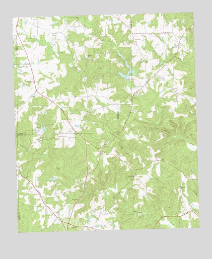
Strouds, GA USGS Topographic Map
Click on map above to begin viewing in our Map Viewer.

This topographic map contains these locations and features:
Feature Name Type Latitude Longitude GNIS ID View Map
Abercrombie LakeReservoirN32.8882°W84.0046°340107View Map
Abercrombie Lake DamDamN32.8868°W84.0032°340106View Map
Bird CemeteryCemeteryN32.9148°W84.0247°311445View Map
BrentPopulated PlaceN32.9818°W84.0102°354847View Map
Brent CemeteryCemeteryN32.9802°W84.0116°343022View Map
Harris CemeteryCemeteryN32.9879°W84.1219°315185View Map
Horns CrossroadsPopulated PlaceN32.9818°W84.0755°344046View Map
King Chapel CemeteryCemeteryN32.9337°W84.0852°316434View Map
Kings Chapel Methodist Church (historical)ChurchN32.9337°W84.0855°344048View Map
Lamar County Fire and Rescue Station 2 RedboneBuildingN32.9899°W84.0980°2604479View Map
Little Tobesofkee Creek Ranch AirportAirportN32.9832°W84.0959°344062View Map
Mangham LakeReservoirN32.9876°W84.1112°340113View Map
Mangham Lake DamDamN32.9868°W84.1099°340112View Map
Monroe County Fire Department Station 8BuildingN32.9783°W84.0054°2604804View Map
Mount Pleasant ChurchChurchN32.9849°W84.0413°318849View Map
Mountain BranchStreamN32.9351°W84.0274°343083View Map
New Macedonia ChurchChurchN32.9054°W84.0435°319475View Map
Orange Grove ChurchChurchN32.8776°W84.0863°320089View Map
Owen CemeteryCemeteryN32.9889°W84.0051°320125View Map
Parker Chapel School (historical)SchoolN32.9237°W84.0632°334211View Map
Parkers Chapel African Methodist Episcopal ChurchChurchN32.9237°W84.0630°343088View Map
Person CemeteryCemeteryN32.9315°W84.0819°320399View Map
Pierson CemeteryCemeteryN32.8932°W84.0824°320504View Map
Pierson LakeReservoirN32.8824°W84.0752°340576View Map
Pierson LakeReservoirN32.9057°W84.0997°337417View Map
Pierson Lake DamDamN32.8835°W84.0749°340575View Map
Pierson Lake DamDamN32.9051°W84.0982°337416View Map
Pippin LakeReservoirN32.9468°W84.0632°340111View Map
Pippin Lake DamDamN32.9468°W84.0632°340110View Map
Pringle CemeteryCemeteryN32.9829°W84.0830°344058View Map
Ramah CemeteryCemeteryN32.9754°W84.0732°344060View Map
Ramah ChurchChurchN32.9760°W84.0732°321301View Map
RedbonePopulated PlaceN32.9901°W84.0974°332814View Map
Russellville ChurchChurchN32.8985°W84.0119°322016View Map
Russellville School (historical)SchoolN32.8985°W84.0121°334214View Map
Sardis CemeteryCemeteryN32.9832°W84.1182°322531View Map
Sardis ChurchChurchN32.9987°W84.1074°322543View Map
Sardis School (historical)SchoolN32.9985°W84.1080°334175View Map
Sharon ChurchChurchN32.9226°W84.0652°322783View Map
Shattles CemeteryCemeteryN32.9537°W84.1132°322803View Map
Sheran-Horne-Smith CemeteryCemeteryN32.9785°W84.0607°344066View Map
Stallings CemeteryCemeteryN32.9710°W84.1149°323500View Map
StroudsPopulated PlaceN32.9204°W84.0660°356566View Map
Sugar Hill ChurchChurchN32.9615°W84.1138°323723View Map
Sugar Hill School (historical)SchoolN32.9612°W84.1141°334177View Map
Tabernacle ChurchChurchN32.9810°W84.0102°323876View Map
Tobesofkee Creek Structure Number 70ReservoirN32.9615°W84.0462°337421View Map
Tobesofkee Creek Structure Number 70 DamDamN32.9618°W84.0466°337420View Map
Wolf CreekStreamN32.9635°W84.0463°325492View Map
Wood CreekStreamN32.8796°W84.0216°325521View Map

Note: Coordinates in the location and feature list above are referenced to NAD83 datum.


Copyright (C) 2008-2024 Ryan Niemi / Sunset Dynamics ... All Rights Reserved