TopoQuest Logo
Do you find TopoQuest useful?
Help keep TopoQuest running and adding new maps/features by donating!
Bitcoin:  19c7KJd3qBynnjoSw5npx9KScwjBe4ifkT
Litecoin:  LXs6TkuXGGXo1vDsWCkWVdjQX94eUKd6ui
Home View Maps Find Maps Find Places Resources & Links


Antrim, Pennsylvania Topographic Map

USGS Map Title: Antrim, PA
USGS Map MRC: 41077F3
DRG (GeoTIFF) Download: o41077f3.tif


Neighboring USGS Topographic Map Quads:


  Asaph, PA  
41077G4
 

  Keeneyville, PA  
41077G3
 

  Crooked Creek, PA  
41077G2
 

  Tiadaghton, PA  
41077F4
 

  Antrim, PA  
41077F3
 

  Cherry Flats, PA  
41077F2
 

  Cedar Run, PA  
41077E4
 

  Morris, PA  
41077E3
 

  Nauvoo, PA  
41077E2


Map MRC Location:

N42°
W78°
N42°
W77°
H8 H7 H6 H5 H4 H3 H2 H1
G8 G7 G6 G5 G4 G3 G2 G1
F8 F7 F6 F5 F4 F3 F2 F1
E8 E7 E6 E5 E4 E3 E2 E1
D8 D7 D6 D5 D4 D3 D2 D1
C8 C7 C6 C5 C4 C3 C2 C1
B8 B7 B6 B5 B4 B3 B2 B1
A8 A7 A6 A5 A4 A3 A2 A1
N41°
W78°
N41°
W77°

Antrim, PA USGS 1:24K Topographic Map Preview:
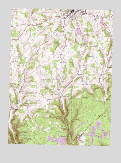
Antrim, PA USGS Topographic Map
Click on map above to begin viewing in our Map Viewer.

This topographic map contains these locations and features:
Feature Name Type Latitude Longitude GNIS ID View Map
Academy Hill CemeteryCemeteryN41.7428°W77.3068°2770034View Map
AntrimPopulated PlaceN41.6340°W77.2869°1168343View Map
Austin Farm / Old Charleston CemeteryCemeteryN41.7431°W77.2704°2770031View Map
Bacon Family Burial Ground CemeteryCemeteryN41.6939°W77.3744°2770028View Map
BalsamPopulated PlaceN41.7031°W77.3486°1203015View Map
Boose HollowValleyN41.6502°W77.3084°1170000View Map
Borough of WellsboroCivilN41.7458°W77.3032°1215629View Map
Boyden BrookStreamN41.7404°W77.3122°1170085View Map
Broadacres CemeteryCemeteryN41.7385°W77.2712°2774801View Map
Broughton HollowPopulated PlaceN41.6690°W77.3116°1203165View Map
BrownleePopulated PlaceN41.6679°W77.2569°1203168View Map
Butler CemeteryCemeteryN41.6821°W77.3584°1170792View Map
Coolidge HollowPopulated PlaceN41.6901°W77.2925°1203332View Map
Dean HillSummitN41.7042°W77.3147°1173032View Map
DraperPopulated PlaceN41.6567°W77.3683°1203444View Map
DuncanPopulated PlaceN41.6520°W77.2578°1203454View Map
East HillSummitN41.6503°W77.3397°1213620View Map
Fork PointSummitN41.6320°W77.3733°1174994View Map
Goat Ranch HillSummitN41.6690°W77.2808°1175762View Map
Hamilton LakeReservoirN41.7367°W77.2615°1195765View Map
Hamilton Lake DamDamN41.7367°W77.2647°1195764View Map
Heise Run SchoolSchoolN41.7337°W77.3489°1176785View Map
Hoover BrookStreamN41.7459°W77.3061°1198019View Map
Johnson RunStreamN41.6409°W77.3730°1178122View Map
Kelsey Creek Dam Pa-600DamN41.7351°W77.3130°1195763View Map
Kelsey Creek LakeReservoirN41.7346°W77.3142°1195762View Map
Lake NessmukReservoirN41.7296°W77.2914°1195758View Map
Lake Nessmuk DamDamN41.7329°W77.2928°1195759View Map
Lost HillSummitN41.6767°W77.2666°1179969View Map
Mount Zion ChurchChurchN41.7434°W77.2630°1181995View Map
PittsPopulated PlaceN41.7442°W77.2700°1204412View Map
RoundtopPopulated PlaceN41.7070°W77.2522°1204553View Map
Roundtop ChurchChurchN41.6979°W77.2558°1185566View Map
Russell HillSummitN41.7284°W77.3547°1185651View Map
Saint Peters Catholic CemeteryCemeteryN41.7353°W77.3071°2774848View Map
Sand RunStreamN41.6398°W77.3011°1186916View Map
Shumway HillSummitN41.7070°W77.2772°1187637View Map
Shumway Hill CemeteryCemeteryN41.7166°W77.2732°1187636View Map
Soldiers and Sailors Memorial HospitalHospitalN41.7451°W77.3004°2718099View Map
Stony ForkPopulated PlaceN41.6731°W77.3622°1188770View Map
Stony Fork Baptist Church CemeteryCemeteryN41.6845°W77.3573°2774853View Map
Stony Fork Mennonite Church CemeteryCemeteryN41.6753°W77.3639°2774854View Map
Tioga County PrisonBuildingN41.7387°W77.2685°2775196View Map
Tioga County Sheriff's OfficeBuildingN41.7474°W77.3028°2768260View Map
Township of DelmarCivilN41.7163°W77.3572°1217106View Map
Township of DuncanCivilN41.6512°W77.2548°1217107View Map
WellsboroPopulated PlaceN41.7487°W77.3005°1190816View Map
Wellsboro Country ClubLocaleN41.7331°W77.3430°1213398View Map
Wellsboro Fire DepartmentBuildingN41.7471°W77.3003°2653036View Map
Wellsboro Firemen's Ambulance Station 1BuildingN41.7475°W77.3001°2652702View Map
Wellsboro Police DepartmentBuildingN41.7472°W77.3001°2768261View Map
WGCR-FM (Wellsboro)TowerN41.7381°W77.3636°1200321View Map
WilliardPopulated PlaceN41.6906°W77.2630°1204957View Map
WNBT-AM (Wellsboro)TowerN41.7448°W77.2928°1200512View Map

Note: Coordinates in the location and feature list above are referenced to NAD83 datum.


Copyright (C) 2008-2024 Ryan Niemi / Sunset Dynamics ... All Rights Reserved