TopoQuest Logo
Do you find TopoQuest useful?
Help keep TopoQuest running and adding new maps/features by donating!
Bitcoin:  19c7KJd3qBynnjoSw5npx9KScwjBe4ifkT
Litecoin:  LXs6TkuXGGXo1vDsWCkWVdjQX94eUKd6ui
Home View Maps Find Maps Find Places Resources & Links


Chestnut Mountain, Georgia Topographic Map

USGS Map Title: Chestnut Mountain, GA
USGS Map MRC: 34083B7
DRG (GeoTIFF) Download: o34083b7.tif


Neighboring USGS Topographic Map Quads:


  Chestatee, GA  
34083C8
 

  Gainesville, GA  
34083C7
 

  Gillsville, GA  
34083C6
 

  Flowery Branch, GA  
34083B8
 

  Chestnut Mountain, GA  
34083B7
 

  Pendergrass, GA  
34083B6
 

  Hog Mountain, GA  
34083A8
 

  Auburn, GA  
34083A7
 

  Winder North, GA  
34083A6


Map MRC Location:

N35°
W84°
N35°
W83°
H8 H7 H6 H5 H4 H3 H2 H1
G8 G7 G6 G5 G4 G3 G2 G1
F8 F7 F6 F5 F4 F3 F2 F1
E8 E7 E6 E5 E4 E3 E2 E1
D8 D7 D6 D5 D4 D3 D2 D1
C8 C7 C6 C5 C4 C3 C2 C1
B8 B7 B6 B5 B4 B3 B2 B1
A8 A7 A6 A5 A4 A3 A2 A1
N34°
W84°
N34°
W83°

Chestnut Mountain, GA USGS 1:24K Topographic Map Preview:
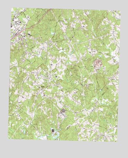
Chestnut Mountain, GA USGS Topographic Map
Click on map above to begin viewing in our Map Viewer.

This topographic map contains these locations and features:
Feature Name Type Latitude Longitude GNIS ID View Map
AlandalePopulated PlaceN34.2059°W83.8285°1686839View Map
BelmontPopulated PlaceN34.1857°W83.7613°354540View Map
Belmont Baptist ChurchChurchN34.1870°W83.7568°1686848View Map
Belmont CemeteryCemeteryN34.1868°W83.7573°1686849View Map
Blackshear PlacePopulated PlaceN34.2209°W83.8610°311505View Map
Bolman EstatesPopulated PlaceN34.2159°W83.7855°1686853View Map
Bretton WoodsPopulated PlaceN34.1790°W83.8185°1686859View Map
BriarwoodPopulated PlaceN34.2234°W83.8718°1686860View Map
CandlerPopulated PlaceN34.2104°W83.7813°331317View Map
Candler BranchStreamN34.2051°W83.8071°312278View Map
Candler Methodist CemeteryCemeteryN34.2125°W83.7818°1686866View Map
Candler Methodist ChurchChurchN34.2123°W83.7816°1686867View Map
Caney ForkStreamN34.1690°W83.7868°312312View Map
Carvers Mill (historical)LocaleN34.2104°W83.8202°1686868View Map
Center Union ChurchChurchN34.1301°W83.7713°333776View Map
Center Union School (historical)SchoolN34.1334°W83.7707°349432View Map
Chestnut HillPopulated PlaceN34.1987°W83.8610°1686880View Map
Chestnut MountainPopulated PlaceN34.1726°W83.8380°312629View Map
Chestnut Mountain Baptist ChurchChurchN34.1729°W83.8371°1686881View Map
Chestnut Mountain Church CemeteryCemeteryN34.1726°W83.8377°1686882View Map
Chestnut Mountain Elementary SchoolSchoolN34.1690°W83.8608°2546087View Map
Chestnut Mountain Presbyterian ChurchChurchN34.1732°W83.8380°1686883View Map
Chicopee Woods Agricultural CenterBuildingN34.2373°W83.8193°333769View Map
Chicopee Woods Elementary SchoolSchoolN34.2319°W83.8214°2546132View Map
Chicopee Woods ParkParkN34.2382°W83.8316°333770View Map
Church of ProphecyChurchN34.1309°W83.7693°333775View Map
College Square Shopping CenterLocaleN34.2282°W83.8666°1686892View Map
Colony SouthPopulated PlaceN34.2201°W83.8288°1686893View Map
Cooper CreekStreamN34.1276°W83.8177°312947View Map
Cross Plains ChurchChurchN34.1923°W83.7757°355382View Map
Deaton CreekStreamN34.1270°W83.8399°313400View Map
Eagle Ranch Christian SchoolSchoolN34.1345°W83.8552°2546347View Map
EaglewoodPopulated PlaceN34.2145°W83.8296°1686902View Map
EdnavillePopulated PlaceN34.1290°W83.7707°349449View Map
Evergreen HeightsPopulated PlaceN34.2382°W83.8046°1686904View Map
Exit 4CrossingN34.2251°W83.8657°1686907View Map
FrazierPopulated PlaceN34.2193°W83.8580°1686928View Map
Gainesville State CollegeSchoolN34.2345°W83.8678°333774View Map
Gainesville Stone LakeReservoirN34.2066°W83.7720°339069View Map
Gainesville Stone Lake DamDamN34.2068°W83.7699°339068View Map
GillelandPopulated PlaceN34.2209°W83.8457°1686941View Map
GoochvillePopulated PlaceN34.1598°W83.7749°349458View Map
Hall County Fire Station 12BuildingN34.1683°W83.8357°2604088View Map
Hall County Fire Station 9BuildingN34.2103°W83.7879°2604086View Map
Hall County JailBuildingN34.2388°W83.8129°2735774View Map
Hillcroft HeightsPopulated PlaceN34.1848°W83.8374°1686964View Map
Hopewell ChurchChurchN34.2137°W83.7863°315661View Map
Johnson High SchoolSchoolN34.2248°W83.8536°333773View Map
Kennedy CemeteryCemeteryN34.1664°W83.8309°316381View Map
Kennedy MountainSummitN34.2257°W83.7830°1686976View Map
KlondikePopulated PlaceN34.1954°W83.7782°326356View Map
Lanier Career AcademySchoolN34.2381°W83.8575°2546133View Map
Lanier SpeedwayLocaleN34.1532°W83.8132°333778View Map
Lanier Technical CollegeSchoolN34.2325°W83.8666°2545803View Map
Lanier Technical College Oakwood CampusSchoolN34.2352°W83.8639°333772View Map
Liberty ChurchChurchN34.1543°W83.7841°349494View Map
Lott CemeteryCemeteryN34.1537°W83.8052°317421View Map
Lott CreekStreamN34.1473°W83.7560°317422View Map
Macedonia Baptist CemeteryCemeteryN34.1518°W83.7994°1686994View Map
Macedonia ChurchChurchN34.1515°W83.7991°317567View Map
Marlette HeightsPopulated PlaceN34.2237°W83.8135°1686995View Map
Martin CemeteryCemeteryN34.1901°W83.8229°317741View Map
McEver LakeReservoirN34.1738°W83.7706°317905View Map
MeadowoodPopulated PlaceN34.2184°W83.8355°1686999View Map
Merchants Crossing Shopping CenterLocaleN34.2293°W83.8693°1687000View Map
Merchants Walk Shopping CenterLocaleN34.2315°W83.8713°1687001View Map
Mercy ChurchChurchN34.1709°W83.7991°318040View Map
Middle Oconee Structure Number One DamDamN34.2251°W83.8249°336674View Map
MulberryPopulated PlaceN34.2073°W83.8582°1687009View Map
Mulberry CreekStreamN34.1257°W83.8566°319134View Map
Myers Elementary SchoolSchoolN34.2094°W83.7839°1687010View Map
Peeks ChapelChurchN34.1307°W83.7688°320338View Map
Platt ParkParkN34.1882°W83.8241°1687030View Map
Pleasant BrookPopulated PlaceN34.2176°W83.8291°1687031View Map
Pleasant Hill CemeteryCemeteryN34.1393°W83.8430°333771View Map
Pleasant Hill Church (historical)ChurchN34.1395°W83.8421°334001View Map
Poplar Springs Baptist CemeteryCemeteryN34.2162°W83.8374°1687034View Map
Poplar Springs ChurchChurchN34.2168°W83.8380°321051View Map
Price MountainSummitN34.1746°W83.7627°321140View Map
Redwine ChurchChurchN34.2248°W83.8535°321426View Map
Redwine CreekStreamN34.2334°W83.8318°321428View Map
Redwine Methodist CemeteryCemeteryN34.2235°W83.8549°1687043View Map
Reservoir OneReservoirN34.2265°W83.8274°336675View Map
Road Atlanta SpeedwayLocaleN34.1459°W83.8163°333777View Map
Sherwood CreekStreamN34.1257°W83.8566°322845View Map
South Hall Community CenterBuildingN34.2187°W83.8677°1687067View Map
South Hall Middle SchoolSchoolN34.2227°W83.8595°323253View Map
Springfield DownsPopulated PlaceN34.2112°W83.8388°1687069View Map
Strickland HeightsPopulated PlaceN34.1873°W83.8502°1687072View Map
Tanner MillPopulated PlaceN34.1782°W83.7857°333188View Map
Trinity Day SchoolSchoolN34.1724°W83.8363°2346439View Map
Union Baptist CemeteryCemeteryN34.1546°W83.8632°1687087View Map
Union ChurchChurchN34.1548°W83.8632°324539View Map
WFOX-FM (Gainesville)TowerN34.1257°W83.8585°352698View Map
World Language AcademySchoolN34.1751°W83.8407°1686884View Map
WYAY-FM (Gainesville)TowerN34.1257°W83.8585°352699View Map

Note: Coordinates in the location and feature list above are referenced to NAD83 datum.


Copyright (C) 2008-2024 Ryan Niemi / Sunset Dynamics ... All Rights Reserved