TopoQuest Logo
Do you find TopoQuest useful?
Help keep TopoQuest running and adding new maps/features by donating!
Bitcoin:  19c7KJd3qBynnjoSw5npx9KScwjBe4ifkT
Litecoin:  LXs6TkuXGGXo1vDsWCkWVdjQX94eUKd6ui
Home View Maps Find Maps Find Places Resources & Links


Auburn, Georgia Topographic Map

USGS Map Title: Auburn, GA
USGS Map MRC: 34083A7
DRG (GeoTIFF) Download: o34083a7.tif


Neighboring USGS Topographic Map Quads:


  Flowery Branch, GA  
34083B8
 

  Chestnut Mountain, GA  
34083B7
 

  Pendergrass, GA  
34083B6
 

  Hog Mountain, GA  
34083A8
 

  Auburn, GA  
34083A7
 

  Winder North, GA  
34083A6
 

  Lawrenceville, GA  
33083H8
 

  Bold Springs, GA  
33083H7
 

  Winder South, GA  
33083H6


Map MRC Location:

N35°
W84°
N35°
W83°
H8 H7 H6 H5 H4 H3 H2 H1
G8 G7 G6 G5 G4 G3 G2 G1
F8 F7 F6 F5 F4 F3 F2 F1
E8 E7 E6 E5 E4 E3 E2 E1
D8 D7 D6 D5 D4 D3 D2 D1
C8 C7 C6 C5 C4 C3 C2 C1
B8 B7 B6 B5 B4 B3 B2 B1
A8 A7 A6 A5 A4 A3 A2 A1
N34°
W84°
N34°
W83°

Auburn, GA USGS 1:24K Topographic Map Preview:
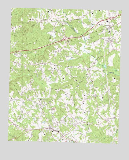
Auburn, GA USGS Topographic Map
Click on map above to begin viewing in our Map Viewer.

This topographic map contains these locations and features:
Feature Name Type Latitude Longitude GNIS ID View Map
Algernon (historical)Populated PlaceN34.0651°W83.7843°1687984View Map
Apalachee ChurchChurchN34.0115°W83.8480°354376View Map
Applachee Baptist CemeteryCemeteryN34.0116°W83.8477°333697View Map
AuburnPopulated PlaceN34.0137°W83.8277°354411View Map
Auburn City HallBuildingN34.0134°W83.8268°356971View Map
Auburn DivisionCivilN34.0303°W83.8111°1936092View Map
Auburn Elementary SchoolSchoolN34.0096°W83.8242°356972View Map
Auburn Fire Department Station 4BuildingN34.0129°W83.8244°2346455View Map
Auburn First Baptist ChurchChurchN34.0129°W83.8252°1687985View Map
Auburn Park ChapelChurchN34.0204°W83.8060°333763View Map
Auburn Police DepartmentBuildingN34.0134°W83.8267°2346456View Map
Auburn United Methodist ChurchChurchN34.0121°W83.8274°1687986View Map
Barrow County Alternative CenterSchoolN34.0445°W83.7761°2545752View Map
Beaver Dam CreekStreamN34.0936°W83.7903°2080924View Map
Bethabra ChurchChurchN34.0643°W83.7846°354566View Map
Bethlehem CemeteryCemeteryN34.0806°W83.7737°349423View Map
Bethlehem Church (historical)ChurchN34.0807°W83.7727°354685View Map
Bradley School (historical)SchoolN34.0540°W83.7580°356985View Map
Bramlett Elementary SchoolSchoolN34.0378°W83.8090°2545650View Map
BraseltonPopulated PlaceN34.1093°W83.7627°331228View Map
Braselton CemeteryCemeteryN34.1095°W83.7688°333766View Map
Braselton City CemeteryCemeteryN34.1098°W83.7682°349424View Map
Braselton Police DepartmentBuildingN34.1078°W83.7622°2734136View Map
Cains Courthouse (historical)Populated PlaceN34.0740°W83.8330°356988View Map
Calvary ChurchChurchN34.0040°W83.8080°333765View Map
CarlPopulated PlaceN34.0057°W83.8113°354992View Map
Carl Baptist ChurchChurchN34.0062°W83.8110°356989View Map
Carl City CemeteryCemeteryN34.0079°W83.8116°356990View Map
Cedar HillPopulated PlaceN34.0223°W83.7655°1687987View Map
City of AuburnCivilN34.0151°W83.8316°2403134View Map
City of HoschtonCivilN34.0934°W83.7617°2404732View Map
Coleman Mill DamDamN34.0551°W83.8749°338873View Map
County High SchoolSchoolN34.1048°W83.7624°313021View Map
County LineLocaleN34.0437°W83.7766°313023View Map
County Line Fire Department Station 5BuildingN34.0560°W83.7807°2603589View Map
Cruce DamDamN34.0784°W83.8049°336794View Map
Cruce LakeReservoirN34.0783°W83.8061°336795View Map
Duncan CreekStreamN34.1093°W83.8063°313722View Map
Duncan Creek ElementarySchoolN34.0746°W83.8729°2346458View Map
Duncan Creek Elementary SchoolSchoolN34.0757°W83.8716°2104351View Map
Duncan Cross RoadsLocaleN34.1057°W83.8732°1686901View Map
Exit 48CrossingN34.0968°W83.8124°1687988View Map
Exit 49CrossingN34.1179°W83.7624°1687997View Map
Frank N Osborne Middle SchoolSchoolN34.0778°W83.8728°2104281View Map
Grace ChurchChurchN34.0090°W83.8532°333764View Map
Grapevine (historical)Populated PlaceN34.0720°W83.8635°1688151View Map
Hall County Fire Station 14BuildingN34.1196°W83.8736°2604085View Map
Hamilton Mill Area High SchoolSchoolN34.0756°W83.8729°2346459View Map
Harmony Grove ChurchChurchN34.0379°W83.8280°356191View Map
Harmony Grove United Methodist Church CemeteryCemeteryN34.0373°W83.8293°357009View Map
Harvey BranchStreamN34.0831°W83.7844°2747218View Map
Helton CemeteryCemeteryN34.0023°W83.8176°333767View Map
Hillcrest-Allen Clinic and Hospital (historical)HospitalN34.0884°W83.7582°349464View Map
HoschtonPopulated PlaceN34.0965°W83.7613°356322View Map
Hoschton City CemeteryCemeteryN34.0946°W83.7658°349472View Map
Hoschton Recreation ParkParkN34.0898°W83.7702°333768View Map
Lake Upper Mulberry River ElevenReservoirN34.0551°W83.8749°338874View Map
Little Mulberry RiverStreamN34.0557°W83.8749°317127View Map
Little Mulberry RiverStreamN34.0651°W83.7652°317128View Map
Living Word ChurchChurchN34.0212°W83.7627°357015View Map
Lollis CreekStreamN34.1204°W83.8685°317293View Map
Mauldins Mills (historical)LocaleN34.1243°W83.8555°1686996View Map
Mount Moriah ChurchChurchN34.0704°W83.8568°318703View Map
Mulberry ChurchChurchN34.1143°W83.8357°319133View Map
Mulberry Elementary SchoolSchoolN34.0314°W83.8631°2546013View Map
Nazareth ChurchChurchN34.0276°W83.7752°319215View Map
Nazareth School (historical)SchoolN34.0282°W83.7755°357019View Map
New Liberty ChurchChurchN34.1159°W83.7957°319462View Map
Oglesby DamDamN34.0568°W83.8366°338740View Map
Oglesby LakeReservoirN34.0568°W83.8366°338741View Map
Pool MountainSummitN34.0543°W83.8674°321004View Map
Rock CreekStreamN34.0607°W83.7913°321727View Map
Sharon ChurchChurchN34.0946°W83.8082°322789View Map
Thompsons MillPopulated PlaceN34.1129°W83.8177°333218View Map
Town of BraseltonCivilN34.1086°W83.8126°2405316View Map
Town of CarlCivilN34.0045°W83.8127°2405378View Map
Trinity ChurchChurchN34.0443°W83.8399°333762View Map
Union Grove ChurchChurchN34.0382°W83.8668°324556View Map
West Jackson County Fire DepartmentBuildingN34.1054°W83.7610°2603695View Map
West Jackson Intermediate SchoolSchoolN34.1024°W83.7596°2545727View Map
West Jackson Primary SchoolSchoolN34.1051°W83.7628°349478View Map
Wheeler CreekStreamN34.1007°W83.8246°325122View Map
Woods Grove ChurchChurchN34.0823°W83.8677°333761View Map
Zion CemeteryCemeteryN34.1187°W83.7553°349549View Map
Zion ChurchChurchN34.1182°W83.7555°325678View Map

Note: Coordinates in the location and feature list above are referenced to NAD83 datum.


Copyright (C) 2008-2024 Ryan Niemi / Sunset Dynamics ... All Rights Reserved