TopoQuest Logo
Do you find TopoQuest useful?
Help keep TopoQuest running and adding new maps/features by donating!
Bitcoin:  19c7KJd3qBynnjoSw5npx9KScwjBe4ifkT
Litecoin:  LXs6TkuXGGXo1vDsWCkWVdjQX94eUKd6ui
Home View Maps Find Maps Find Places Resources & Links


Chauncey, Illinois Topographic Map

USGS Map Title: Chauncey, IL
USGS Map MRC: 38087G7
DRG (GeoTIFF) Download: o38087g7.tif


Neighboring USGS Topographic Map Quads:


  Oblong South, IL  
38087H8
 

  Stoy, IL  
38087H7
 

  Flat Rock, IL  
38087H6
 

  Landes, IL  
38087G8
 

  Chauncey, IL  
38087G7
 

  Birds, IL  
38087G6
 

  Claremont, IL  
38087F8
 

  Sumner, IL  
38087F7
 

  Lawrenceville, IL  
38087F6


Map MRC Location:

N39°
W88°
N39°
W87°
H8 H7 H6 H5 H4 H3 H2 H1
G8 G7 G6 G5 G4 G3 G2 G1
F8 F7 F6 F5 F4 F3 F2 F1
E8 E7 E6 E5 E4 E3 E2 E1
D8 D7 D6 D5 D4 D3 D2 D1
C8 C7 C6 C5 C4 C3 C2 C1
B8 B7 B6 B5 B4 B3 B2 B1
A8 A7 A6 A5 A4 A3 A2 A1
N38°
W88°
N38°
W87°

Chauncey, IL USGS 1:24K Topographic Map Preview:
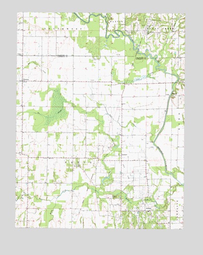
Chauncey, IL USGS Topographic Map
Click on map above to begin viewing in our Map Viewer.

This topographic map contains these locations and features:
Feature Name Type Latitude Longitude GNIS ID View Map
ApplegatePopulated PlaceN38.7928°W87.7967°422411View Map
Bethany ChurchChurchN38.8223°W87.7970°404248View Map
Bethany School (historical)SchoolN38.8195°W87.7884°1764744View Map
Bluffs CemeteryCemeteryN38.7689°W87.8009°404629View Map
Bridgeport Fire Protection District Station 2BuildingN38.7602°W87.7789°2682320View Map
Bugaboo CreekStreamN38.7695°W87.8681°405170View Map
Carter CreekStreamN38.8450°W87.7684°405650View Map
Charlottsville (historical)Populated PlaceN38.8348°W87.7550°1816169View Map
ChaunceyPopulated PlaceN38.8353°W87.8709°405994View Map
Chauncey Marsh Nature PreserveParkN38.8203°W87.8445°1816170View Map
Christy Fire Protection District Station 2BuildingN38.8349°W87.8711°2681715View Map
Crow BranchStreamN38.8428°W87.7717°406843View Map
Eagle BranchStreamN38.8003°W87.7728°407560View Map
Hazledale School (historical)SchoolN38.7764°W87.8664°1764773View Map
Honey CreekStreamN38.8695°W87.8078°410473View Map
Island ChurchChurchN38.8045°W87.7970°410958View Map
Island School (historical)SchoolN38.7862°W87.7786°1764775View Map
Keplinger CemeteryCemeteryN38.8695°W87.8739°411420View Map
Mad CreekStreamN38.8234°W87.8375°412815View Map
Muddy CreekStreamN38.7762°W87.7520°414209View Map
Oak Ridge School (historical)SchoolN38.8637°W87.7781°1736281View Map
Paul CreekStreamN38.7675°W87.8442°415460View Map
PetroliaPopulated PlaceN38.7606°W87.7789°415592View Map
Petty Elementary SchoolSchoolN38.7906°W87.8500°415595View Map
Petty School (historical)SchoolN38.7914°W87.8323°1764789View Map
Pinhook School (historical)SchoolN38.7531°W87.8059°1764790View Map
Pleasant Hill ChurchChurchN38.7870°W87.8281°415833View Map
Pleasant Ridge School (historical)SchoolN38.8334°W87.7998°1764795View Map
Pleasant View School (historical)SchoolN38.7950°W87.8139°1764796View Map
Port JacksonPopulated PlaceN38.8637°W87.7784°423079View Map
Port Jackson CemeteryCemeteryN38.8645°W87.7886°416039View Map
Rich Valley School (historical)SchoolN38.8353°W87.8325°1764799View Map
Smith FordCrossingN38.8520°W87.7842°1736288View Map
The SloughStreamN38.7712°W87.8134°419642View Map
Township of PettyCivilN38.7980°W87.8340°427928View Map
Township of SouthwestCivilN38.8650°W87.8710°429780View Map
Valley School (historical)SchoolN38.7559°W87.7509°1764809View Map
Waggoner CemeteryCemeteryN38.8506°W87.8709°420368View Map
Waggoner CemeteryCemeteryN38.8506°W87.8700°1940778View Map
WestportPopulated PlaceN38.8273°W87.7598°423303View Map

Note: Coordinates in the location and feature list above are referenced to NAD83 datum.


Copyright (C) 2008-2024 Ryan Niemi / Sunset Dynamics ... All Rights Reserved