TopoQuest Logo
Do you find TopoQuest useful?
Help keep TopoQuest running and adding new maps/features by donating!
Bitcoin:  19c7KJd3qBynnjoSw5npx9KScwjBe4ifkT
Litecoin:  LXs6TkuXGGXo1vDsWCkWVdjQX94eUKd6ui
Home View Maps Find Maps Find Places Resources & Links


Chandler Heights, Arizona Topographic Map

USGS Map Title: Chandler Heights, AZ
USGS Map MRC: 33111B6
DRG (GeoTIFF) Download: o33111b6.tif


Neighboring USGS Topographic Map Quads:


  Chandler, AZ  
33111C7
 

  Higley, AZ  
33111C6
 

  Desert Well, AZ  
33111C5
 

  Gila Butte, AZ  
33111B7
 

  Chandler Heights, AZ  
33111B6
 

  Sacaton NE, AZ  
33111B5
 

  Gila Butte SE, AZ  
33111A7
 

  Sacaton, AZ  
33111A6
 

  Blackwater, AZ  
33111A5


Map MRC Location:

N34°
W112°
N34°
W111°
H8 H7 H6 H5 H4 H3 H2 H1
G8 G7 G6 G5 G4 G3 G2 G1
F8 F7 F6 F5 F4 F3 F2 F1
E8 E7 E6 E5 E4 E3 E2 E1
D8 D7 D6 D5 D4 D3 D2 D1
C8 C7 C6 C5 C4 C3 C2 C1
B8 B7 B6 B5 B4 B3 B2 B1
A8 A7 A6 A5 A4 A3 A2 A1
N33°
W112°
N33°
W111°

Chandler Heights, AZ USGS 1:24K Topographic Map Preview:
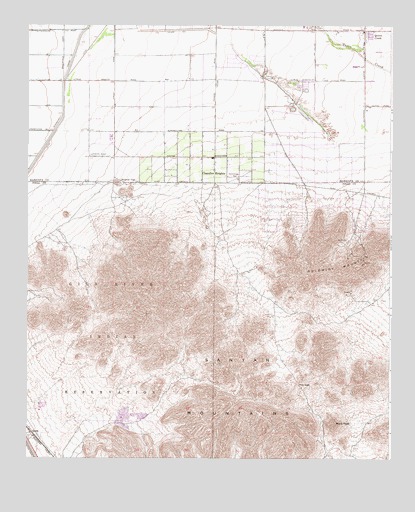
Chandler Heights, AZ USGS Topographic Map
Click on map above to begin viewing in our Map Viewer.

This topographic map contains these locations and features:
Feature Name Type Latitude Longitude GNIS ID View Map
Calvary Chapel of Queen CreekChurchN33.2127°W111.6686°2670678View Map
Chandler HeightsPopulated PlaceN33.2120°W111.6862°2749View Map
Chandler Heights SchoolSchoolN33.2114°W111.6907°14331View Map
Chandler Traditional Campus - FreedomSchoolN33.2403°W111.7235°2517766View Map
Charlotte Upham Patterson Elementary SchoolSchoolN33.2145°W111.7405°2517775View Map
Desert Mountain Bible FellowshipChurchN33.2055°W111.6778°2670855View Map
Desert Mountain Elementary SchoolSchoolN33.2461°W111.6505°2517660View Map
DockLocaleN33.1323°W111.7485°3988View Map
Dock Railroad StationBuildingN33.1317°W111.7479°23691View Map
Family of Faith FellowshipChurchN33.2484°W111.6315°2670914View Map
Gilbert Fire Department Station 11BuildingN33.2198°W111.7277°2672489View Map
Goldmine MountainSummitN33.1856°W111.6290°5140View Map
Malpais HillsSummitN33.1356°W111.6693°23736View Map
Maricopa County Sheriff's Office District 6BuildingN33.2439°W111.6350°2751693View Map
Newell Barney Junior High SchoolSchoolN33.2209°W111.6675°2517784View Map
Our Lady of Guadalupe Catholic ChurchChurchN33.2489°W111.6392°2671657View Map
Patriot AcademySchoolN33.2114°W111.6728°2467267View Map
Payne Junior High SchoolSchoolN33.2107°W111.7192°2517776View Map
Queen CreekPopulated PlaceN33.2487°W111.6343°9868View Map
Queen Creek Community CenterBuildingN33.2447°W111.6340°2669895View Map
Queen Creek Elementary SchoolSchoolN33.2328°W111.6438°9869View Map
Queen Creek Fire Department Station 411BuildingN33.2447°W111.6341°2672389View Map
Queen Creek Fire Department Station 412BuildingN33.2234°W111.6685°2672717View Map
Queen Creek Post OfficePost OfficeN33.2448°W111.6385°44831View Map
Queen Creek Town HallBuildingN33.2447°W111.6349°2669593View Map
Riggs Elementary SchoolSchoolN33.2247°W111.7128°2517778View Map
Rittenhouse SubstationLocaleN33.2484°W111.6401°14976View Map
Rock PeakSummitN33.1351°W111.6446°10412View Map
Round TopSummitN33.2045°W111.7196°10543View Map
San Tan Mountain Regional ParkParkN33.1500°W111.6417°2124615View Map
Sanokai VillagePopulated PlaceN33.2334°W111.6715°25073View Map
Santan CanalCanalN33.1276°W111.7485°10955View Map
Santan MountainSummitN33.1734°W111.7090°23805View Map
Santan MountainsSummitN33.1412°W111.6812°10957View Map
Seville Golf and Country ClubLocaleN33.2273°W111.7072°2670479View Map
The Church of Jesus Christ of Latter Day SaintsChurchN33.2336°W111.6423°2671863View Map
The Church of Jesus Christ of Latter Day SaintsChurchN33.2117°W111.6375°2671864View Map
The Church of Jesus Christ of Latter Day SaintsChurchN33.2202°W111.6826°2671379View Map
The Church of Jesus Christ of Latter Day SaintsChurchN33.2494°W111.6569°2671383View Map
The GapGapN33.1464°W111.6565°12319View Map
Town of Queen CreekCivilN33.2373°W111.6404°2412518View Map

Note: Coordinates in the location and feature list above are referenced to NAD83 datum.


Copyright (C) 2008-2024 Ryan Niemi / Sunset Dynamics ... All Rights Reserved