TopoQuest Logo
Do you find TopoQuest useful?
Help keep TopoQuest running and adding new maps/features by donating!
Bitcoin:  19c7KJd3qBynnjoSw5npx9KScwjBe4ifkT
Litecoin:  LXs6TkuXGGXo1vDsWCkWVdjQX94eUKd6ui
Home View Maps Find Maps Find Places Resources & Links


Sacaton NE, Arizona Topographic Map

USGS Map Title: Sacaton NE, AZ
USGS Map MRC: 33111B5
DRG (GeoTIFF) Download: o33111b5.tif


Neighboring USGS Topographic Map Quads:


  Higley, AZ  
33111C6
 

  Desert Well, AZ  
33111C5
 

  Superstition Mountains SW, AZ  
33111C4
 

  Chandler Heights, AZ  
33111B6
 

  Sacaton NE, AZ  
33111B5
 

  Magma, AZ  
33111B4
 

  Sacaton, AZ  
33111A6
 

  Blackwater, AZ  
33111A5
 

  Florence, AZ  
33111A4


Map MRC Location:

N34°
W112°
N34°
W111°
H8 H7 H6 H5 H4 H3 H2 H1
G8 G7 G6 G5 G4 G3 G2 G1
F8 F7 F6 F5 F4 F3 F2 F1
E8 E7 E6 E5 E4 E3 E2 E1
D8 D7 D6 D5 D4 D3 D2 D1
C8 C7 C6 C5 C4 C3 C2 C1
B8 B7 B6 B5 B4 B3 B2 B1
A8 A7 A6 A5 A4 A3 A2 A1
N33°
W112°
N33°
W111°

Sacaton NE, AZ USGS 1:24K Topographic Map Preview:
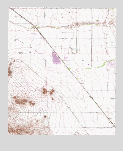
Sacaton NE, AZ USGS Topographic Map
Click on map above to begin viewing in our Map Viewer.

This topographic map contains these locations and features:
Feature Name Type Latitude Longitude GNIS ID View Map
Banner Ironwood Medical CenterHospitalN33.2148°W111.5656°2667645View Map
Bellavista FarmsLocaleN33.1612°W111.5012°1223View Map
Central Arizona College San Tan CenterSchoolN33.1362°W111.5397°2545072View Map
Circle Cross Ranch K - 8 SchoolSchoolN33.2042°W111.5711°2544898View Map
Combs Traditional AcademySchoolN33.2187°W111.5618°2544929View Map
Copper Basin K - 8 SchoolSchoolN33.1376°W111.5277°2544876View Map
Ellsworth Elementary SchoolSchoolN33.2284°W111.5552°2544911View Map
Frances Brandon - Pickett Elementary SchoolSchoolN33.2332°W111.6096°2517782View Map
Inverness Industrial ParkLocaleN33.2462°W111.6129°2671951View Map
J O Combs Middle SchoolSchoolN33.2211°W111.5487°2545013View Map
Jack W Harmon Elementary SchoolSchoolN33.2379°W111.5545°2544918View Map
Kathryn Sue Simonton Elementary SchoolSchoolN33.2455°W111.5210°2544914View Map
Las Colinas Golf ClubLocaleN33.2403°W111.6168°2670249View Map
Links Estates Mobile Home ParkPopulated PlaceN33.2474°W111.5561°2670204View Map
Mountain Vista K - 8 SchoolSchoolN33.1837°W111.6055°2544949View Map
Pegasus AirparkAirportN33.2076°W111.6179°2650992View Map
Pinal County Sheriff's Office Combs Region ABuildingN33.2183°W111.5646°2751705View Map
Queen Creek High SchoolSchoolN33.2465°W111.6057°2517669View Map
Queen Creek SidingLocaleN33.2220°W111.5857°9870View Map
Ray Schnepf Ranch Airport (historical)AirportN33.2242°W111.5943°45481View Map
Rural / Metro Fire Department Station 841BuildingN33.1556°W111.5572°2672696View Map
Rural / Metro Fire Department Station 842BuildingN33.2084°W111.5635°2672668View Map
Rural / Metro Fire Department Station 843BuildingN33.1367°W111.5264°2672697View Map
San Tan Foothills High SchoolSchoolN33.1390°W111.5802°2544950View Map
San Tan Heights Elementary SchoolSchoolN33.1784°W111.5936°2544930View Map
San Tan ValleyPopulated PlaceN33.1911°W111.5280°2576311View Map
San Tan Valley Census Designated PlaceCensusN33.1879°W111.5473°2629370View Map
Skyline Ranch K - 8 SchoolSchoolN33.1857°W111.5786°2544877View Map
The Church of Jesus Christ of Latter Day SaintsChurchN33.2477°W111.6080°2671866View Map
The Golf Club at Johnson RanchLocaleN33.1605°W111.5677°2669918View Map
The Links Golf ClubLocaleN33.2447°W111.5601°2670588View Map
Walker Butte K - 8 SchoolSchoolN33.1485°W111.5549°2544897View Map

Note: Coordinates in the location and feature list above are referenced to NAD83 datum.


Copyright (C) 2008-2024 Ryan Niemi / Sunset Dynamics ... All Rights Reserved