TopoQuest Logo
Do you find TopoQuest useful?
Help keep TopoQuest running and adding new maps/features by donating!
Bitcoin:  19c7KJd3qBynnjoSw5npx9KScwjBe4ifkT
Litecoin:  LXs6TkuXGGXo1vDsWCkWVdjQX94eUKd6ui
Home View Maps Find Maps Find Places Resources & Links


Castle Rock Creek, Wyoming Topographic Map

USGS Map Title: Castle Rock Creek, WY
USGS Map MRC: 44109D3
DRG (GeoTIFF) Download: o44109d3.tif


Neighboring USGS Topographic Map Quads:


  Jim Mountain, WY  
44109E4
 

  Logan Mountain, WY  
44109E3
 

  Shoshone Canyon, WY  
44109E2
 

  Wapiti, WY  
44109D4
 

  Castle Rock Creek, WY  
44109D3
 

  Irma Flats, WY  
44109D2
 

  Twin Creek, WY  
44109C4
 

  Belknap Creek, WY  
44109C3
 

  Devils Tooth, WY  
44109C2


Map MRC Location:

N45°
W110°
N45°
W109°
H8 H7 H6 H5 H4 H3 H2 H1
G8 G7 G6 G5 G4 G3 G2 G1
F8 F7 F6 F5 F4 F3 F2 F1
E8 E7 E6 E5 E4 E3 E2 E1
D8 D7 D6 D5 D4 D3 D2 D1
C8 C7 C6 C5 C4 C3 C2 C1
B8 B7 B6 B5 B4 B3 B2 B1
A8 A7 A6 A5 A4 A3 A2 A1
N44°
W110°
N44°
W109°

Castle Rock Creek, WY USGS 1:24K Topographic Map Preview:
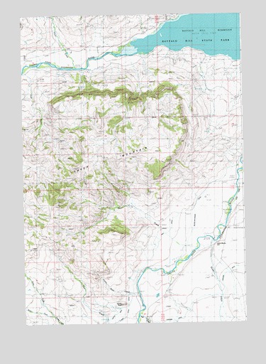
Castle Rock Creek, WY USGS Topographic Map
Click on map above to begin viewing in our Map Viewer.

This topographic map contains these locations and features:
Feature Name Type Latitude Longitude GNIS ID View Map
Andy Martin HillSlopeN44.4075°W109.2627°1584837View Map
Andy Martin PitMineN44.4033°W109.2729°1725945View Map
Bar Flying E AirportAirportN44.4049°W109.2809°2443880View Map
Bear CreekStreamN44.4066°W109.2771°1585246View Map
Broken H LodgeLocaleN44.4805°W109.3715°1585943View Map
Bull CreekStreamN44.3797°W109.3093°1598487View Map
Bull Creek CemeteryCemeteryN44.3777°W109.3056°2774442View Map
Castle RockSummitN44.3827°W109.3207°1609076View Map
Castle Rock CreekStreamN44.3872°W109.3163°1586449View Map
Castle Rock DitchCanalN44.3880°W109.3010°1604560View Map
Castle Rock RanchLocaleN44.3861°W109.3104°1586450View Map
East Fork Timber CreekStreamN44.3783°W109.3602°1599501View Map
Neff DitchCanalN44.3808°W109.3177°1597187View Map
North Fork Shoshone RiverStreamN44.4838°W109.3146°1604438View Map
Northfork PitMineN44.4930°W109.2602°1725957View Map
Park County Fire Protection District 2 Station 2BuildingN44.4071°W109.2622°2673591View Map
Post CreekStreamN44.4777°W109.3743°1592974View Map
Sheep CreekStreamN44.4083°W109.2677°1602842View Map
Sheep MountainRidgeN44.4416°W109.3302°1594204View Map
Sheep MountainSummitN44.4416°W109.3302°1594209View Map
Stout RanchLocaleN44.4772°W109.3363°1595094View Map
Trout CreekStreamN44.4788°W109.3446°1603784View Map
Trout Creek RanchLocaleN44.4877°W109.3504°1595721View Map
Wapiti Post OfficePost OfficeN44.4858°W109.3478°2767874View Map
West Fork Timber CreekStreamN44.3780°W109.3599°1604080View Map
Wilson-McKissack DitchCanalN44.4250°W109.2752°1596507View Map

Note: Coordinates in the location and feature list above are referenced to NAD83 datum.


Copyright (C) 2008-2024 Ryan Niemi / Sunset Dynamics ... All Rights Reserved