TopoQuest Logo
Do you find TopoQuest useful?
Help keep TopoQuest running and adding new maps/features by donating!
Bitcoin:  19c7KJd3qBynnjoSw5npx9KScwjBe4ifkT
Litecoin:  LXs6TkuXGGXo1vDsWCkWVdjQX94eUKd6ui
Home View Maps Find Maps Find Places Resources & Links


Devils Tooth, Wyoming Topographic Map

USGS Map Title: Devils Tooth, WY
USGS Map MRC: 44109C2
DRG (GeoTIFF) Download: o44109c2.tif


Neighboring USGS Topographic Map Quads:


  Castle Rock Creek, WY  
44109D3
 

  Irma Flats, WY  
44109D2
 

  Indian Pass, WY  
44109D1
 

  Belknap Creek, WY  
44109C3
 

  Devils Tooth, WY  
44109C2
 

  Horner Creek, WY  
44109C1
 

  North Fork Pickett Creek, WY  
44109B3
 

  Thomas Reservoir, WY  
44109B2
 

  Tonopah Ridge, WY  
44109B1


Map MRC Location:

N45°
W110°
N45°
W109°
H8 H7 H6 H5 H4 H3 H2 H1
G8 G7 G6 G5 G4 G3 G2 G1
F8 F7 F6 F5 F4 F3 F2 F1
E8 E7 E6 E5 E4 E3 E2 E1
D8 D7 D6 D5 D4 D3 D2 D1
C8 C7 C6 C5 C4 C3 C2 C1
B8 B7 B6 B5 B4 B3 B2 B1
A8 A7 A6 A5 A4 A3 A2 A1
N44°
W110°
N44°
W109°

Devils Tooth, WY USGS 1:24K Topographic Map Preview:
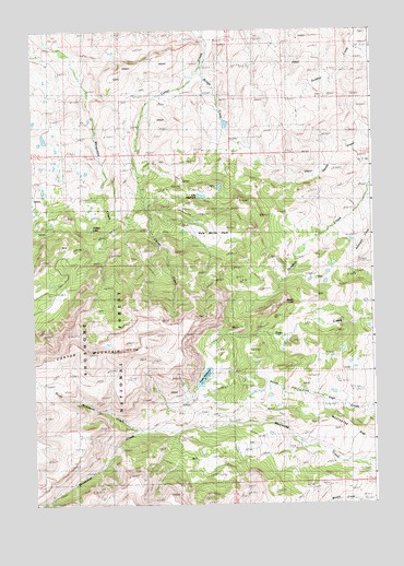
Devils Tooth, WY USGS Topographic Map
Click on map above to begin viewing in our Map Viewer.

This topographic map contains these locations and features:
Feature Name Type Latitude Longitude GNIS ID View Map
Bridge CreekStreamN44.3672°W109.1871°1585902View Map
Coe ReservoirReservoirN44.3313°W109.1882°1586864View Map
Darrah DamDamN44.3483°W109.1724°1607824View Map
Darrah Number 1 DamDamN44.3316°W109.1824°1607782View Map
Darrah Number 1 ReservoirReservoirN44.3316°W109.1824°1607783View Map
Darrah Number 2 DamDamN44.3333°W109.1807°1607784View Map
Darrah Number 2 ReservoirReservoirN44.3338°W109.1812°1607785View Map
Darrah Number 3 ReservoirReservoirN44.3483°W109.1724°1607825View Map
Devils ToothSummitN44.3038°W109.1579°1587571View Map
Eagle LakeReservoirN44.3433°W109.2357°1607829View Map
Eagle Lake DamDamN44.3433°W109.2357°1607828View Map
Foster Number 3 DamDamN44.2783°W109.1840°1607814View Map
Foster Number 3 ReservoirReservoirN44.2783°W109.1840°1607815View Map
Foster ReservoirReservoirN44.2834°W109.1876°1588666View Map
Grabbert CabinLocaleN44.2638°W109.1563°1589013View Map
Hidden LakeLakeN44.3231°W109.2286°1589524View Map
Nina DamDamN44.2833°W109.1707°1607748View Map
Nina ReservoirReservoirN44.2833°W109.1707°1607749View Map
North Meeteetse CreekStreamN44.2694°W109.2101°1601843View Map
Pete Miller ParkFlatN44.3205°W109.1838°1592681View Map
Shoshone Number 1 DamDamN44.3300°W109.1957°1607822View Map
Shoshone Number 1 ReservoirReservoirN44.3300°W109.1957°1607823View Map
Shoshone RanchLocaleN44.3622°W109.1932°1594292View Map
Sylvan DamDamN44.3083°W109.1857°1607738View Map
Sylvan ReservoirReservoirN44.3083°W109.1857°1607739View Map

Note: Coordinates in the location and feature list above are referenced to NAD83 datum.


Copyright (C) 2008-2024 Ryan Niemi / Sunset Dynamics ... All Rights Reserved