TopoQuest Logo
Do you find TopoQuest useful?
Help keep TopoQuest running and adding new maps/features by donating!
Bitcoin:  19c7KJd3qBynnjoSw5npx9KScwjBe4ifkT
Litecoin:  LXs6TkuXGGXo1vDsWCkWVdjQX94eUKd6ui
Home View Maps Find Maps Find Places Resources & Links


Spreckels, California Topographic Map

USGS Map Title: Spreckels, CA
USGS Map MRC: 36121E6
DRG (GeoTIFF) Download: o36121e6.tif


Neighboring USGS Topographic Map Quads:


  Marina, CA  
36121F7
 

  Salinas, CA  
36121F6
 

  Natividad, CA  
36121F5
 

  Seaside, CA  
36121E7
 

  Spreckels, CA  
36121E6
 

  Chualar, CA  
36121E5
 

  Mount Carmel, CA  
36121D7
 

  Carmel Valley, CA  
36121D6
 

  Rana Creek, CA  
36121D5


Map MRC Location:

N37°
W122°
N37°
W121°
H8 H7 H6 H5 H4 H3 H2 H1
G8 G7 G6 G5 G4 G3 G2 G1
F8 F7 F6 F5 F4 F3 F2 F1
E8 E7 E6 E5 E4 E3 E2 E1
D8 D7 D6 D5 D4 D3 D2 D1
C8 C7 C6 C5 C4 C3 C2 C1
B8 B7 B6 B5 B4 B3 B2 B1
A8 A7 A6 A5 A4 A3 A2 A1
N36°
W122°
N36°
W121°

Spreckels, CA USGS 1:24K Topographic Map Preview:
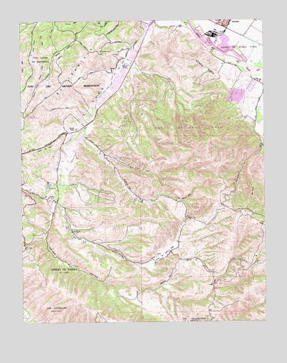
Spreckels, CA USGS Topographic Map
Click on map above to begin viewing in our Map Viewer.

This topographic map contains these locations and features:
Feature Name Type Latitude Longitude GNIS ID View Map
Ambler ParkPopulated PlaceN36.5763°W121.7202°1873370View Map
Barlow Canyon TrailTrailN36.5830°W121.6780°1873371View Map
Barloy CanyonValleyN36.6238°W121.7402°218676View Map
Bessie Canyon TrailTrailN36.5927°W121.6766°1873372View Map
Bingamin RanchLocaleN36.6066°W121.6969°219302View Map
Buena VistaCivilN36.6047°W121.6561°220075View Map
Buena Vista Middle SchoolSchoolN36.6059°W121.6479°2504487View Map
Calera CanyonValleyN36.5497°W121.7330°220389View Map
Canyon Del ReyValleyN36.5788°W121.7208°217912View Map
Corral de TierraPopulated PlaceN36.5700°W121.7324°1873397View Map
Corral de Tierra Country ClubLocaleN36.5686°W121.7261°1873398View Map
Corral de Tierra ValleyValleyN36.5322°W121.7141°221580View Map
Cougar Ridge TrailTrailN36.5772°W121.6808°1873399View Map
CreeksidePopulated PlaceN36.6105°W121.6930°1873402View Map
East Ridge TrailTrailN36.5944°W121.6719°1873405View Map
El ChamisalCivilN36.6044°W121.7263°223028View Map
El ToroCivilN36.5900°W121.7152°223062View Map
El Toro LakeLakeN36.5564°W121.7372°223065View Map
Gibson TrailTrailN36.5855°W121.6908°1873411View Map
Guidotti RanchLocaleN36.5802°W121.7224°224710View Map
Harper CreekStreamN36.5802°W121.7183°224953View Map
Jacks Ranger StationLocaleN36.6119°W121.7094°226071View Map
Kalte CanyonValleyN36.5713°W121.6266°234104View Map
Keltron ParkParkN36.6033°W121.6997°1873423View Map
Laguna Seca Race TrackLocaleN36.5833°W121.7494°253872View Map
Lincoln SchoolLocaleN36.5294°W121.6749°254910View Map
Lincoln School (historical)SchoolN36.5291°W121.6752°1693212View Map
Lookout RidgeRidgeN36.6036°W121.7402°227644View Map
Los LaurellesCivilN36.5047°W121.7413°234199View Map
Lost Valley Wilderness AreaReserveN36.5869°W121.6799°1873432View Map
Montessori Learning CenterSchoolN36.6228°W121.6466°2504452View Map
Morgan WineryLocaleN36.6219°W121.6858°1873439View Map
Ollason TrailTrailN36.5822°W121.6927°1873443View Map
Perry RidgeRidgeN36.6250°W121.7405°234451View Map
Rancho Corral de TierraCivilN36.5244°W121.7366°221586View Map
Salinas Rural Fire Protection District Station 1 Toro StationBuildingN36.6182°W121.6875°2623818View Map
San Benancio CanyonValleyN36.5800°W121.7183°1954402View Map
San Benancio GulchValleyN36.5702°W121.7116°232376View Map
San Benancio Middle SchoolSchoolN36.5781°W121.7155°232377View Map
Serra VillagePopulated PlaceN36.6041°W121.6983°1873457View Map
SpreckelsPopulated PlaceN36.6219°W121.6469°1659842View Map
Spreckels Census Designated PlaceCensusN36.6247°W121.6465°2408789View Map
Spreckels Memorial ParkParkN36.6244°W121.6469°1873462View Map
Spreckels Post OfficePost OfficeN36.6225°W121.6468°1873463View Map
Spreckels Volunteer Fire CompanyBuildingN36.6224°W121.6466°2624162View Map
Toro Park DivisionCivilN36.5559°W121.6449°1935342View Map
Toro Park Shopping CenterLocaleN36.6052°W121.6961°1873468View Map
Toro Pask Elementary SchoolSchoolN36.5958°W121.7048°1873467View Map
Toro Regional ParkParkN36.5833°W121.6677°252375View Map
Toro School for the Hearing ImpairedSchoolN36.5955°W121.7049°1873469View Map
Toyon Ridge TrailTrailN36.5808°W121.6727°1873470View Map
Washington Elementary SchoolSchoolN36.5379°W121.7250°237315View Map
Watson CreekStreamN36.5788°W121.7211°237344View Map
Wildcat RidgeRidgeN36.6063°W121.7494°237806View Map

Note: Coordinates in the location and feature list above are referenced to NAD83 datum.


Copyright (C) 2008-2024 Ryan Niemi / Sunset Dynamics ... All Rights Reserved