TopoQuest Logo
Do you find TopoQuest useful?
Help keep TopoQuest running and adding new maps/features by donating!
Bitcoin:  19c7KJd3qBynnjoSw5npx9KScwjBe4ifkT
Litecoin:  LXs6TkuXGGXo1vDsWCkWVdjQX94eUKd6ui
Home View Maps Find Maps Find Places Resources & Links


Elmira, Idaho Topographic Map

USGS Map Title: Elmira, ID
USGS Map MRC: 48116D4
DRG (GeoTIFF) Download: o48116d4.tif


Neighboring USGS Topographic Map Quads:


  Dodge Peak, ID  
48116E5
 

  Naples, ID  
48116E4
 

  Twentymile Creek, ID  
48116E3
 

  Colburn, ID  
48116D5
 

  Elmira, ID  
48116D4
 

  Wylie Knob, ID  
48116D3
 

  Sandpoint, ID  
48116C5
 

  Oden Bay, ID  
48116C4
 

  Trout Peak, ID  
48116C3


Map MRC Location:

N49°
W117°
N49°
W116°
H8 H7 H6 H5 H4 H3 H2 H1
G8 G7 G6 G5 G4 G3 G2 G1
F8 F7 F6 F5 F4 F3 F2 F1
E8 E7 E6 E5 E4 E3 E2 E1
D8 D7 D6 D5 D4 D3 D2 D1
C8 C7 C6 C5 C4 C3 C2 C1
B8 B7 B6 B5 B4 B3 B2 B1
A8 A7 A6 A5 A4 A3 A2 A1
N48°
W117°
N48°
W116°

Elmira, ID USGS 1:24K Topographic Map Preview:
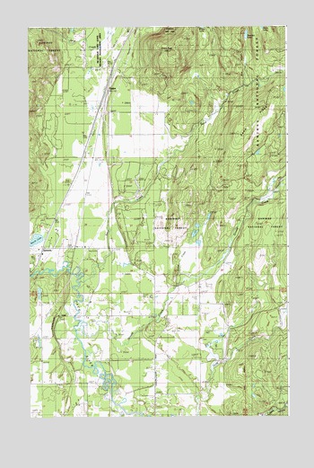
Elmira, ID USGS Topographic Map
Click on map above to begin viewing in our Map Viewer.

This topographic map contains these locations and features:
Feature Name Type Latitude Longitude GNIS ID View Map
Albertson CreekStreamN48.3796°W116.4188°2784646View Map
Bloom CreekStreamN48.4838°W116.4077°399381View Map
Bottle Bay Seaplane BaseAirportN48.4791°W116.4455°400927View Map
Center Valley School (historical)LocaleN48.3927°W116.4938°379142View Map
Colburn Post OfficePost OfficeN48.4896°W116.4581°2767307View Map
Dennick LakeLakeN48.4974°W116.3948°400374View Map
ElmiraPopulated PlaceN48.4797°W116.4624°381439View Map
Elmira PeakSummitN48.4924°W116.4305°381440View Map
Gold Creek CemeteryCemeteryN48.4000°W116.4177°394312View Map
Grouse CreekStreamN48.4027°W116.4782°382740View Map
Grouse Creek School (historical)LocaleN48.4080°W116.4407°382744View Map
Jones CreekStreamN48.4158°W116.4294°384012View Map
Northside Fire District Station 4BuildingN48.4290°W116.4924°2619107View Map
SamuelsPopulated PlaceN48.4294°W116.4938°397133View Map
Sand CreekStreamN48.4197°W116.4752°389897View Map
Sand RidgeRidgeN48.4758°W116.3796°400392View Map
Sandpoint DivisionCivilN48.3794°W116.4614°1936805View Map
Spear Valley AirportAirportN48.3764°W116.4848°2717316View Map
Walsh LakeLakeN48.4322°W116.4967°392804View Map

Note: Coordinates in the location and feature list above are referenced to NAD83 datum.


Copyright (C) 2008-2024 Ryan Niemi / Sunset Dynamics ... All Rights Reserved