TopoQuest Logo
Do you find TopoQuest useful?
Help keep TopoQuest running and adding new maps/features by donating!
Bitcoin:  19c7KJd3qBynnjoSw5npx9KScwjBe4ifkT
Litecoin:  LXs6TkuXGGXo1vDsWCkWVdjQX94eUKd6ui
Home View Maps Find Maps Find Places Resources & Links


Naples, Idaho Topographic Map

USGS Map Title: Naples, ID
USGS Map MRC: 48116E4
DRG (GeoTIFF) Download: o48116e4.tif


Neighboring USGS Topographic Map Quads:


  Roman Nose, ID  
48116F5
 

  Moravia, ID  
48116F4
 

  Bonners Ferry, ID  
48116F3
 

  Dodge Peak, ID  
48116E5
 

  Naples, ID  
48116E4
 

  Twentymile Creek, ID  
48116E3
 

  Colburn, ID  
48116D5
 

  Elmira, ID  
48116D4
 

  Wylie Knob, ID  
48116D3


Map MRC Location:

N49°
W117°
N49°
W116°
H8 H7 H6 H5 H4 H3 H2 H1
G8 G7 G6 G5 G4 G3 G2 G1
F8 F7 F6 F5 F4 F3 F2 F1
E8 E7 E6 E5 E4 E3 E2 E1
D8 D7 D6 D5 D4 D3 D2 D1
C8 C7 C6 C5 C4 C3 C2 C1
B8 B7 B6 B5 B4 B3 B2 B1
A8 A7 A6 A5 A4 A3 A2 A1
N48°
W117°
N48°
W116°

Naples, ID USGS 1:24K Topographic Map Preview:
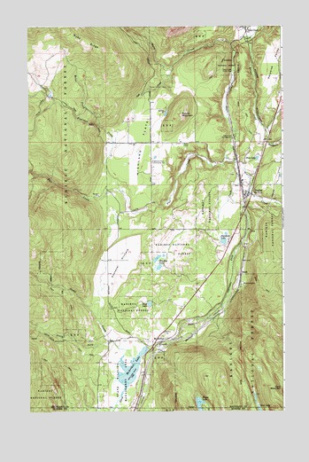
Naples, ID USGS Topographic Map
Click on map above to begin viewing in our Map Viewer.

This topographic map contains these locations and features:
Feature Name Type Latitude Longitude GNIS ID View Map
Bloom LakeLakeN48.5024°W116.4169°377875View Map
Blue LakeLakeN48.5821°W116.3879°377926View Map
Bond LakeLakeN48.5350°W116.4411°378017View Map
Bradley LakeLakeN48.5496°W116.4374°378180View Map
Brown CreekStreamN48.6216°W116.3902°378265View Map
Deep CreekPopulated PlaceN48.6233°W116.3933°396387View Map
Deep Creek Access AreaLocaleN48.6194°W116.3841°401288View Map
Deep Creek CampgroundLocaleN48.5894°W116.3988°380395View Map
Deep Creek Picnic AreaParkN48.6105°W116.3991°396388View Map
Dodge CreekStreamN48.5172°W116.4494°380666View Map
Fall CreekStreamN48.5819°W116.4027°381558View Map
Gold CreekStreamN48.6116°W116.4296°382362View Map
Highland CreekStreamN48.5713°W116.4541°383182View Map
Highland FlatsFlatN48.5874°W116.4438°383183View Map
Highland Flats Community HallLocaleN48.5813°W116.4396°383184View Map
Kootenai OrchardFlatN48.5483°W116.4555°384298View Map
Mc ArthurPopulated PlaceN48.5235°W116.4335°399130View Map
McArthur DamDamN48.5199°W116.4427°398759View Map
McArthur LakeReservoirN48.5137°W116.4506°397896View Map
McArthur Lake AccessLocaleN48.5210°W116.4421°394172View Map
McArthur Wildlife Management AreaLocaleN48.5074°W116.4552°398488View Map
Molar CreekStreamN48.5930°W116.4652°387077View Map
NaplesPopulated PlaceN48.5710°W116.3924°387463View Map
Naples Elementary SchoolSchoolN48.5716°W116.3939°401014View Map
Naples Post OfficePost OfficeN48.5700°W116.3940°2766864View Map
Round MountainSummitN48.5966°W116.4252°389661View Map
Ruby CreekStreamN48.6191°W116.4010°389702View Map
Ruby RidgeRidgeN48.6247°W116.4838°389713View Map
Sand LakeLakeN48.5006°W116.3875°389900View Map
ShilohPopulated PlaceN48.5449°W116.3955°400219View Map
South Boundary Fire Protection District Station 1BuildingN48.5712°W116.3926°2619186View Map
South Boundary Fire Protection District Station Number 3BuildingN48.5679°W116.4403°2766768View Map
South Fork Dodge CreekStreamN48.5227°W116.4594°390925View Map
Stampede LakeLakeN48.5551°W116.4047°391333View Map
Trail CreekStreamN48.5788°W116.3977°392312View Map
Twentymile CreekStreamN48.5908°W116.3835°392488View Map
White CreekStreamN48.5010°W116.4585°376431View Map

Note: Coordinates in the location and feature list above are referenced to NAD83 datum.


Copyright (C) 2008-2024 Ryan Niemi / Sunset Dynamics ... All Rights Reserved