TopoQuest Logo
Do you find TopoQuest useful?
Help keep TopoQuest running and adding new maps/features by donating!
Bitcoin:  19c7KJd3qBynnjoSw5npx9KScwjBe4ifkT
Litecoin:  LXs6TkuXGGXo1vDsWCkWVdjQX94eUKd6ui
Home View Maps Find Maps Find Places Resources & Links


Brushy Mountain, New Mexico Topographic Map

USGS Map Title: Brushy Mountain, NM
USGS Map MRC: 32108G6
DRG (GeoTIFF) Download: o32108g6.tif


Neighboring USGS Topographic Map Quads:


  Applegate Mountain, NM  
32108H7
 

  Antelope Ridge, NM  
32108H6
 

  Cliff, NM  
32108H5
 

  Walker Canyon, NM  
32108G7
 

  Brushy Mountain, NM  
32108G6
 

  Mangas Springs, NM  
32108G5
 

  Nichols Canyon, NM  
32108F7
 

  Redrock, NM  
32108F6
 

  Bullard Peak, NM  
32108F5


Map MRC Location:

N33°
W109°
N33°
W108°
H8 H7 H6 H5 H4 H3 H2 H1
G8 G7 G6 G5 G4 G3 G2 G1
F8 F7 F6 F5 F4 F3 F2 F1
E8 E7 E6 E5 E4 E3 E2 E1
D8 D7 D6 D5 D4 D3 D2 D1
C8 C7 C6 C5 C4 C3 C2 C1
B8 B7 B6 B5 B4 B3 B2 B1
A8 A7 A6 A5 A4 A3 A2 A1
N32°
W109°
N32°
W108°

Brushy Mountain, NM USGS 1:24K Topographic Map Preview:
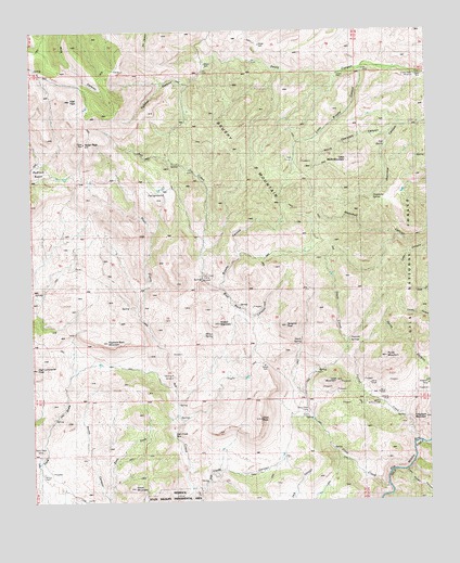
Brushy Mountain, NM USGS Topographic Map
Click on map above to begin viewing in our Map Viewer.

This topographic map contains these locations and features:
Feature Name Type Latitude Longitude GNIS ID View Map
Ash Creek BoxValleyN32.7645°W108.7039°903439View Map
Ash Creek CampLocaleN32.8109°W108.6964°903440View Map
Black Eagle MineMineN32.7634°W108.7489°903861View Map
Blue Rock CanyonValleyN32.8087°W108.6964°903953View Map
Brushy CanyonValleyN32.8070°W108.6914°904106View Map
Brushy MountainSummitN32.8434°W108.6864°904115View Map
Clark PeakSummitN32.7717°W108.6789°905183View Map
Crows Nest WindmillLocaleN32.8628°W108.6281°905531View Map
Davis WindmillLocaleN32.8631°W108.6528°905624View Map
East Fork Smith CanyonValleyN32.7512°W108.7264°905971View Map
Elephant Back MountainSummitN32.7926°W108.7270°906112View Map
FairgroundLocaleN32.8326°W108.7076°906220View Map
Foxtail CreekStreamN32.7656°W108.6295°906369View Map
Foxtail SpringSpringN32.7724°W108.6336°899193View Map
Grapevine SpringSpringN32.8306°W108.6430°906704View Map
Hatch SpringSpringN32.7919°W108.6660°906868View Map
Hells Hole TankReservoirN32.8321°W108.6333°899192View Map
High Lonesome PeakSummitN32.7859°W108.7495°906970View Map
High PeakSummitN32.8567°W108.7378°906974View Map
Lead MountainSummitN32.7815°W108.6551°907909View Map
Little Black MountainSummitN32.8404°W108.6492°907994View Map
Little Brushy CanyonValleyN32.8642°W108.6456°907999View Map
Little Rough CanyonValleyN32.7576°W108.6334°908047View Map
Lower Slate Creek TankReservoirN32.7626°W108.6413°899194View Map
Nolen PeakSummitN32.8451°W108.7337°909115View Map
North Cherokee CanyonValleyN32.8476°W108.6387°909130View Map
Oliver WindmillLocaleN32.7992°W108.7170°909352View Map
Panther CanyonValleyN32.8609°W108.7012°909470View Map
Pearson SpringsSpringN32.7926°W108.6509°909527View Map
Pot Hole WindmillLocaleN32.8376°W108.6992°909809View Map
Pyrite MountainSummitN32.7881°W108.6389°909910View Map
Redrock State Wildlife Experimental AreaLocaleN32.7515°W108.7062°2038815View Map
Slate CreekStreamN32.7537°W108.6389°911125View Map
Slate Creek CampLocaleN32.7731°W108.6648°911126View Map
Slate Creek Canyon DepositsMineN32.7829°W108.6617°914896View Map
Smith MountainSummitN32.7537°W108.7187°911154View Map
South Black SpringSpringN32.8367°W108.6456°1766230View Map
Tampico PeakSummitN32.7965°W108.6703°911535View Map
Telegraph MountainSummitN32.7717°W108.6273°911589View Map
Tub SpringSpringN32.8445°W108.6389°936533View Map
Turner TankReservoirN32.8430°W108.6322°1853753View Map
Tyrone DivisionCivilN32.8676°W108.7230°1937611View Map
Walking H WindmillLocaleN32.7829°W108.7062°912143View Map
West Prong Ash CreekStreamN32.7840°W108.7056°912253View Map
Wilson MountainSummitN32.7973°W108.6917°912435View Map
Wilson SpringSpringN32.7944°W108.6962°912438View Map

Note: Coordinates in the location and feature list above are referenced to NAD83 datum.


Copyright (C) 2008-2024 Ryan Niemi / Sunset Dynamics ... All Rights Reserved