TopoQuest Logo
Do you find TopoQuest useful?
Help keep TopoQuest running and adding new maps/features by donating!
Bitcoin:  19c7KJd3qBynnjoSw5npx9KScwjBe4ifkT
Litecoin:  LXs6TkuXGGXo1vDsWCkWVdjQX94eUKd6ui
Home View Maps Find Maps Find Places Resources & Links


Nichols Canyon, New Mexico Topographic Map

USGS Map Title: Nichols Canyon, NM
USGS Map MRC: 32108F7
DRG (GeoTIFF) Download: o32108f7.tif


Neighboring USGS Topographic Map Quads:


  Steeple Rock, NM  
32108G8
 

  Walker Canyon, NM  
32108G7
 

  Brushy Mountain, NM  
32108G6
 

  Canador Peak, NM  
32108F8
 

  Nichols Canyon, NM  
32108F7
 

  Redrock, NM  
32108F6
 

  Rock Tank Draw, NM  
32108E8
 

  Caprock Mountain, NM  
32108E7
 

  Willow Draw, NM  
32108E6


Map MRC Location:

N33°
W109°
N33°
W108°
H8 H7 H6 H5 H4 H3 H2 H1
G8 G7 G6 G5 G4 G3 G2 G1
F8 F7 F6 F5 F4 F3 F2 F1
E8 E7 E6 E5 E4 E3 E2 E1
D8 D7 D6 D5 D4 D3 D2 D1
C8 C7 C6 C5 C4 C3 C2 C1
B8 B7 B6 B5 B4 B3 B2 B1
A8 A7 A6 A5 A4 A3 A2 A1
N32°
W109°
N32°
W108°

Nichols Canyon, NM USGS 1:24K Topographic Map Preview:
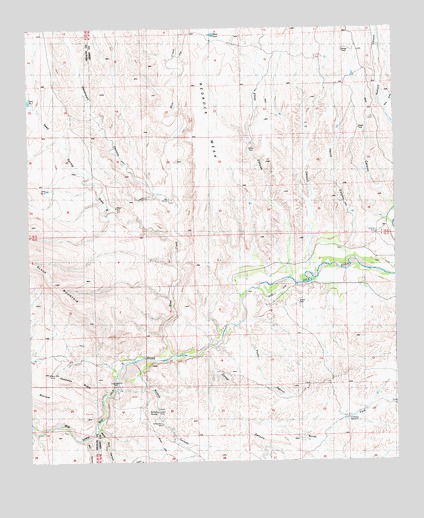
Nichols Canyon, NM USGS Topographic Map
Click on map above to begin viewing in our Map Viewer.

This topographic map contains these locations and features:
Feature Name Type Latitude Longitude GNIS ID View Map
Anderson WindmillLocaleN32.6370°W108.7664°885745View Map
Bar U WindmillLocaleN32.7006°W108.8262°938835View Map
Black Bob Group MineMineN32.6517°W108.8617°915233View Map
Black Bob MineMineN32.6504°W108.8687°886399View Map
Blue CreekStreamN32.6551°W108.8270°903937View Map
Box CanyonValleyN32.6312°W108.8562°886674View Map
Consolation MineMineN32.6356°W108.8298°887795View Map
Corral CanyonValleyN32.6565°W108.8156°905371View Map
Davenport CanyonValleyN32.7026°W108.8303°888208View Map
Deadman RidgeRidgeN32.6487°W108.8581°888245View Map
Elliot CanyonValleyN32.6790°W108.7851°888854View Map
Harris CanyonValleyN32.6862°W108.7664°889792View Map
Hill CanyonValleyN32.6981°W108.7514°889997View Map
L C CanyonValleyN32.6837°W108.7789°890759View Map
McHaffey WindmillLocaleN32.7054°W108.7792°891768View Map
Mesa TankReservoirN32.7482°W108.8122°891868View Map
Nichols CanyonValleyN32.6495°W108.8384°892532View Map
Nichols SpringSpringN32.6395°W108.8324°892533View Map
North Fork Corral CanyonValleyN32.6367°W108.8020°909142View Map
Picnic CanyonValleyN32.6645°W108.8017°893247View Map
Remington LodeMineN32.6517°W108.8617°915232View Map
Seep Spring DrawValleyN32.6904°W108.8270°894704View Map
Tank DrawValleyN32.7248°W108.7534°911540View Map
Tank Number TwoReservoirN32.7037°W108.8689°914448View Map
White Rock CanyonValleyN32.6345°W108.8520°896523View Map
Wilson MineMineN32.6484°W108.8431°923783View Map
Winnie ClaimMineN32.6470°W108.8576°915235View Map

Note: Coordinates in the location and feature list above are referenced to NAD83 datum.


Copyright (C) 2008-2024 Ryan Niemi / Sunset Dynamics ... All Rights Reserved