TopoQuest Logo
Do you find TopoQuest useful?
Help keep TopoQuest running and adding new maps/features by donating!
Bitcoin:  19c7KJd3qBynnjoSw5npx9KScwjBe4ifkT
Litecoin:  LXs6TkuXGGXo1vDsWCkWVdjQX94eUKd6ui
Home View Maps Find Maps Find Places Resources & Links


Trinway, Ohio Topographic Map

USGS Map Title: Trinway, OH
USGS Map MRC: 40082B1
DRG (GeoTIFF) Download: o40082b1.tif


Neighboring USGS Topographic Map Quads:


  Walhonding, OH  
40082C2
 

  Warsaw, OH  
40082C1
 

  Randle, OH  
40081C8
 

  Perryton, OH  
40082B2
 

  Trinway, OH  
40082B1
 

  Conesville, OH  
40081B8
 

  Toboso, OH  
40082A2
 

  Dresden, OH  
40082A1
 

  Adamsville, OH  
40081A8


Map MRC Location:

N41°
W83°
N41°
W82°
H8 H7 H6 H5 H4 H3 H2 H1
G8 G7 G6 G5 G4 G3 G2 G1
F8 F7 F6 F5 F4 F3 F2 F1
E8 E7 E6 E5 E4 E3 E2 E1
D8 D7 D6 D5 D4 D3 D2 D1
C8 C7 C6 C5 C4 C3 C2 C1
B8 B7 B6 B5 B4 B3 B2 B1
A8 A7 A6 A5 A4 A3 A2 A1
N40°
W83°
N40°
W82°

Trinway, OH USGS 1:24K Topographic Map Preview:
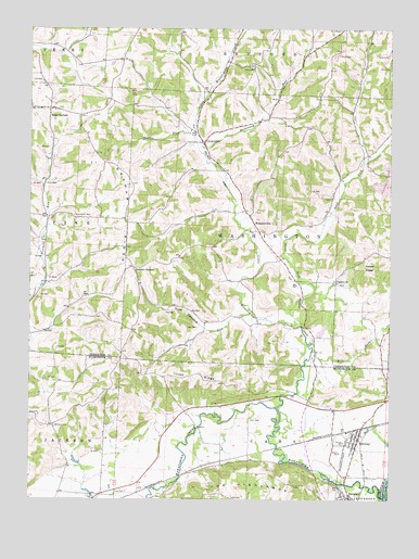
Trinway, OH USGS Topographic Map
Click on map above to begin viewing in our Map Viewer.

This topographic map contains these locations and features:
Feature Name Type Latitude Longitude GNIS ID View Map
Arnold FarmLocaleN40.1272°W82.0908°2704584View Map
Broomstick CemeteryCemeteryN40.2003°W82.1099°1038363View Map
Chalfant ChurchChurchN40.1828°W82.0182°1048318View Map
Chalfant Meeting House CemeteryCemeteryN40.1829°W82.0187°1964103View Map
Chalfant Methodist Episcopal CemeteryCemeteryN40.1828°W82.0190°1964104View Map
Clark School (historical)SchoolN40.2117°W82.1001°1050359View Map
Cody CemeteryCemeteryN40.1273°W82.0949°1039216View Map
CooperdalePopulated PlaceN40.2198°W82.0651°1056969View Map
Cooperdale Nazarene ChurchChurchN40.2187°W82.0638°1057295View Map
Cooperdale Post Office (historical)Post OfficeN40.2195°W82.0651°1967478View Map
Dickinson RunStreamN40.2170°W82.0643°1066678View Map
Graham CornersPopulated PlaceN40.1870°W82.0882°1062790View Map
Graham RidgeRidgeN40.1981°W82.0907°1041015View Map
Hamilton School (historical)SchoolN40.2167°W82.0082°1050361View Map
Hill N Dale Dairy FarmLocaleN40.2319°W82.0656°2634748View Map
Indian KnobSummitN40.1870°W82.0085°1041942View Map
Irish RidgeRidgeN40.1598°W82.0668°1041993View Map
Irish School (historical)SchoolN40.1542°W82.0760°1054525View Map
Little Wakatomika CreekStreamN40.1498°W82.0379°1042694View Map
McCurty School (historical)SchoolN40.2487°W82.0249°1050360View Map
Mill ForkStreamN40.1648°W82.0265°1043332View Map
Moore LakeReservoirN40.1617°W82.0249°1079288View Map
Moore Lake DamDamN40.1617°W82.0249°1079287View Map
Mount Zion Christian CemeteryCemeteryN40.1448°W82.1157°1964175View Map
Opossum RunStreamN40.1753°W82.0465°1066878View Map
Presbyterian CemeteryCemeteryN40.2052°W82.0207°1964133View Map
Sand ForkStreamN40.1715°W82.0321°1066942View Map
Steffee RunStreamN40.2223°W82.0704°1063514View Map
Tomika Regular Baptist CemeteryCemeteryN40.2012°W82.0465°1964142View Map
Township of CassCivilN40.1311°W82.0328°1086716View Map
Township of WashingtonCivilN40.1969°W82.0451°1085930View Map
TrinwayPopulated PlaceN40.1412°W82.0099°1061707View Map
Trinway Census Designated PlaceCensusN40.1376°W82.0119°2628979View Map
Trinway Methodist ChurchChurchN40.1420°W82.0110°1069075View Map
Trinway Post OfficePost OfficeN40.1417°W82.0096°2039608View Map
Union ChurchChurchN40.2398°W82.0460°1047268View Map
Union Methodist Episcopal CemeteryCemeteryN40.2403°W82.0482°1964143View Map
WakatomikaPopulated PlaceN40.1987°W82.0471°1062590View Map
Wakatomika CreekStreamN40.1259°W82.0015°1067036View Map
Wakatomika Post Office (historical)Post OfficeN40.1987°W82.0471°1967457View Map
West CarlislePopulated PlaceN40.2290°W82.1182°1049305View Map
West Carlisle CemeteryCemeteryN40.2312°W82.1171°1964148View Map
West Carlisle Post Office (historical)Post OfficeN40.2292°W82.1179°1967459View Map

Note: Coordinates in the location and feature list above are referenced to NAD83 datum.


Copyright (C) 2008-2024 Ryan Niemi / Sunset Dynamics ... All Rights Reserved