TopoQuest Logo
Do you find TopoQuest useful?
Help keep TopoQuest running and adding new maps/features by donating!
Bitcoin:  19c7KJd3qBynnjoSw5npx9KScwjBe4ifkT
Litecoin:  LXs6TkuXGGXo1vDsWCkWVdjQX94eUKd6ui
Home View Maps Find Maps Find Places Resources & Links


Perryton, Ohio Topographic Map

USGS Map Title: Perryton, OH
USGS Map MRC: 40082B2
DRG (GeoTIFF) Download: o40082b2.tif


Neighboring USGS Topographic Map Quads:


  Martinsburg, OH  
40082C3
 

  Walhonding, OH  
40082C2
 

  Warsaw, OH  
40082C1
 

  Hickman, OH  
40082B3
 

  Perryton, OH  
40082B2
 

  Trinway, OH  
40082B1
 

  Hanover, OH  
40082A3
 

  Toboso, OH  
40082A2
 

  Dresden, OH  
40082A1


Map MRC Location:

N41°
W83°
N41°
W82°
H8 H7 H6 H5 H4 H3 H2 H1
G8 G7 G6 G5 G4 G3 G2 G1
F8 F7 F6 F5 F4 F3 F2 F1
E8 E7 E6 E5 E4 E3 E2 E1
D8 D7 D6 D5 D4 D3 D2 D1
C8 C7 C6 C5 C4 C3 C2 C1
B8 B7 B6 B5 B4 B3 B2 B1
A8 A7 A6 A5 A4 A3 A2 A1
N40°
W83°
N40°
W82°

Perryton, OH USGS 1:24K Topographic Map Preview:
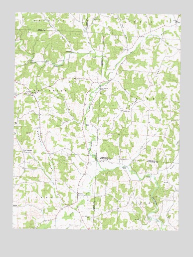
Perryton, OH USGS Topographic Map
Click on map above to begin viewing in our Map Viewer.

This topographic map contains these locations and features:
Feature Name Type Latitude Longitude GNIS ID View Map
Anderson CemeteryCemeteryN40.1661°W82.1694°1037412View Map
Anderson RunStreamN40.2267°W82.2043°1037419View Map
Ashcraft FordCrossingN40.1559°W82.1468°1062636View Map
Ashcraft RidgeRidgeN40.2045°W82.1507°1037514View Map
Ashcraft School (historical)SchoolN40.1940°W82.1671°1050357View Map
Brushy ForkStreamN40.1592°W82.1818°1038428View Map
Crawford BridgeBridgeN40.1651°W82.1860°1039457View Map
Fairview School (historical)SchoolN40.1456°W82.1563°1054495View Map
FallsburgPopulated PlaceN40.2028°W82.2360°1064637View Map
Fallsburg CemeteryCemeteryN40.2040°W82.2399°1954713View Map
Fallsburg Post Office (historical)Post OfficeN40.2028°W82.2365°2026302View Map
Fivemile RunStreamN40.1559°W82.1432°1040490View Map
Fox Den KnobSummitN40.1803°W82.2404°1048756View Map
FramptonPopulated PlaceN40.2273°W82.2063°1064671View Map
Frampton Post Office (historical)Post OfficeN40.2278°W82.2068°2026068View Map
Framptons Mills (historical)LocaleN40.2276°W82.2049°1052173View Map
Gardner School (historical)SchoolN40.2162°W82.1454°1050358View Map
Gregg Mill BridgeBridgeN40.2217°W82.2382°1052172View Map
Holmes Mill (historical)LocaleN40.2020°W82.2332°1052174View Map
Jug RunStreamN40.2253°W82.1879°1042157View Map
Meek CemeteryCemeteryN40.2013°W82.2182°1954804View Map
Moran BridgeBridgeN40.1859°W82.1951°1043480View Map
Mount Pleasant CemeteryCemeteryN40.2044°W82.1873°1954720View Map
Mount Pleasant ChurchChurchN40.2065°W82.1840°1085179View Map
Nickel Valley RunStreamN40.1592°W82.1601°1043872View Map
Norris CemeteryCemeteryN40.1889°W82.1293°1964124View Map
Oxley RunStreamN40.2265°W82.1610°1063512View Map
Patterson BridgeBridgeN40.1617°W82.1646°1044318View Map
Perry ChapelChurchN40.2465°W82.1901°1050355View Map
Perry Chapel CemeteryCemeteryN40.2477°W82.1896°1964127View Map
Perry Elementary SchoolSchoolN40.1259°W82.2321°1081763View Map
PerrytonPopulated PlaceN40.1445°W82.2010°1057919View Map
Perryton CemeteryCemeteryN40.1467°W82.2038°1071332View Map
Perryton Church of ChristChurchN40.1445°W82.2010°1071333View Map
Perryton Post Office (historical)Post OfficeN40.1445°W82.2013°2026266View Map
Perryton United Methodist ChurchChurchN40.1434°W82.2015°1071334View Map
Pisgah School (historical)SchoolN40.2384°W82.1763°1050356View Map
Pleasant ValleyValleyN40.1553°W82.2196°1044588View Map
Priest RunStreamN40.1323°W82.2099°1044772View Map
Rine CornersLocaleN40.2298°W82.1643°1045027View Map
Robinson CemeteryCemeteryN40.1941°W82.1677°1045096View Map
Rocky Run School (historical)SchoolN40.2228°W82.2365°1052171View Map
Tilton CrossroadsPopulated PlaceN40.1698°W82.2432°1063060View Map
Township of FallsburyCivilN40.2046°W82.2332°1086457View Map
Township of JacksonCivilN40.1292°W82.1420°1086722View Map
Township of PerryCivilN40.1327°W82.2360°1086477View Map
Township of PikeCivilN40.2003°W82.1381°1085926View Map
Union Elementary SchoolSchoolN40.2459°W82.1279°1081972View Map
Winding ForkStreamN40.2120°W82.1785°1047997View Map

Note: Coordinates in the location and feature list above are referenced to NAD83 datum.


Copyright (C) 2008-2024 Ryan Niemi / Sunset Dynamics ... All Rights Reserved