TopoQuest Logo
Do you find TopoQuest useful?
Help keep TopoQuest running and adding new maps/features by donating!
Bitcoin:  19c7KJd3qBynnjoSw5npx9KScwjBe4ifkT
Litecoin:  LXs6TkuXGGXo1vDsWCkWVdjQX94eUKd6ui
Home View Maps Find Maps Find Places Resources & Links


Capac, Michigan Topographic Map

USGS Map Title: Capac, MI
USGS Map MRC: 43082A8
DRG (GeoTIFF) Download: o43082a8.tif


Neighboring USGS Topographic Map Quads:


  Burnside, MI  
43083B1
 

  Brown City, MI  
43082B8
 

  Yale, MI  
43082B7
 

  Imlay City, MI  
43083A1
 

  Capac, MI  
43082A8
 

  Brockway, MI  
43082A7
 

  Almont, MI  
42083H1
 

  Allenton, MI  
42082H8
 

  Memphis, MI  
42082H7


Map MRC Location:

N44°
W83°
N44°
W82°
H8 H7 H6 H5 H4 H3 H2 H1
G8 G7 G6 G5 G4 G3 G2 G1
F8 F7 F6 F5 F4 F3 F2 F1
E8 E7 E6 E5 E4 E3 E2 E1
D8 D7 D6 D5 D4 D3 D2 D1
C8 C7 C6 C5 C4 C3 C2 C1
B8 B7 B6 B5 B4 B3 B2 B1
A8 A7 A6 A5 A4 A3 A2 A1
N43°
W83°
N43°
W82°

Capac, MI USGS 1:24K Topographic Map Preview:
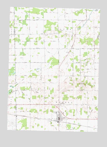
Capac, MI USGS Topographic Map
Click on map above to begin viewing in our Map Viewer.

This topographic map contains these locations and features:
Feature Name Type Latitude Longitude GNIS ID View Map
Baines LakeLakeN43.0383°W82.9991°620465View Map
Black Segate Reid DrainCanalN43.0903°W82.9841°1624398View Map
CapacPopulated PlaceN43.0125°W82.9280°1624440View Map
Capac Community MuseumBuildingN43.0172°W82.9244°2582189View Map
Capac Elementary SchoolSchoolN43.0169°W82.9317°2582192View Map
Capac High SchoolSchoolN43.0186°W82.9328°2582194View Map
Capac LibraryBuildingN43.0133°W82.9275°2582190View Map
Capac Middle SchoolSchoolN43.0142°W82.9306°2582193View Map
Capac Police DepartmentBuildingN43.0145°W82.9275°2582191View Map
Capac Post OfficePost OfficeN43.0128°W82.9283°2582187View Map
Capac StationLocaleN43.0094°W82.9281°2582237View Map
Cox Doty DrainCanalN43.0259°W82.8755°1624481View Map
Deer View Golf ClubLocaleN43.1139°W82.9661°2581645View Map
First Baptist Church of CapacChurchN43.0139°W82.9294°2582184View Map
First United Methodist ChurchChurchN43.0122°W82.9308°2582183View Map
Flansburg DrainCanalN43.1117°W82.9899°1624537View Map
Franklin DrainCanalN43.0759°W82.9977°1624550View Map
Frasier DrainCanalN43.1031°W82.9352°1624551View Map
Galley DrainCanalN43.0834°W82.9708°1624555View Map
Gavagan FieldAirportN43.1052°W82.8921°1624335View Map
Kaufman DrainCanalN43.0697°W82.8958°1624638View Map
Kolb DrainCanalN43.0759°W82.9308°1624652View Map
Lemon DrainCanalN43.0014°W82.9013°1624672View Map
Lutheran CemeteryCemeteryN43.0264°W82.9264°2581636View Map
Lynn Corner SchoolSchoolN43.1131°W82.8994°1624699View Map
Lynn Mussey DrainCanalN43.0672°W82.9099°1624700View Map
Lynn Post Office (historical)Post OfficeN43.1119°W82.8986°2581493View Map
Lynn Township CemeteryCemeteryN43.0950°W82.9100°2581630View Map
Mercy Family CareHospitalN43.0197°W82.9261°2582188View Map
Mudcat DrainCanalN43.0492°W82.9841°1624769View Map
Mussey Township Fire DepartmentBuildingN43.0122°W82.9368°2620056View Map
North Branch Mill CreekStreamN43.1239°W82.8841°1624783View Map
Petz LakeLakeN43.0442°W82.9950°634742View Map
Pine Hill CemeteryCemeteryN43.0492°W82.8985°1624825View Map
Root DrainCanalN43.1236°W82.9541°1624871View Map
Saint John's Lutheran ChurchChurchN43.0175°W82.9275°2582185View Map
Saint Nicholas Catholic ChurchChurchN43.0211°W82.9294°2582186View Map
Sans LakeLakeN43.0396°W82.9969°637247View Map
Sidel DrainCanalN43.0470°W82.9408°1624929View Map
South Branch Mill CreekStreamN43.1239°W82.8841°1624940View Map
Stein DrainCanalN43.0289°W82.8824°1624956View Map
The IslandIslandN43.0989°W82.9399°1624981View Map
Township of LynnCivilN43.1125°W82.9335°1626649View Map
Township of MusseyCivilN43.0266°W82.9291°1626786View Map
Tri - Hospital Emergency Medical Services Station 7BuildingN43.0200°W82.9265°2662128View Map
United Brethren CemeteryCemeteryN43.0278°W82.9264°2581635View Map
United Brethren ChurchChurchN43.0278°W82.9269°1624993View Map
Village of CapacCivilN43.0077°W82.9271°2397548View Map
Weitzig DrainCanalN43.0409°W82.9666°1625007View Map
Wendt DrainCanalN43.0345°W82.9749°1625008View Map

Note: Coordinates in the location and feature list above are referenced to NAD83 datum.


Copyright (C) 2008-2024 Ryan Niemi / Sunset Dynamics ... All Rights Reserved