TopoQuest Logo
Do you find TopoQuest useful?
Help keep TopoQuest running and adding new maps/features by donating!
Bitcoin:  19c7KJd3qBynnjoSw5npx9KScwjBe4ifkT
Litecoin:  LXs6TkuXGGXo1vDsWCkWVdjQX94eUKd6ui
Home View Maps Find Maps Find Places Resources & Links


Burnside, Michigan Topographic Map

USGS Map Title: Burnside, MI
USGS Map MRC: 43083B1
DRG (GeoTIFF) Download: o43083b1.tif


Neighboring USGS Topographic Map Quads:


  Clifford, MI  
43083C2
 

  Marlette, MI  
43083C1
 

  Juhl, MI  
43082C8
 

  North Branch, MI  
43083B2
 

  Burnside, MI  
43083B1
 

  Brown City, MI  
43082B8
 

  Attica, MI  
43083A2
 

  Imlay City, MI  
43083A1
 

  Capac, MI  
43082A8


Map MRC Location:

N44°
W84°
N44°
W83°
H8 H7 H6 H5 H4 H3 H2 H1
G8 G7 G6 G5 G4 G3 G2 G1
F8 F7 F6 F5 F4 F3 F2 F1
E8 E7 E6 E5 E4 E3 E2 E1
D8 D7 D6 D5 D4 D3 D2 D1
C8 C7 C6 C5 C4 C3 C2 C1
B8 B7 B6 B5 B4 B3 B2 B1
A8 A7 A6 A5 A4 A3 A2 A1
N43°
W84°
N43°
W83°

Burnside, MI USGS 1:24K Topographic Map Preview:
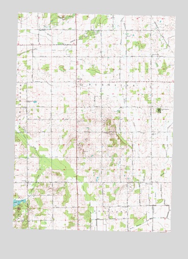
Burnside, MI USGS Topographic Map
Click on map above to begin viewing in our Map Viewer.

This topographic map contains these locations and features:
Feature Name Type Latitude Longitude GNIS ID View Map
Abbott SchoolSchoolN43.1392°W83.0347°619790View Map
BurnsidePopulated PlaceN43.2106°W83.0772°622305View Map
Burnside Post Office (historical)Post OfficeN43.2106°W83.0772°2575343View Map
Clarkson DrainCanalN43.1409°W83.0119°623383View Map
Clear LakeLakeN43.1404°W83.1212°623431View Map
Clear Lake SchoolSchoolN43.1522°W83.1147°623438View Map
Courter DrainCanalN43.1509°W83.0180°623896View Map
Cummings DrainCanalN43.2495°W83.0949°624207View Map
Deanville CemeteryCemeteryN43.1822°W83.0224°624430View Map
Deanville Post Office (historical)Post OfficeN43.1833°W83.0167°2575339View Map
Deanville SchoolSchoolN43.1814°W83.0166°624431View Map
Evans and McKillen DrainCanalN43.1503°W83.0080°625670View Map
Evergreen CemeteryCemeteryN43.2217°W83.0003°2575801View Map
Fox CemeteryCemeteryN43.2239°W83.0733°2575800View Map
Gibbard DrainCanalN43.2392°W83.0666°626777View Map
Index Post Office (historical)Post OfficeN43.2494°W83.0194°2575332View Map
Index Station (historical)LocaleN43.2494°W83.0194°2575280View Map
Madison DrainCanalN43.1325°W83.0585°631309View Map
McKimmon DrainCanalN43.2403°W83.0380°631949View Map
McNary DrainCanalN43.2028°W83.0583°632009View Map
Murray DrainCanalN43.2464°W83.1058°633148View Map
Murray FarmsLocaleN43.2417°W83.0536°2725317View Map
Muxlow Dairy FarmLocaleN43.1992°W83.0142°2725318View Map
North Goodland ChurchChurchN43.1534°W83.0155°633579View Map
R D R Dairy FarmsLocaleN43.2089°W83.0894°2725319View Map
Saint Mary's Catholic CemeteryCemeteryN43.1989°W83.1167°2575802View Map
Saint Marys ChurchChurchN43.1986°W83.1161°636903View Map
South Burnside CemeteryCemeteryN43.1884°W83.0758°638326View Map
Township of BurnsideCivilN43.2188°W83.0578°1626006View Map
United Brethren ChurchChurchN43.2270°W83.0183°1615366View Map
United Missionary ChurchChurchN43.1959°W83.0116°1615374View Map
Weaver DrainCanalN43.1939°W83.0358°1615923View Map
Weaver DrainCanalN43.2153°W83.0355°1615925View Map

Note: Coordinates in the location and feature list above are referenced to NAD83 datum.


Copyright (C) 2008-2024 Ryan Niemi / Sunset Dynamics ... All Rights Reserved