TopoQuest Logo
Do you find TopoQuest useful?
Help keep TopoQuest running and adding new maps/features by donating!
Bitcoin:  19c7KJd3qBynnjoSw5npx9KScwjBe4ifkT
Litecoin:  LXs6TkuXGGXo1vDsWCkWVdjQX94eUKd6ui
Home View Maps Find Maps Find Places Resources & Links


Perryman, Maryland Topographic Map

USGS Map Title: Perryman, MD
USGS Map MRC: 39076D2
DRG (GeoTIFF) Download: o39076d2.tif


Neighboring USGS Topographic Map Quads:


  Bel Air, MD  
39076E3
 

  Aberdeen, MD  
39076E2
 

  Havre De Grace, MD  
39076E1
 

  Edgewood, MD  
39076D3
 

  Perryman, MD  
39076D2
 

  Spesutie, MD  
39076D1
 

  Gunpowder Neck, MD  
39076C3
 

  Hanesville, MD  
39076C2
 

  Betterton, MD  
39076C1


Map MRC Location:

N40°
W77°
N40°
W76°
H8 H7 H6 H5 H4 H3 H2 H1
G8 G7 G6 G5 G4 G3 G2 G1
F8 F7 F6 F5 F4 F3 F2 F1
E8 E7 E6 E5 E4 E3 E2 E1
D8 D7 D6 D5 D4 D3 D2 D1
C8 C7 C6 C5 C4 C3 C2 C1
B8 B7 B6 B5 B4 B3 B2 B1
A8 A7 A6 A5 A4 A3 A2 A1
N39°
W77°
N39°
W76°

Perryman, MD USGS 1:24K Topographic Map Preview:
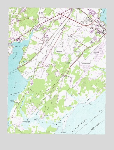
Perryman, MD USGS Topographic Map
Click on map above to begin viewing in our Map Viewer.

This topographic map contains these locations and features:
Feature Name Type Latitude Longitude GNIS ID View Map
Aberdeen Airpark (historical)AirportN39.4992°W76.1806°2099641View Map
Aberdeen Fire Department House 4BuildingN39.4745°W76.2022°2131779View Map
Aberdeen Industrial CenterLocaleN39.4896°W76.1800°1698611View Map
Aberdeen Proving GroundMilitaryN39.3963°W76.1997°2512026View Map
Aberdeen Proving Ground Census Designated PlaceCensusN39.4670°W76.1307°2389114View Map
Aberdeen Proving Ground Fire and Emergency Services - Aberdeen Station 1BuildingN39.4839°W76.1322°2087225View Map
Aberdeen Proving Ground Fire and Emergency Services - Airbase Station 2BuildingN39.4726°W76.1700°2580589View Map
Aberdeen Proving Ground Post OfficePost OfficeN39.4823°W76.1302°1698612View Map
Back CreekStreamN39.3884°W76.2030°582977View Map
Bar Harbor CampgroundLocaleN39.4618°W76.2455°1698622View Map
Bayside VillagePopulated PlaceN39.4959°W76.1425°1698626View Map
Beechtree Golf ClubLocaleN39.4981°W76.2071°2503106View Map
BelcampPopulated PlaceN39.4690°W76.2333°589725View Map
Belcamp BeachBeachN39.4659°W76.2347°583140View Map
Belcamp Industrial ParkLocaleN39.4690°W76.2330°1698629View Map
Belcamp Post OfficePost OfficeN39.4684°W76.2386°1698630View Map
Blessed Hope Baptist ChurchChurchN39.4795°W76.2109°2503115View Map
Boothby HillSummitN39.4821°W76.1630°589788View Map
Briar PointCapeN39.3884°W76.2127°583375View Map
Bridge CreekStreamN39.3929°W76.2130°583385View Map
Bush CreekStreamN39.4626°W76.2433°588408View Map
Bush PointCapeN39.4609°W76.2422°583504View Map
Bush RiverPopulated PlaceN39.4412°W76.2375°589864View Map
Bush River Mobile Home ParkPopulated PlaceN39.4487°W76.2322°1698643View Map
Bush River Yacht ClubLocaleN39.4548°W76.2436°1698645View Map
Channel Industrial ParkLocaleN39.4773°W76.1938°1698649View Map
ChelseaPopulated PlaceN39.4196°W76.2227°589945View Map
Chilbury PointCapeN39.4071°W76.2419°583754View Map
Church CreekStreamN39.4671°W76.2236°583782View Map
Church Creek Elementary SchoolSchoolN39.4754°W76.2483°2132401View Map
Church PointCapeN39.4618°W76.2291°583786View Map
Cole (historical)Populated PlaceN39.4584°W76.1291°1698664View Map
Cranberry ChurchChurchN39.4643°W76.2061°583961View Map
Cranberry RunStreamN39.4782°W76.2175°583962View Map
Cranberry Run Business ParkLocaleN39.4876°W76.1833°1698675View Map
Cranberry United Methodist Church CemeteryCemeteryN39.4643°W76.2061°1698674View Map
Deep Spring BranchStreamN39.4426°W76.2369°1698678View Map
Delph CreekStreamN39.4059°W76.1575°584087View Map
District 2, Halls Cross RoadsCivilN39.4714°W76.1629°1929532View Map
East ChapelChurchN39.4807°W76.1261°1698681View Map
Elm Tree PointCapeN39.3876°W76.1854°584290View Map
Fords FarmLocaleN39.4115°W76.1955°588772View Map
Forest GreensPopulated PlaceN39.4571°W76.2288°1698710View Map
Forest Greens Country ClubLocaleN39.4529°W76.2280°592425View Map
Grays RunStreamN39.4815°W76.2161°584716View Map
Gum PointCapeN39.4334°W76.2494°584792View Map
Hardees Industrial ParkLocaleN39.4934°W76.1983°1698724View Map
Harford Furnace SchoolSchoolN39.4904°W76.2469°584867View Map
Henley ParkPopulated PlaceN39.4890°W76.2488°1698743View Map
High PointCapeN39.4934°W76.1325°584962View Map
Kirk Army Health ClinicHospitalN39.4899°W76.1351°1698763View Map
Little Romney CreekStreamN39.3857°W76.1841°585505View Map
Little Romney CreekStreamN39.4007°W76.1644°585506View Map
Locust PointCapeN39.3818°W76.1861°585542View Map
Long Bar HarborHarborN39.4548°W76.2438°585555View Map
Long Bar Harbor Montessori SchoolSchoolN39.4607°W76.2436°1698770View Map
Main ChapelChurchN39.4826°W76.1330°1698776View Map
MichaelsvillePopulated PlaceN39.4329°W76.1755°588698View Map
Monocacy IslandIslandN39.3868°W76.2247°585929View Map
Old BaltimorePopulated PlaceN39.4059°W76.2413°590938View Map
Old Womans GutStreamN39.4054°W76.1505°586325View Map
Otter Point CreekStreamN39.4462°W76.2436°593888View Map
Palisades ParkParkN39.4873°W76.1286°586387View Map
Palmer HouseLocaleN39.4423°W76.2019°586388View Map
Penny Come Quick AreaAreaN39.4101°W76.1905°586466View Map
PerrymanPopulated PlaceN39.4696°W76.2044°590998View Map
Perryman Census Designated PlaceCensusN39.4634°W76.2113°2389664View Map
Perryman Industrial ParkLocaleN39.4723°W76.2008°1698800View Map
Perryman ParkParkN39.4732°W76.2152°1698801View Map
Perryman Post OfficePost OfficeN39.4665°W76.2025°1698802View Map
Perryman SchoolSchoolN39.4787°W76.2069°586477View Map
PerrywoodPopulated PlaceN39.4798°W76.2038°1698803View Map
Phillips Army AirfieldAirportN39.4656°W76.1659°2443748View Map
Poverty Island AreaAreaN39.4048°W76.2186°586693View Map
Quinlans Grist Mill (historical)LocaleN39.4768°W76.2038°1698810View Map
Ripkins CornerPopulated PlaceN39.4896°W76.2116°1698812View Map
RiversidePopulated PlaceN39.4737°W76.2413°1698813View Map
Riverside Business ParkLocaleN39.4793°W76.2330°1698814View Map
Riverside Census Designated PlaceCensusN39.4777°W76.2386°2389758View Map
Riverside Village of Church CreekPopulated PlaceN39.4737°W76.2352°1698816View Map
Romney CreekStreamN39.3759°W76.1833°586924View Map
Ruggles Golf CourseLocaleN39.4840°W76.1697°1698819View Map
Saint Georges Parish Vestry HouseBuildingN39.4729°W76.2047°1698822View Map
Saint Georges Spesutia Episcopal Church CemeteryCemeteryN39.4743°W76.2042°1698833View Map
Saint Paul Lutheran CemeteryCemeteryN39.4830°W76.2092°1698823View Map
Sewells BarBarN39.4621°W76.2419°1698826View Map
Shine FieldParkN39.4843°W76.1386°1698828View Map
Short LaneLocaleN39.4909°W76.1827°587352View Map
Sod RunStreamN39.4271°W76.2247°587424View Map
Spesutie ChurchChurchN39.4748°W76.2038°587492View Map
Stony PointCapeN39.4054°W76.1469°587585View Map
Swan NeckCapeN39.4432°W76.1802°1698842View Map
Taylor IslandIslandN39.3898°W76.1752°587708View Map
Taylor Island PointCapeN39.3782°W76.1797°587709View Map
WildwoodPopulated PlaceN39.4584°W76.2450°1698862View Map
Wrights Mobile Home VillagePopulated PlaceN39.4874°W76.1959°2503772View Map
Wrights Trailer VillagePopulated PlaceN39.4871°W76.1958°1698881View Map

Note: Coordinates in the location and feature list above are referenced to NAD83 datum.


Copyright (C) 2008-2024 Ryan Niemi / Sunset Dynamics ... All Rights Reserved