TopoQuest Logo
Do you find TopoQuest useful?
Help keep TopoQuest running and adding new maps/features by donating!
Bitcoin:  19c7KJd3qBynnjoSw5npx9KScwjBe4ifkT
Litecoin:  LXs6TkuXGGXo1vDsWCkWVdjQX94eUKd6ui
Home View Maps Find Maps Find Places Resources & Links


Parallel Canyon, Arizona Topographic Map

USGS Map Title: Parallel Canyon, AZ
USGS Map MRC: 34110B7
DRG (GeoTIFF) Download: o34110b7.tif


Neighboring USGS Topographic Map Quads:


  Woods Canyon, AZ  
34110C8
 

  O W Point, AZ  
34110C7
 

  Brookbank Point, AZ  
34110C6
 

  Oxbow Mountain, AZ  
34110B8
 

  Parallel Canyon, AZ  
34110B7
 

  Chediski Peak, AZ  
34110B6
 

  Young, AZ  
34110A8
 

  Gentry Mountain, AZ  
34110A7
 

  Oak Creek Ranch, AZ  
34110A6


Map MRC Location:

N35°
W111°
N35°
W110°
H8 H7 H6 H5 H4 H3 H2 H1
G8 G7 G6 G5 G4 G3 G2 G1
F8 F7 F6 F5 F4 F3 F2 F1
E8 E7 E6 E5 E4 E3 E2 E1
D8 D7 D6 D5 D4 D3 D2 D1
C8 C7 C6 C5 C4 C3 C2 C1
B8 B7 B6 B5 B4 B3 B2 B1
A8 A7 A6 A5 A4 A3 A2 A1
N34°
W111°
N34°
W110°

Parallel Canyon, AZ USGS 1:24K Topographic Map Preview:
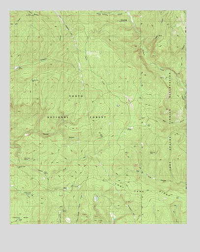
Parallel Canyon, AZ USGS Topographic Map
Click on map above to begin viewing in our Map Viewer.

This topographic map contains these locations and features:
Feature Name Type Latitude Longitude GNIS ID View Map
Billy June TankReservoirN34.1668°W110.7767°40651View Map
Bottle SpringSpringN34.1458°W110.8378°26632View Map
Bull Flat CanyonValleyN34.2103°W110.7554°26962View Map
Burn TankReservoirN34.2245°W110.8271°39303View Map
Carroll SpringSpringN34.1336°W110.8377°27309View Map
Cherry Creek HillSummitN34.1584°W110.8704°27546View Map
Clay SpringSpringN34.2156°W110.8715°39355View Map
Colcord MountainSummitN34.2475°W110.8610°27793View Map
Cow CreekStreamN34.2042°W110.7515°28082View Map
Frog PondReservoirN34.1402°W110.8145°29213View Map
Hells CanyonValleyN34.2253°W110.7787°29861View Map
Lost LakeReservoirN34.1659°W110.7985°40706View Map
Lost TankReservoirN34.1404°W110.7558°31312View Map
Lost Tank RidgeRidgeN34.1431°W110.7685°31321View Map
Naegelin Rim TankReservoirN34.2098°W110.8593°39648View Map
Nail RanchLocaleN34.1292°W110.8043°32240View Map
Ramer TankReservoirN34.1948°W110.7982°39723View Map
Red Lake Adminitrative SiteLocaleN34.1803°W110.7893°43548View Map
Redman CaveLocaleN34.1873°W110.7837°33532View Map
Rock SpringSpringN34.1550°W110.8518°39751View Map
Rock Tanks SpringSpringN34.1627°W110.8651°39752View Map
Sheep Corral SpringSpringN34.1422°W110.8626°34326View Map
Swamp CreekStreamN34.1984°W110.7529°34994View Map
Trail TankReservoirN34.1767°W110.8123°2060922View Map
Upper TankReservoirN34.1278°W110.8695°39858View Map
Valentine CanyonValleyN34.2492°W110.7932°25506View Map
Valentine Ridge CampgroundLocaleN34.2436°W110.7975°2669963View Map
Valentine Ridge Recreation SiteLocaleN34.2437°W110.7976°2060921View Map
Valentine TankReservoirN34.2484°W110.8109°39863View Map
Walnut SpringSpringN34.1753°W110.7501°35876View Map
Willis TankReservoirN34.1827°W110.7787°40752View Map

Note: Coordinates in the location and feature list above are referenced to NAD83 datum.


Copyright (C) 2008-2024 Ryan Niemi / Sunset Dynamics ... All Rights Reserved