TopoQuest Logo
Do you find TopoQuest useful?
Help keep TopoQuest running and adding new maps/features by donating!
Bitcoin:  19c7KJd3qBynnjoSw5npx9KScwjBe4ifkT
Litecoin:  LXs6TkuXGGXo1vDsWCkWVdjQX94eUKd6ui
Home View Maps Find Maps Find Places Resources & Links


New Cuyama, California Topographic Map

USGS Map Title: New Cuyama, CA
USGS Map MRC: 34119H6
DRG (GeoTIFF) Download: o34119h6.tif


Neighboring USGS Topographic Map Quads:


  Caliente Mountain, CA  
35119A7
 

  Wells Ranch, CA  
35119A6
 

  Elkhorn Hills, CA  
35119A5
 

  Peak Mountain, CA  
34119H7
 

  New Cuyama, CA  
34119H6
 

  Cuyama, CA  
34119H5
 

  Hurricane Deck, CA  
34119G7
 

  Salisbury Potrero, CA  
34119G6
 

  Fox Mountain, CA  
34119G5


Map MRC Location:

N35°
W120°
N35°
W119°
H8 H7 H6 H5 H4 H3 H2 H1
G8 G7 G6 G5 G4 G3 G2 G1
F8 F7 F6 F5 F4 F3 F2 F1
E8 E7 E6 E5 E4 E3 E2 E1
D8 D7 D6 D5 D4 D3 D2 D1
C8 C7 C6 C5 C4 C3 C2 C1
B8 B7 B6 B5 B4 B3 B2 B1
A8 A7 A6 A5 A4 A3 A2 A1
N34°
W120°
N34°
W119°

New Cuyama, CA USGS 1:24K Topographic Map Preview:
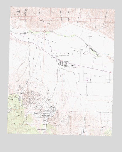
New Cuyama, CA USGS Topographic Map
Click on map above to begin viewing in our Map Viewer.

This topographic map contains these locations and features:
Feature Name Type Latitude Longitude GNIS ID View Map
Angle CanyonValleyN34.9097°W119.7435°269540View Map
Bee Rock CanyonValleyN34.9753°W119.7101°269782View Map
Bitter CreekStreamN34.9714°W119.7165°269871View Map
Branch CanyonValleyN34.8978°W119.6932°270002View Map
Branch Canyon CampgroundLocaleN34.8928°W119.7010°270003View Map
Branch Canyon Guard Station (historical)LocaleN34.8930°W119.7012°1693271View Map
Branch Canyon WashStreamN34.9705°W119.7115°270004View Map
Central CanyonValleyN34.9075°W119.7368°270376View Map
Cuyama Christian AcademySchoolN34.9433°W119.6879°2518334View Map
Cuyama RanchLocaleN34.9594°W119.6651°270722View Map
Cuyama Valley High SchoolSchoolN34.9437°W119.6748°270725View Map
East CanyonValleyN34.9075°W119.7365°270978View Map
Horse CanyonValleyN34.9833°W119.6874°271638View Map
Johnson Ranch (historical)LocaleN34.8908°W119.7051°1693273View Map
Juniper SpringSpringN34.9841°W119.7063°271843View Map
Middle CanyonValleyN34.9855°W119.6818°272436View Map
New CuyamaPopulated PlaceN34.9469°W119.6854°1661100View Map
New Cuyama AirportAirportN34.9415°W119.6894°1653761View Map
New Cuyama Branch Santa Maria Public LibraryBuildingN34.9458°W119.6821°1871648View Map
New Cuyama Census Designated PlaceCensusN34.9421°W119.6808°2583090View Map
New Cuyama Elementary SchoolSchoolN34.9447°W119.6865°1871649View Map
New Cuyama Post OfficePost OfficeN34.9473°W119.6883°2783780View Map
New RiverStreamN34.9733°W119.6718°272641View Map
Newsome CanyonValleyN34.8978°W119.6935°272648View Map
Padrones CanyonValleyN34.9778°W119.6457°272837View Map
Priest CanyonValleyN34.9786°W119.7407°273125View Map
Priest SpringSpringN34.9954°W119.7409°273126View Map
Richardson ParkParkN34.9447°W119.6824°273278View Map
Salisbury CanyonValleyN34.9003°W119.6601°273406View Map
Salisbury Canyon WashStreamN34.9519°W119.6946°273407View Map
Santa Barbara County Fire Department Station 41BuildingN34.9457°W119.6820°2665033View Map
Santa Barbara County Sheriff's Office New Cuyama StationBuildingN34.9453°W119.6825°2756308View Map
Sierra Madre Continuation High SchoolSchoolN34.9437°W119.6746°2518324View Map
South Cuyama Oil FieldOilfieldN34.9039°W119.7187°277421View Map
Sulphur CanyonValleyN34.9789°W119.7321°273941View Map
Sulphur SpringSpringN34.9969°W119.7336°273949View Map
Turkey Trap RidgeRidgeN34.9558°W119.6635°274235View Map
Wells CanyonValleyN34.9855°W119.6699°274413View Map
Windmill CanyonValleyN34.9116°W119.7360°274546View Map

Note: Coordinates in the location and feature list above are referenced to NAD83 datum.


Copyright (C) 2008-2024 Ryan Niemi / Sunset Dynamics ... All Rights Reserved