TopoQuest Logo
Do you find TopoQuest useful?
Help keep TopoQuest running and adding new maps/features by donating!
Bitcoin:  19c7KJd3qBynnjoSw5npx9KScwjBe4ifkT
Litecoin:  LXs6TkuXGGXo1vDsWCkWVdjQX94eUKd6ui
Home View Maps Find Maps Find Places Resources & Links


Hurricane Deck, California Topographic Map

USGS Map Title: Hurricane Deck, CA
USGS Map MRC: 34119G7
DRG (GeoTIFF) Download: o34119g7.tif


Neighboring USGS Topographic Map Quads:


  Bates Canyon, CA  
34119H8
 

  Peak Mountain, CA  
34119H7
 

  New Cuyama, CA  
34119H6
 

  Bald Mountain, CA  
34119G8
 

  Hurricane Deck, CA  
34119G7
 

  Salisbury Potrero, CA  
34119G6
 

  Figueroa Mountain, CA  
34119F8
 

  San Rafael Mountain, CA  
34119F7
 

  Big Pine Mountain, CA  
34119F6


Map MRC Location:

N35°
W120°
N35°
W119°
H8 H7 H6 H5 H4 H3 H2 H1
G8 G7 G6 G5 G4 G3 G2 G1
F8 F7 F6 F5 F4 F3 F2 F1
E8 E7 E6 E5 E4 E3 E2 E1
D8 D7 D6 D5 D4 D3 D2 D1
C8 C7 C6 C5 C4 C3 C2 C1
B8 B7 B6 B5 B4 B3 B2 B1
A8 A7 A6 A5 A4 A3 A2 A1
N34°
W120°
N34°
W119°

Hurricane Deck, CA USGS 1:24K Topographic Map Preview:
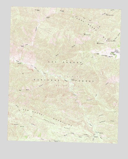
Hurricane Deck, CA USGS Topographic Map
Click on map above to begin viewing in our Map Viewer.

This topographic map contains these locations and features:
Feature Name Type Latitude Longitude GNIS ID View Map
Abel CanyonValleyN34.8233°W119.8643°269426View Map
Abel Canyon CampgroundLocaleN34.8228°W119.8626°1655154View Map
Abel Canyon SpringSpringN34.8711°W119.8168°238394View Map
Big Bend CanyonValleyN34.8114°W119.8365°269810View Map
Black Willow SpringSpringN34.8311°W119.7643°239454View Map
Cliff CampgroundLocaleN34.8183°W119.8479°275376View Map
Cuyama DivisionCivilN34.7887°W119.7880°1935067View Map
East Mine Canyon SpringSpringN34.8436°W119.7779°241780View Map
Ernest Blanco SpringSpringN34.8719°W119.8440°242050View Map
Foresters Leap CanyonValleyN34.7842°W119.7926°271174View Map
Happy Hunting Ground CampgroundLocaleN34.7511°W119.8232°1655165View Map
Hurricane DeckBenchN34.7661°W119.8204°243751View Map
Hurricane Deck TrailTrailN34.7844°W119.8701°271696View Map
Jackson SpringSpringN34.8333°W119.7782°243976View Map
Jackson TrailTrailN34.8255°W119.7860°243977View Map
Live Oak SpringSpringN34.8375°W119.8604°244975View Map
Lonnie Davis CampgroundLocaleN34.7558°W119.7779°1655169View Map
Lost Knife SpringSpringN34.8664°W119.8360°245212View Map
Manzana TrailTrailN34.7553°W119.7968°245459View Map
Mine CanyonValleyN34.8147°W119.8410°245951View Map
Montgomery Number Three SpringSpringN34.8314°W119.7654°246148View Map
Montgomery Number Two SpringSpringN34.8319°W119.7560°246147View Map
Montgomery PotreroFlatN34.8339°W119.7529°272541View Map
Montgomery SpringSpringN34.8355°W119.7599°246150View Map
North Mine Canyon SpringSpringN34.8514°W119.7935°246645View Map
Painted Rock CampgroundLocaleN34.8358°W119.7537°1655175View Map
San Rafael WildernessReserveN34.8128°W119.8655°2035286View Map
South Fork Guard StationLocaleN34.7594°W119.7721°249704View Map
South Fork Rustic CampsiteLocaleN34.7603°W119.7724°275373View Map
South Fork Sisquoc RiverStreamN34.7603°W119.7732°249720View Map
Sweetwater CanyonValleyN34.7680°W119.7818°273982View Map
Sycamore CampgroundLocaleN34.8083°W119.8060°1655177View Map
Upper Branch Canyon SpringSpringN34.8451°W119.7567°250836View Map
Upper Trough Canyon SpringSpringN34.8704°W119.7680°250859View Map
White Ledge CampgroundLocaleN34.7583°W119.8054°275372View Map
White Ledge CanyonValleyN34.7564°W119.7785°251473View Map

Note: Coordinates in the location and feature list above are referenced to NAD83 datum.


Copyright (C) 2008-2024 Ryan Niemi / Sunset Dynamics ... All Rights Reserved