TopoQuest Logo
Do you find TopoQuest useful?
Help keep TopoQuest running and adding new maps/features by donating!
Bitcoin:  19c7KJd3qBynnjoSw5npx9KScwjBe4ifkT
Litecoin:  LXs6TkuXGGXo1vDsWCkWVdjQX94eUKd6ui
Home View Maps Find Maps Find Places Resources & Links


Mountain View School, Montana Topographic Map

USGS Map Title: Mountain View School, MT
USGS Map MRC: 48112G1
DRG (GeoTIFF) Download: o48112g1.tif


Neighboring USGS Topographic Map Quads:


  Fitzpatrick Lake, MT  
48112H2
 

  Hillside Colony, MT  
48112H1
 

  Sunburst, MT  
48111H8
 

  Glacier Colony, MT  
48112G2
 

  Mountain View School, MT  
48112G1
 

  Kevin North, MT  
48111G8
 

  Ethridge NW, MT  
48112F2
 

  Aloe, MT  
48112F1
 

  Kevin South, MT  
48111F8


Map MRC Location:

N49°
W113°
N49°
W112°
H8 H7 H6 H5 H4 H3 H2 H1
G8 G7 G6 G5 G4 G3 G2 G1
F8 F7 F6 F5 F4 F3 F2 F1
E8 E7 E6 E5 E4 E3 E2 E1
D8 D7 D6 D5 D4 D3 D2 D1
C8 C7 C6 C5 C4 C3 C2 C1
B8 B7 B6 B5 B4 B3 B2 B1
A8 A7 A6 A5 A4 A3 A2 A1
N48°
W113°
N48°
W112°

Mountain View School, MT USGS 1:24K Topographic Map Preview:
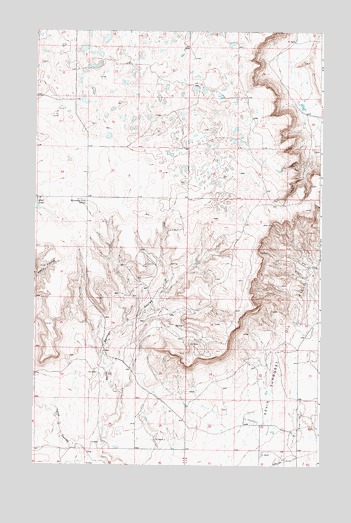
Mountain View School, MT USGS Topographic Map
Click on map above to begin viewing in our Map Viewer.

This topographic map contains these locations and features:
Feature Name Type Latitude Longitude GNIS ID View Map
35N03W18CA__01 WellWellN48.7883°W112.0509°1636543View Map
35N04W01DB__01 WellWellN48.8175°W112.0673°1636697View Map
35N04W02CA__01 WellWellN48.8175°W112.0945°1636698View Map
35N04W03AA__01 WellWellN48.8247°W112.1053°1636727View Map
35N04W03AA__02 WellWellN48.8247°W112.1053°1636728View Map
35N04W11AA__01 WellWellN48.8103°W112.0834°1636660View Map
35N04W11DC__01 WellWellN48.7994°W112.0889°1636600View Map
35N04W11DC__02 WellWellN48.7994°W112.0889°1636601View Map
35N04W11DD__01 WellWellN48.7994°W112.0834°1636599View Map
35N04W12BB__01 WellWellN48.8103°W112.0781°1636659View Map
35N04W12BC__01 WellWellN48.8067°W112.0781°1636640View Map
35N04W12BD__01 WellWellN48.8067°W112.0725°1636638View Map
35N04W12BD__02 WellWellN48.8067°W112.0725°1636639View Map
35N04W12CA__01 WellWellN48.8030°W112.0725°1636617View Map
35N04W12CB__01 WellWellN48.8030°W112.0781°1636618View Map
35N04W12CB__02 WellWellN48.8030°W112.0781°1636619View Map
36N03W19BB__01 WellWellN48.8694°W112.0564°1636874View Map
36N03W19CC__01 WellWellN48.8586°W112.0564°1636838View Map
36N03W30CB__01 WellWellN48.8478°W112.0564°1636810View Map
36N03W30DD__01 WellWellN48.8442°W112.0400°1636799View Map
36N03W32CD__01 WellWellN48.8297°W112.0292°1636743View Map
36N04W22AD__01 WellWellN48.8661°W112.1045°1636863View Map
36N04W22DC__01 WellWellN48.8589°W112.1100°1636840View Map
36N04W25AB__01 WellWellN48.8553°W112.0664°1636828View Map
36N04W34AD__01 WellWellN48.8372°W112.1045°1636768View Map
36N04W35AA__01 WellWellN48.8408°W112.0828°1636788View Map
36N04W35AB__01 WellWellN48.8408°W112.0881°1636789View Map
36N04W35AD__01 WellWellN48.8372°W112.0828°1636766View Map
36N04W35AD__02 WellWellN48.8372°W112.0828°1636767View Map
36N04W36DA__01 WellWellN48.8336°W112.0609°1636757View Map
Benton Trail LakesLakeN48.8728°W112.0943°1749955View Map
Cowboys LakeLakeN48.8434°W112.0578°1749957View Map
Foxtail LakesLakeN48.8686°W112.0990°1749954View Map
Frenchman LakeLakeN48.8586°W112.0555°1749958View Map
Kevin Sunburst Oil FieldOilfieldN48.7850°W112.0164°773013View Map
Mountain View School (historical)SchoolN48.8250°W112.1020°774435View Map
Rocky Springs (historical)LocaleN48.8278°W112.0231°1750058View Map

Note: Coordinates in the location and feature list above are referenced to NAD83 datum.


Copyright (C) 2008-2024 Ryan Niemi / Sunset Dynamics ... All Rights Reserved