TopoQuest Logo
Do you find TopoQuest useful?
Help keep TopoQuest running and adding new maps/features by donating!
Bitcoin:  19c7KJd3qBynnjoSw5npx9KScwjBe4ifkT
Litecoin:  LXs6TkuXGGXo1vDsWCkWVdjQX94eUKd6ui
Home View Maps Find Maps Find Places Resources & Links


Fitzpatrick Lake, Montana Topographic Map

USGS Map Title: Fitzpatrick Lake, MT
USGS Map MRC: 48112H2
DRG (GeoTIFF) Download: o48112h2.tif


Neighboring USGS Topographic Map Quads:


  Headlight Butte NE, MT  
48112H3
 

  Fitzpatrick Lake, MT  
48112H2
 

  Hillside Colony, MT  
48112H1
 

  Headlight Butte, MT  
48112G3
 

  Glacier Colony, MT  
48112G2
 

  Mountain View School, MT  
48112G1


Map MRC Location:

N49°
W113°
N49°
W112°
H8 H7 H6 H5 H4 H3 H2 H1
G8 G7 G6 G5 G4 G3 G2 G1
F8 F7 F6 F5 F4 F3 F2 F1
E8 E7 E6 E5 E4 E3 E2 E1
D8 D7 D6 D5 D4 D3 D2 D1
C8 C7 C6 C5 C4 C3 C2 C1
B8 B7 B6 B5 B4 B3 B2 B1
A8 A7 A6 A5 A4 A3 A2 A1
N48°
W113°
N48°
W112°

Fitzpatrick Lake, MT USGS 1:24K Topographic Map Preview:
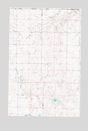
Fitzpatrick Lake, MT USGS Topographic Map
Click on map above to begin viewing in our Map Viewer.

This topographic map contains these locations and features:
Feature Name Type Latitude Longitude GNIS ID View Map
36N04W04AA__01 WellWellN48.9133°W112.1264°1637024View Map
36N04W07AC__01 WellWellN48.8953°W112.1753°1636954View Map
36N04W09BB__01 WellWellN48.8989°W112.1428°1636969View Map
36N05W01DCCC01 WellWellN48.9025°W112.1976°1636982View Map
36N05W11BA__01 WellWellN48.8989°W112.2248°1636970View Map
36N05W12AC__01 WellWellN48.8953°W112.1976°1636955View Map
36N05W12DC__01 WellWellN48.8880°W112.1976°1636935View Map
36N05W13AA__01 WellWellN48.8844°W112.1923°1636928View Map
36N05W14AC__01 WellWellN48.8808°W112.2195°1636906View Map
36N05W14BD__01 WellWellN48.8808°W112.2248°1636907View Map
37N04W05CB__01 WellWellN48.9917°W112.1687°1637341View Map
37N04W05CBAD01 WellWellN48.9928°W112.1662°1637346View Map
37N04W18BBAC01 WellWellN48.9711°W112.1895°1637245View Map
37N04W18CC__01 WellWellN48.9592°W112.1906°1637196View Map
37N04W28DC__01 WellWellN48.9300°W112.1356°1637084View Map
37N04W29DA__01 WellWellN48.9336°W112.1520°1637096View Map
37N04W29DB__01 WellWellN48.9336°W112.1576°1637097View Map
37N04W31AC__01 WellWellN48.9228°W112.1795°1637060View Map
37N05W10DC__01 WellWellN48.9733°W112.2445°1637249View Map
37N05W12AA__01 WellWellN48.9842°W112.1951°1637299View Map
37N05W13AD__01 WellWellN48.9661°W112.1951°1637220View Map
37N05W15DA__01 WellWellN48.9625°W112.2389°1637210View Map
37N05W24BA__01 WellWellN48.9550°W112.2059°1637177View Map
37N05W26CB__01 WellWellN48.9333°W112.2334°1637093View Map
37N05W34AD__01 WellWellN48.9225°W112.2389°1637059View Map
37N05W34DD__01 WellWellN48.9153°W112.2389°1637034View Map
37N05W34DD__02 WellWellN48.9153°W112.2389°1637035View Map
37N05W35CD__01 WellWellN48.9153°W112.2278°1637033View Map
Alkali LakeLakeN48.8946°W112.2112°768193View Map
Demers (historical)Populated PlaceN48.8850°W112.1676°1750071View Map
Demers Post Office (historical)Post OfficeN48.8850°W112.1676°1750010View Map
Fitzpatrick CouleeValleyN48.9500°W112.2448°771407View Map
Fitzpatrick LakeLakeN48.8939°W112.1681°771408View Map
Grassy LakeLakeN48.8754°W112.2110°771937View Map
Pearsons CouleeValleyN48.9647°W112.2253°775130View Map
Ramcharger DamDamN48.9150°W112.2242°798409View Map
Red Creek Oil FieldAreaN48.9847°W112.1751°775632View Map

Note: Coordinates in the location and feature list above are referenced to NAD83 datum.


Copyright (C) 2008-2024 Ryan Niemi / Sunset Dynamics ... All Rights Reserved